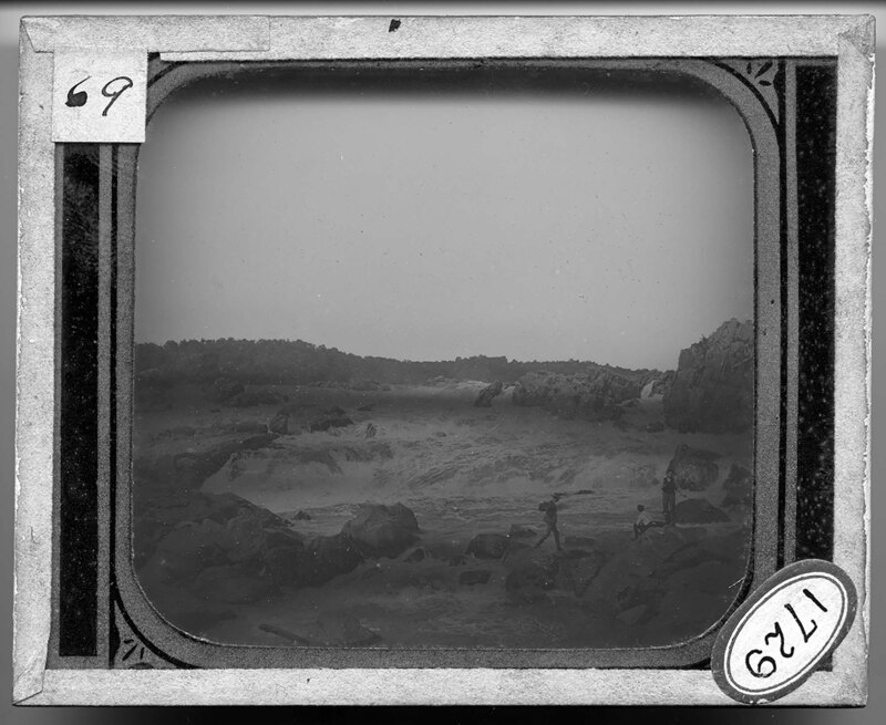
The Great Falls of the Potomac. Men walk across boulders in the foreground, as the river flows around them. Strong rapids are created as the river passes over rocks in the river bed and large rock faces stick out of the river. The bank on the opposite side is covered with vegetation.
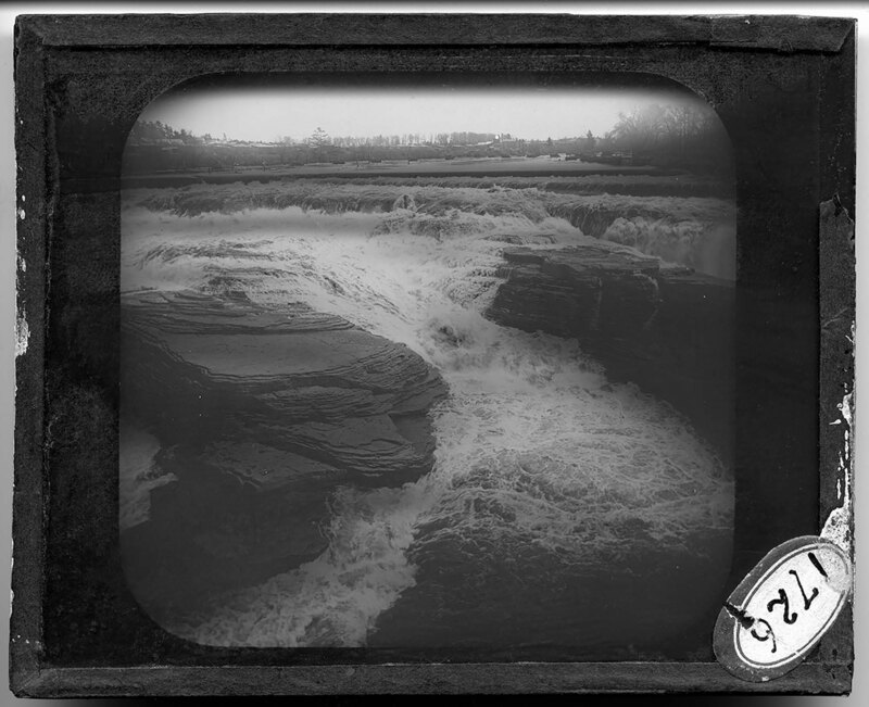
Gleus Falls in New York. Strong currents in the river flow around the projecting stone riverbed, creating rapids in the water. The banks of the river are covered in vegetation and buildings dot the landscape.
Streetscape at Niagara Falls in New York. It is noted that the couple to the left is part of a bridal party. Streetcar rails cross through the cobblestone street and sings reading, "Snyders," and "Hotel Clifton," can be seen further down the street. Power lines cross over the street as pedestrians walk down the sidewalk.
A snow covered tree bends under the weight of the ice coating its branches at Niagara Falls in New York. A suspension bridge can be seen in the background, stretching over the Niagara River. Large ice dams have formed at the base of the falls and are snow covered.
A cabin in Prospect Park almost entirely buried in snow at Niagara Falls, New York. People walk down paths leading to the cabin, surrounded by walls of snow.
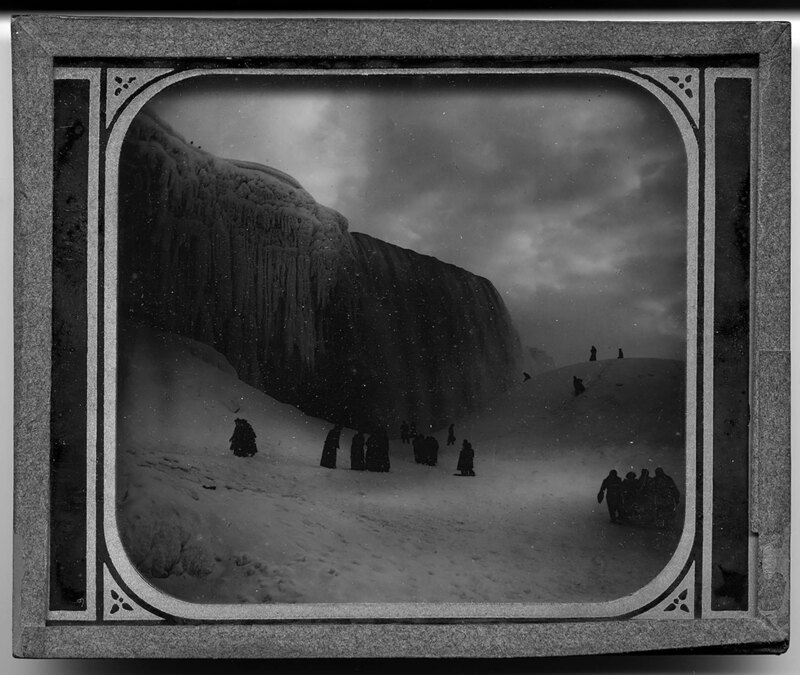
Tourists climb on the packed snow field under the frozen cliff of Niagara Falls during the winter. Large icicles hang from a rocky overhang to the side of the falls, which can be seen in the background.
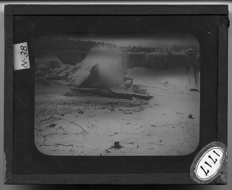
A portion of the ice bridge at Niagara Falls breaking apart and falling to the base of the falls. It is noted that the ice sometimes lasts until June. The surrounding banks of the river are still covered in heavy layers of ice and snow.
Tourists climb on the packed snow field under the frozen cliff of Niagara Falls during the winter. Large icicles hang from a rocky overhang to the side of the falls, which can be seen in the background.
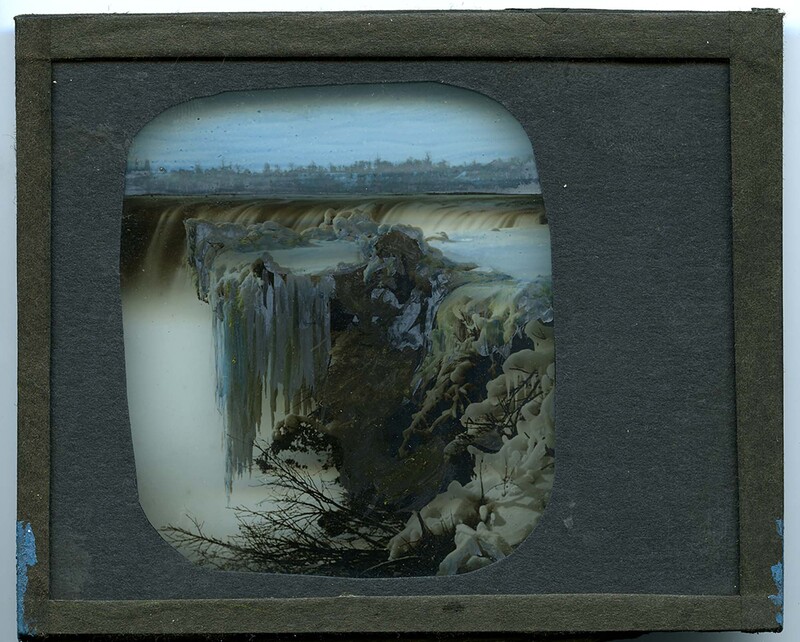
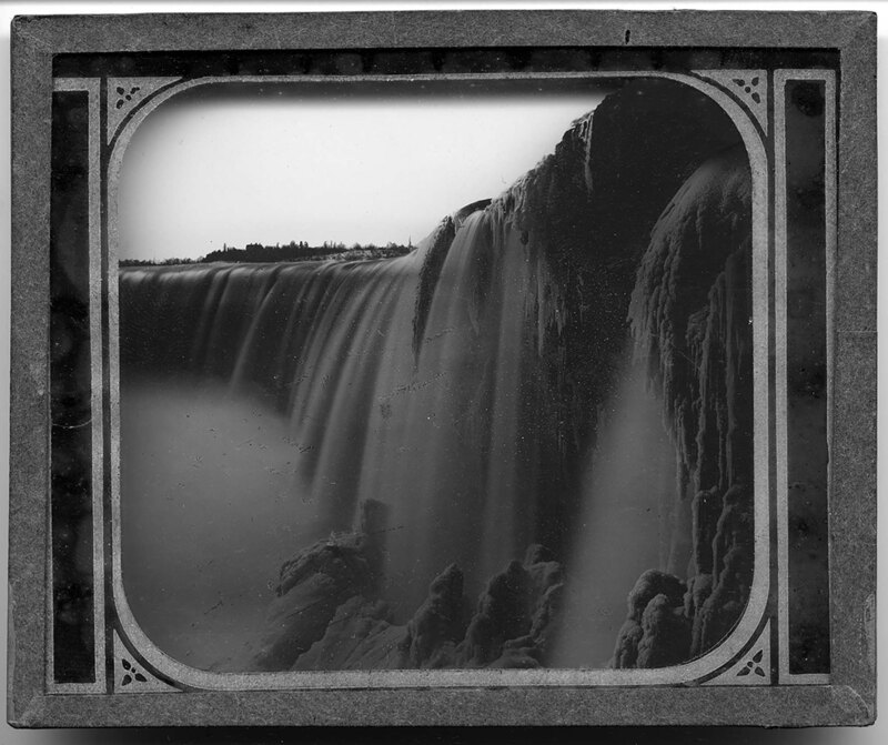
The frozen edge of Niagara Falls in the winter. Large icicles hang from a rocky ledge over the falls and most of the plants have been coated with thick layers of ice. The falls can be seen in the background.
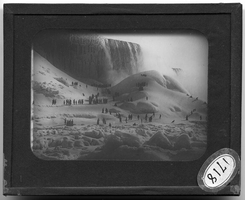
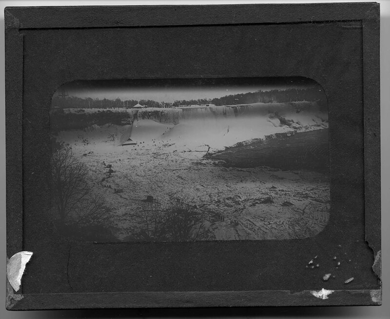
Niagara Falls in New York during the winter. A large ice bridge has formed at the base of the falls and tourists can be seen pitching tents and sledding down the ice hills. A large ice dam has formed at the base of the river and most of the rocks have been coated with thick layers of ice and snow.
Looking out over Niagara Falls from Cave of the Winds in New York. A portion of the falls are frozen and most of the rocks at the base of the falls are coated in thick layers of ice. Clouds of water spray rise from the base of the falls and obscure the view.
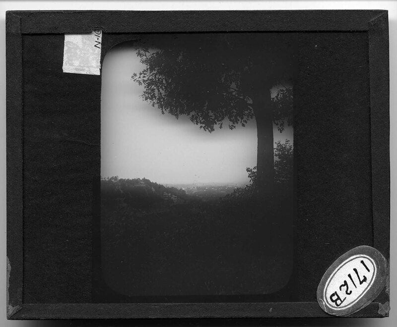
Landscape of Roy Terrace overlooking the Niagara River. It is noted the picture was taken below Brock's Monument in Ontario, Canada. Trees and grass cover the landscape and the steep walls of the banks of the river can be seen in the background and are densely forested.
The Niagara Escarpment looking towards the American side of the river. It is noted that the picture shows a glimpse of the Ontario Plain beyond in the background. The steep rocky face of the escarpment is densely forested.
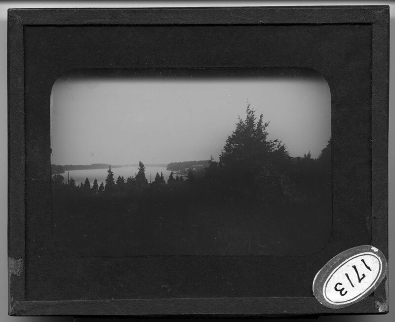
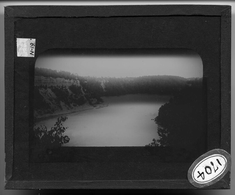
The calm waters of the Lower Niagara River, with Brock's Monument prominently overlooking the river on the opposite bank. A row boat and wooden boat house are in the foreground while a town can be seen on the opposite bank of the river. The landscape around the river is hilly and heavily forested.
Brock's Monument at Niagara Falls in Queenstown, Ontario, Canada. It is noted that General Brock of the British armed forces was killed here in 1812. The monument is a large obelisk with a carved capital and a statue on top. Tourists walk the grounds around the monument, which are landscaped with grasses and trees.
Overlooking the Niagara River from an earthen bank. The main whirlpool of the river can be seen at the base of the cliff, and the opposite bank is rocky and heavily forested. Strong currents are created in the river as the water rushes over submerged rocks in the riverbed.
Taken from the Canadian banks of the Niagara River, overlooking the rapids below the whirlpool. The steep rocky cliffs of the river banks are covered with vegetation and several houses can be seen amongst the trees. A roadway has been constructed at the base of the bank to the right.
Women stand on the American banks of the Niagara River, overlooking the surface of the whirlpool in the middle of the river. Strong rapids are created as the water travels around boulders in the riverbed. The opposite bank of the river is rocky and heavily forested.
Taken from the Canadian banks of the Niagara River, overlooking the rapids below the whirlpool. The steep rocky cliffs of the river banks are covered with vegetation and several houses can be seen amongst the trees. A roadway has been constructed at the base of the bank to the right.
aerial view of the Niagara River, with the river whirlpool further down the river. The steep, rocky banks of the river are covered with vegetation and the rapids of the river can be seen in the foreground.
Wooded landscape of the Fossil Channel at Foster Flats. Grasses and scrub bushes cover the ground and trees grow on the hills. It is noted that this picture was taken above the fossil fall.
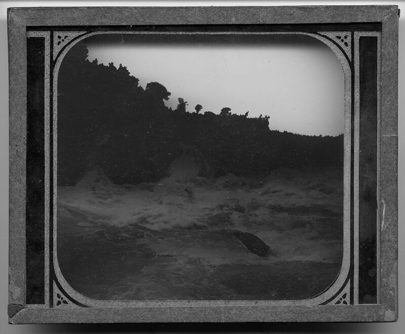
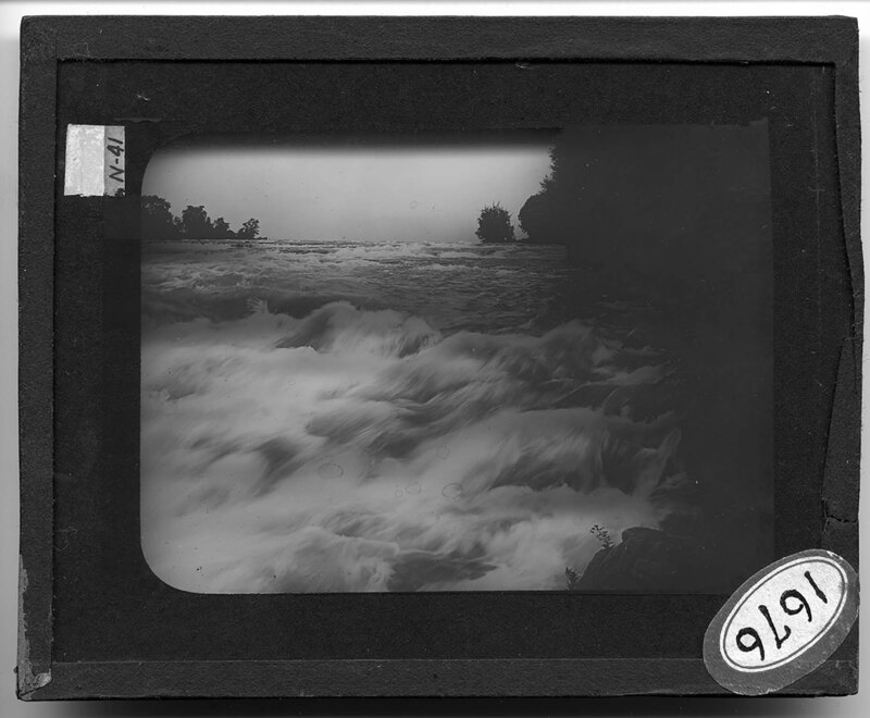
Whirlpool rapids in the middle of Niagara River. Water rushes over submerged rocks in the river bed creating huge waves and strong rapids. The opposite bank of the river is heavily forested and there are no buildings.
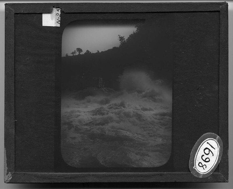
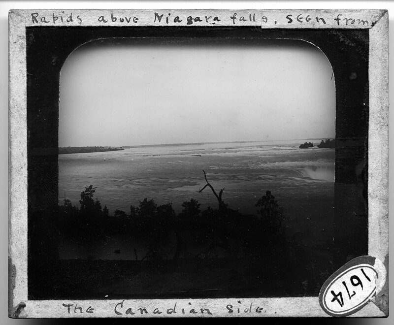
The rapids of Niagara Falls, looking downstream towards the falls. The water rushes over submerged rocks and creates huge waves. The steep bank on the opposite side of the river is heavily forested and there are no buildings.
A cresting wave in the Niagara Falls rapids in New York. It is noted that these waves seem to happen at rhythmic periods. Strong currents create huge rapids in the river as water travels around the rocks in the riverbed. Dense vegetation covers the bank on the opposite side of the river.
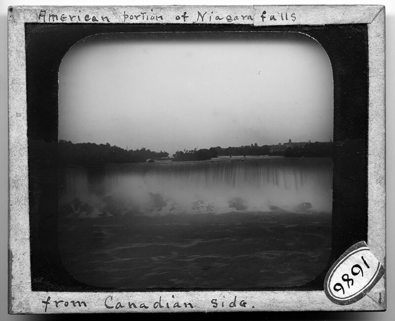
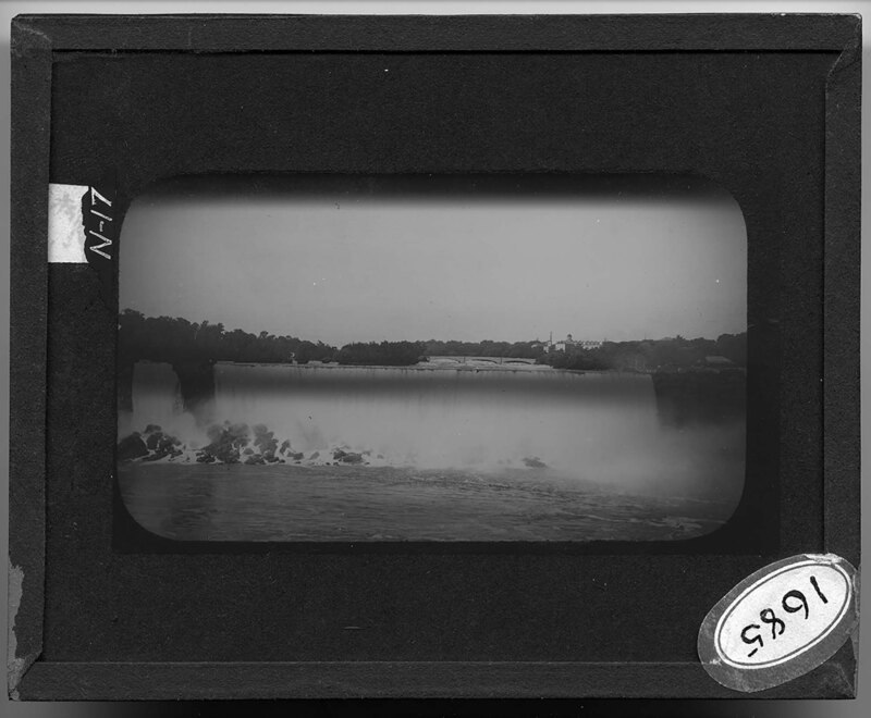
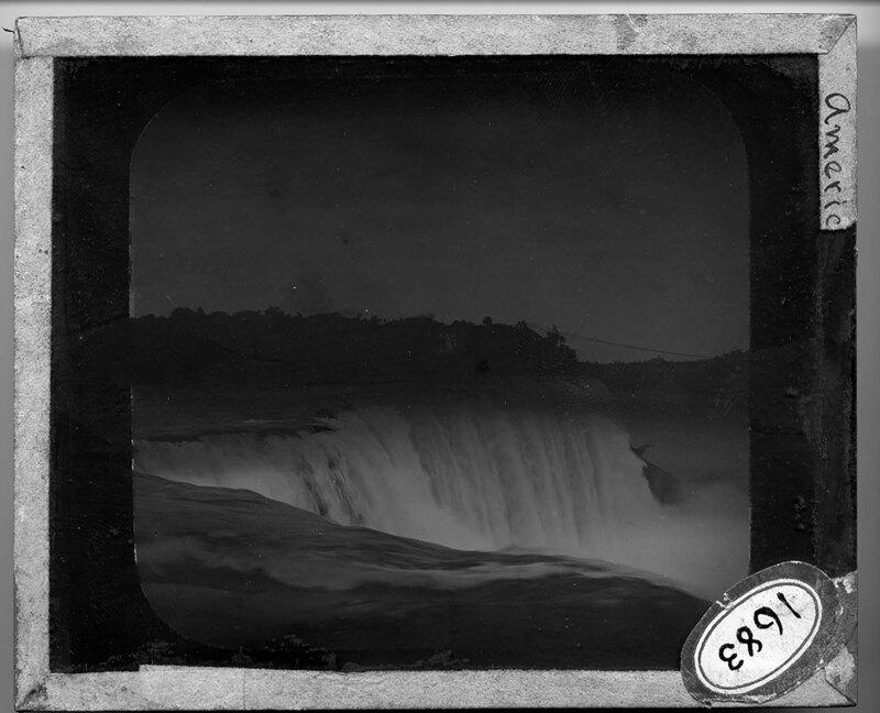
Overlooking Niagara Falls from Prospect Point in New York. Water crashes over the crestline of the main falls and at Horseshoe Falls, and large spray clouds obscure the base of the falls. Dense vegetation covers the landscape between the falls and the Canadian bank of the river can be seen in the background.
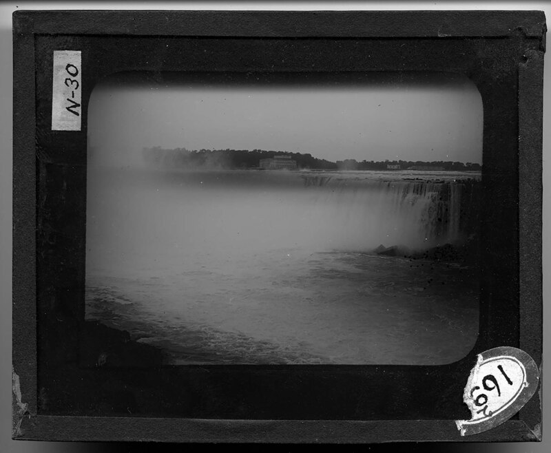
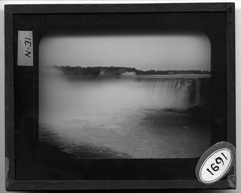
Overlooking the notch in Niagara Falls from the angle of Horseshoe Falls in Ontario, Canada. Water crashes over the edge of the falls and creates large spray clouds that obscure most of the base of the falls. River rapids can be seen in the foreground and several buildings can be seen in the background on the banks of the Canadian side of the falls.
Overlooking Niagara Falls from the angle of Horseshoe Falls in Ontario, Canada. Water crashes over the edge of the falls and creates large spray clouds that obscure most of the base of the falls. River rapids can be seen in the foreground and several buildings can be seen in the background on the banks of the Canadian side of the falls.
Overlooking Niagara Falls from the angle of Horseshoe Falls in Ontario, Canada. Water crashes over the edge of the falls and creates large spray clouds that obscure most of the base of the falls. River rapids can be seen in the foreground and several buildings can be seen in the background on the banks of the Canadian side of the falls.
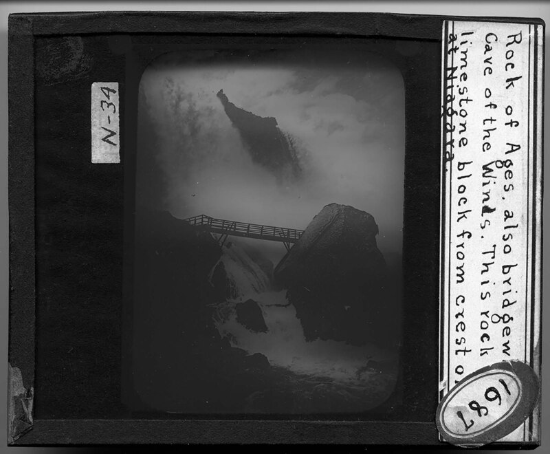
The Rock of Ages and the Cave of the Winds at Niagara Falls in New York. A wooden bridge has been constructed between the Rock of Ages and the banks at the base of the river. Water rushes underneath the bridge and the falls can be seen in the background.
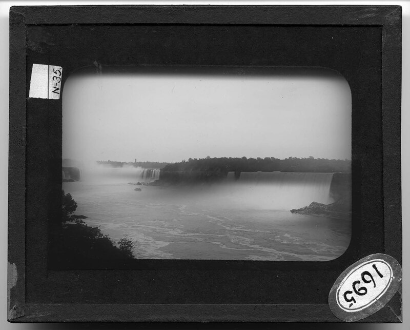
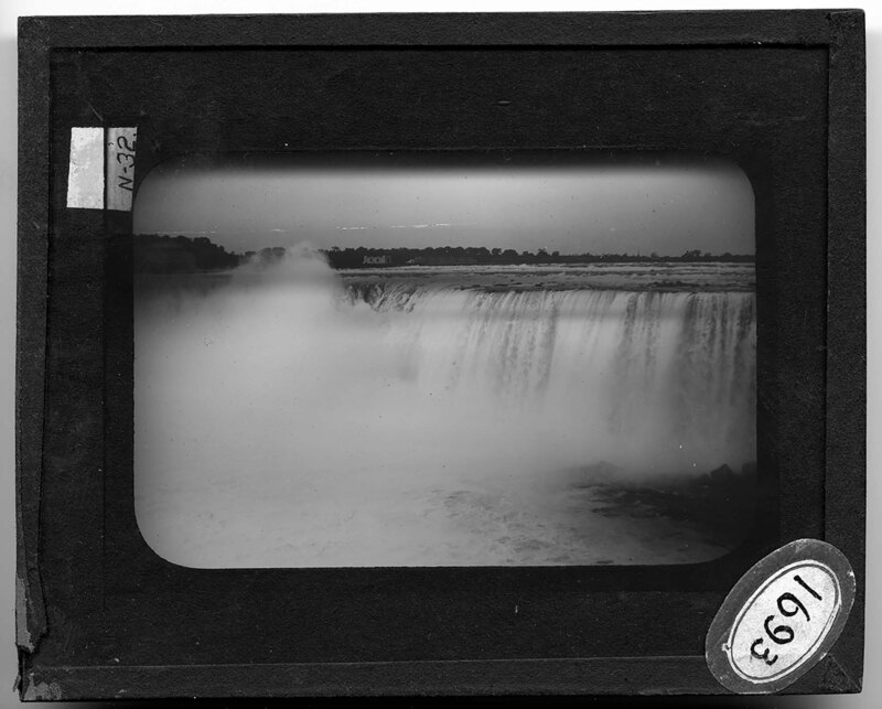
A panoramic view of Niagara Falls from Canada. Large boulders are piled at the base of the falls to the left, and Goat Island can be seen in the middle of the river at the top of the falls. A stone bridge spans the river, connecting the American and Canadian banks.
A panoramic view of Niagara Falls from Canada. Large boulders are piled at the base of the falls to the left, and Goat Island can be seen in the middle of the river at the top of the falls. A stone bridge spans the river, connecting the American and Canadian banks.
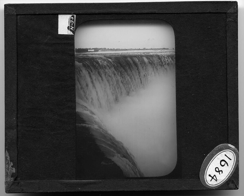
Close-up view of the crest line of Niagara Falls from the Canadian side. Water crashes over the edge of the falls and large spray clouds obscure the bottom of the falls. Several buildings can be seen in the background on the banks of the river.
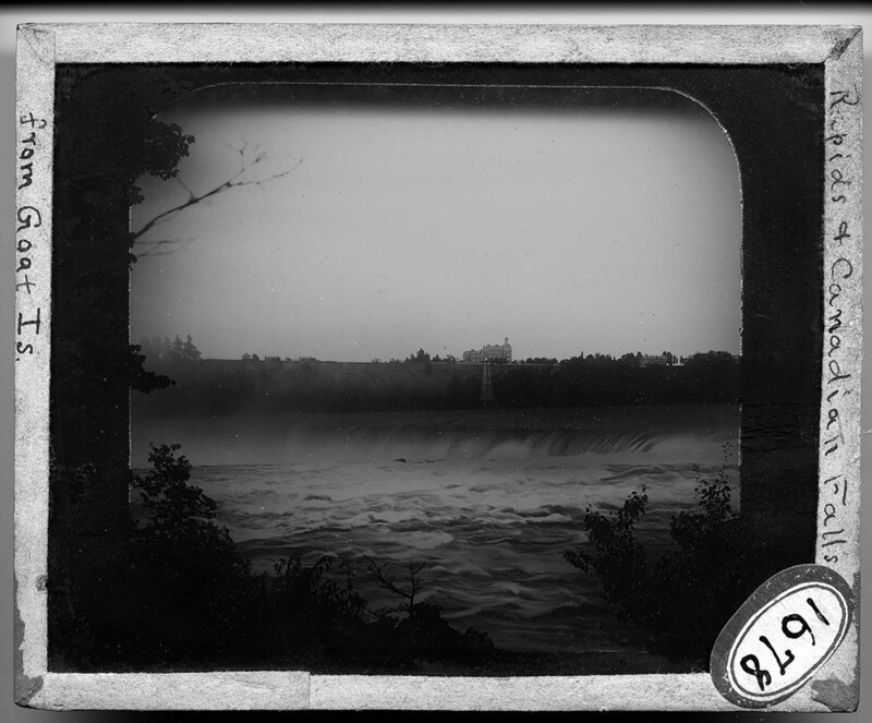
Niagara Falls from Goat Island in New York. The falls crash over the riverbed in the foreground and a large suspension bridge can be seen in the background. The opposite bank of the river is heavily forested and several buildings have been constructed on the cliffs.
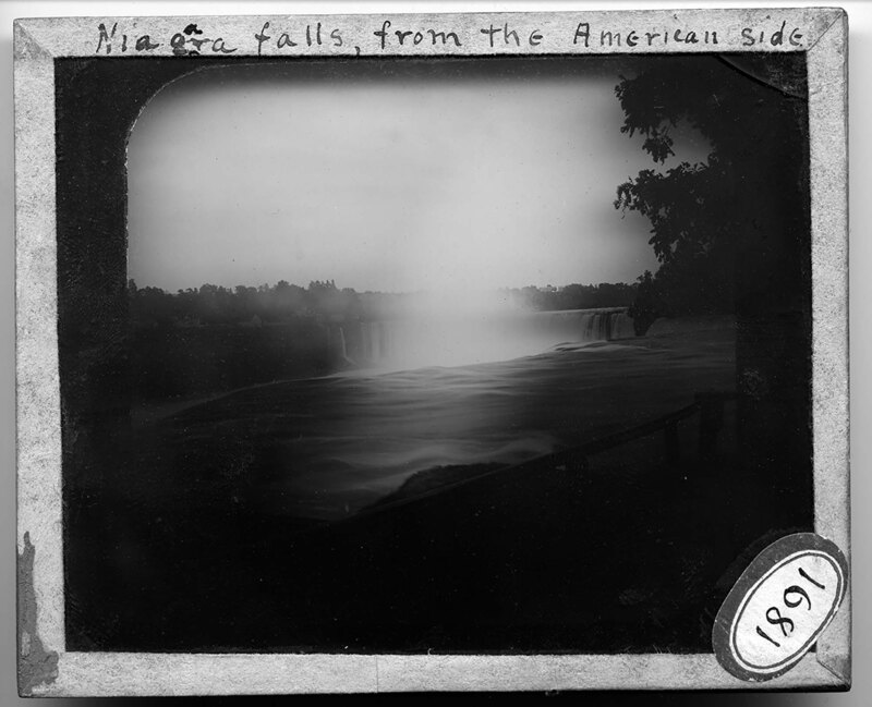
Niagara Falls from the American side in New York. The falls can be seen to the right and the opposite Canadian bank in the background. A wooden fence blocks off the viewing deck from the rapids in the foreground.
Niagara Falls from Goat Island, looking west at the Canadian bank. Water crashes over the falls and rapids can be seen in the foreground, cresting rocks in the riverbed. Several buildings can be seen in the background, on the banks of the river.
Close-up picture of the rapids of Niagara Falls between New York and Ontario, Canada. Trees and bushes grow on the banks of the river and the rapids can be seen in the background, breaking over rocks.
Overlooking the Niagara Falls rapids from the American side in New York. It is noted the picture was taken looking out between the islands of the American rapids.
Overlooking the Niagara Falls rapids from Canada. A wooden boardwalk extends out over the rapids in the foreground and the beginning of the falls can be seen to the right.
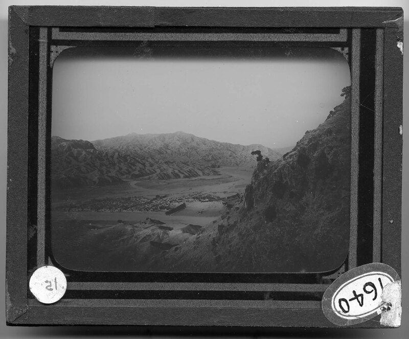
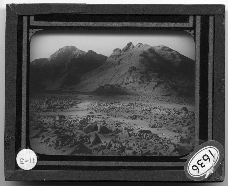
Mountainscape of Fou-ping in the Chihli province, China. It is noted that this area was once rich in timber. A large river corridor cuts through the mountains and leaves a plateau on the landscape. A town can be seen at the base of the mountain in the foreground and stepped fields can be seen on the opposite side of the river.
Looking out over a mountainous landscape that has been affected by deforestation in Wu-tai-shan, China. Farmers have created artificial terracing to utilize what is left of the soil on top of the mountains. There are no trees and the landscape is sparse, except for the fields. Mountains can be seen in the background.
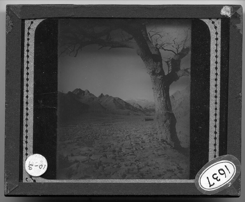
Looking down a river corridor from Tai-shan-ho to Tung-tai, one of the five sacred mountains in China. A large tree grows out of the rocky river bed in the foreground and stands of trees can be seen further down the river bed. The steep, barren mountains rise on either side of the river.
Rocky landscape in Wu-tai-shan of the Shan-si province in China. It is noted that the lands at the base of the deforested mountains are buried in waste. Large boulders and rocks cover the barren landscape, and several buildings and stepped agricultural fields can be seen at the base of the mountains. There is no vegetation.
A barren landscape in Wu-tai-shan of the Shan-si province in China. It is noted that the picture shows what farming is like in the path of a recent flood. Square fields can be seen to the left, but the landscape is barren and rocky. Mountains rise in the background.
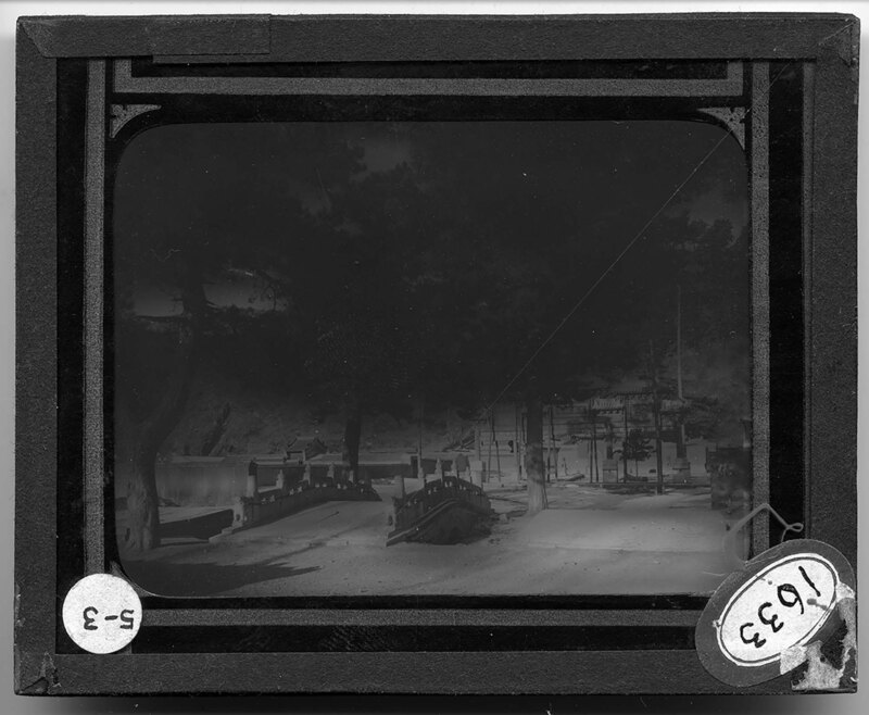
A Buddhist temple at Wu-tai-shan in the Shan-si province, China. A stone bridge leads to the ornate temple in the background, obscured by trees. The landscape is hilly and covered with grass and trees. A temple is built next to a lake.
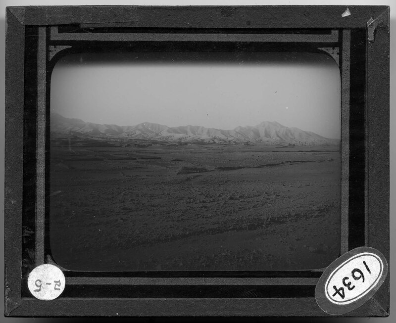
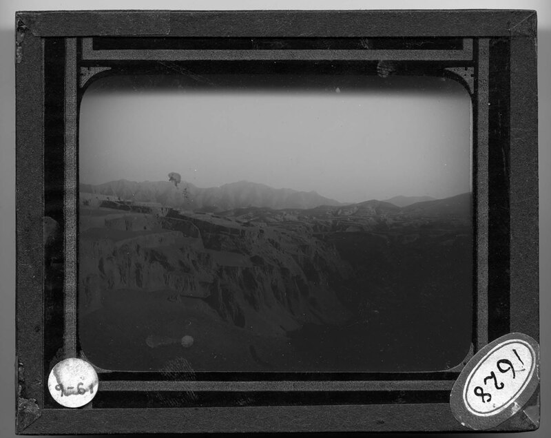
aerial view of 200 square miles of once wooded mountains in the Chili Province, China. The landscape is barren and very mountainous. A river bed can be seen to the left, cutting through the canyons of the mountain range.
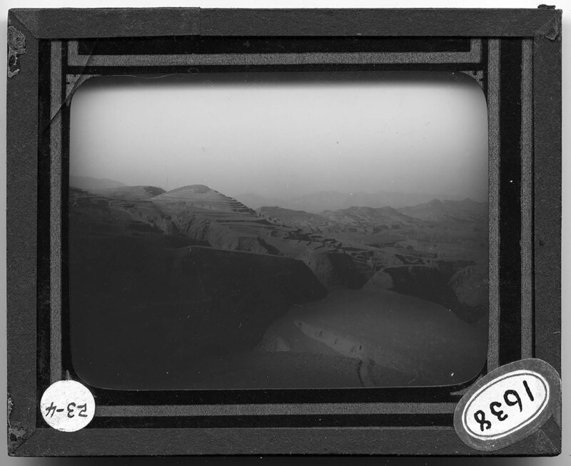
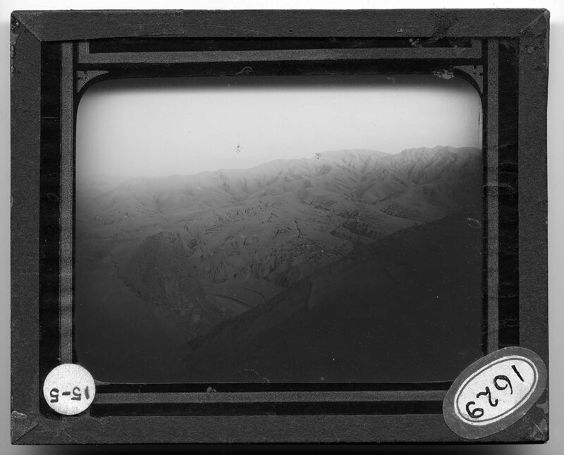
1200 feet above the Loess canyon, southeast of Wu-tai-hsien, China. Stepped cultivated fields are situated in the canyon, and steep rock walls rise on either side of the fields. Mountains can be seen in the background and it is noted that the picture shows the distribution and erosion of the canyon.
Loess canyon five miles southwest of Tung-Yu in the Shansi Province, China. The steep, rocky walls of the canyon open to stepped cultivated fields that dot the landscape. Mountains can be seen in the background.
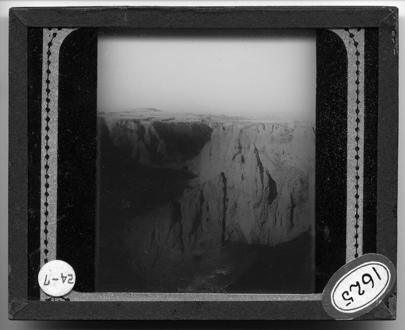
Loess canyon north of Ho Chou in China. The canyon has steep rock walls and pinnacles that have been eroded over time. There is no vegetation and the landscape desolate.
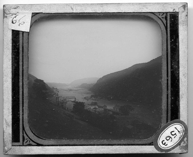
aerial view of the Shenandoah River near Harpers Ferry, West Virginia. The landscape is very hilly around the river and the banks of either side are very steep and covered with dense vegetation. Large boulders stick out of the river and create strong currents as the water rushes past them. Several buildings can be seen on the bank in the foreground, along with a rail line.
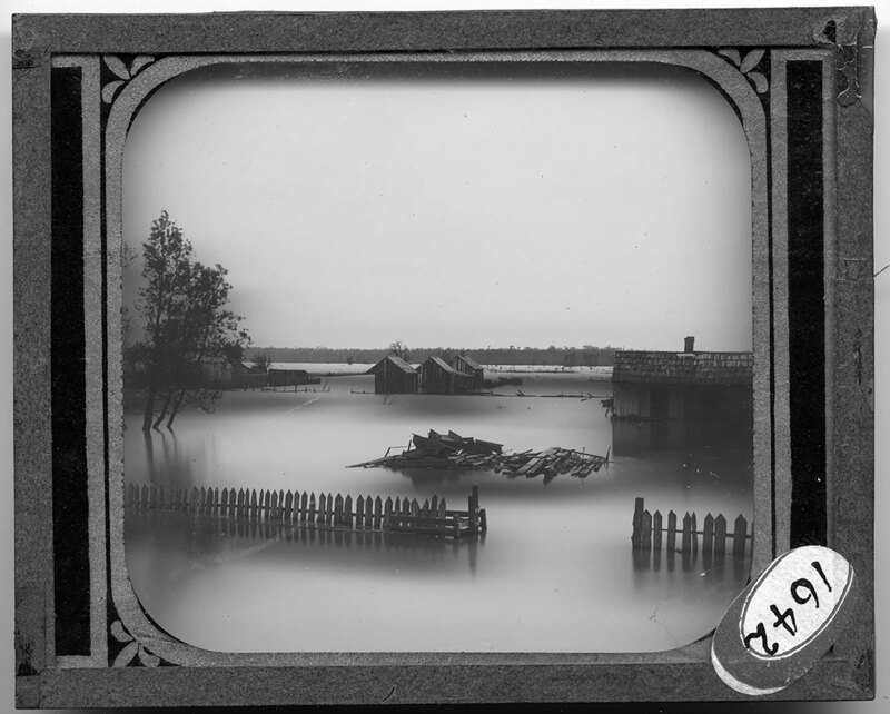
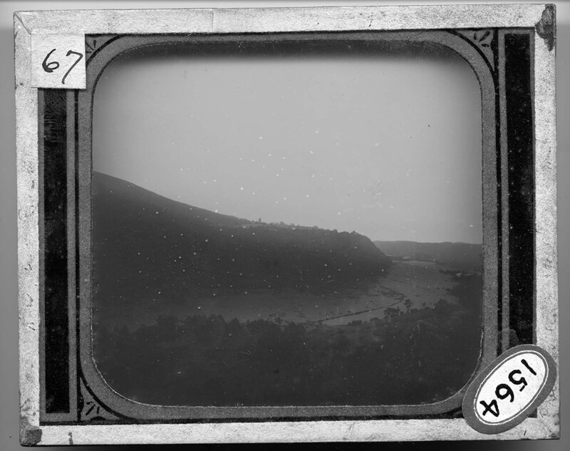
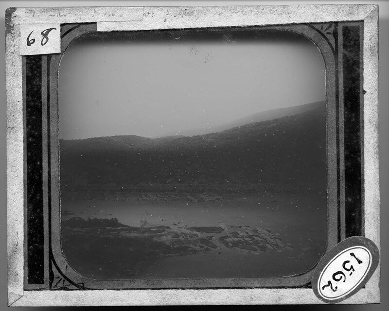
The junction point of the Shenandoah and Potomac Rivers in Harpers Ferry, West Virginia. The landscape is very hilly and the river cuts through the valley between the steep banks on either side. Houses have been built on the bank in the foreground and there appears to be a lot of debris or rocks in the middle of the river. A stone and steel bridge is under construction, joining the two side of the river.
aerial view of the Potomac River, near Harpers Ferry, West Virginia. The landscape is hilly and the banks of the river are covered with trees. Ice and snow have accumulated on the river and around the small island in the foreground. A roadway can be seen on the opposite side of the river, at the base of a hill.
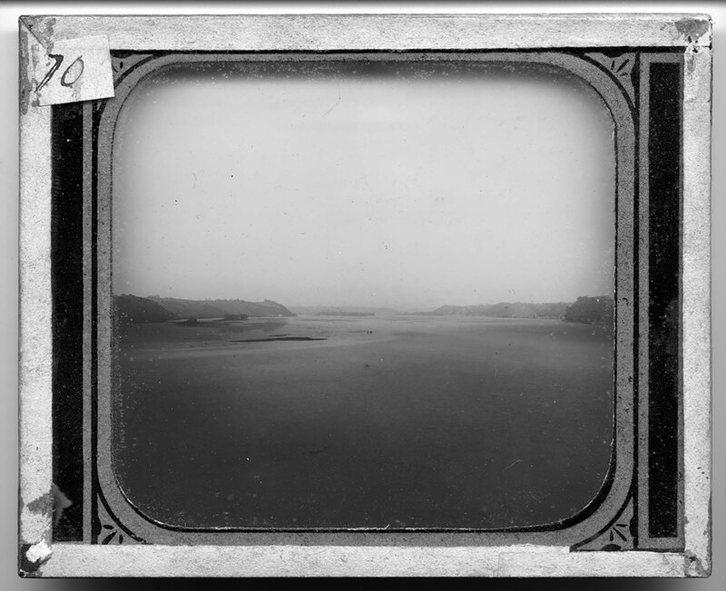
The gorge of the lower Susquehanna River, likely in Pennsylvania. The entire river runs from the Pennsylvania, New York, and and Maryland, and is the longest river on the east coast of the United States. The river cuts through the gorge and leaves small islands in the water. The banks of the river are steep and covered with trees.
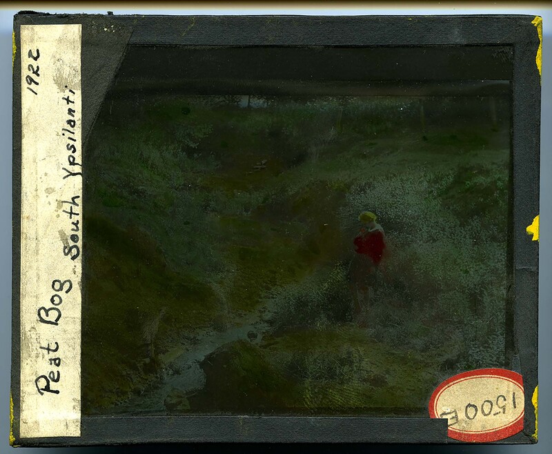
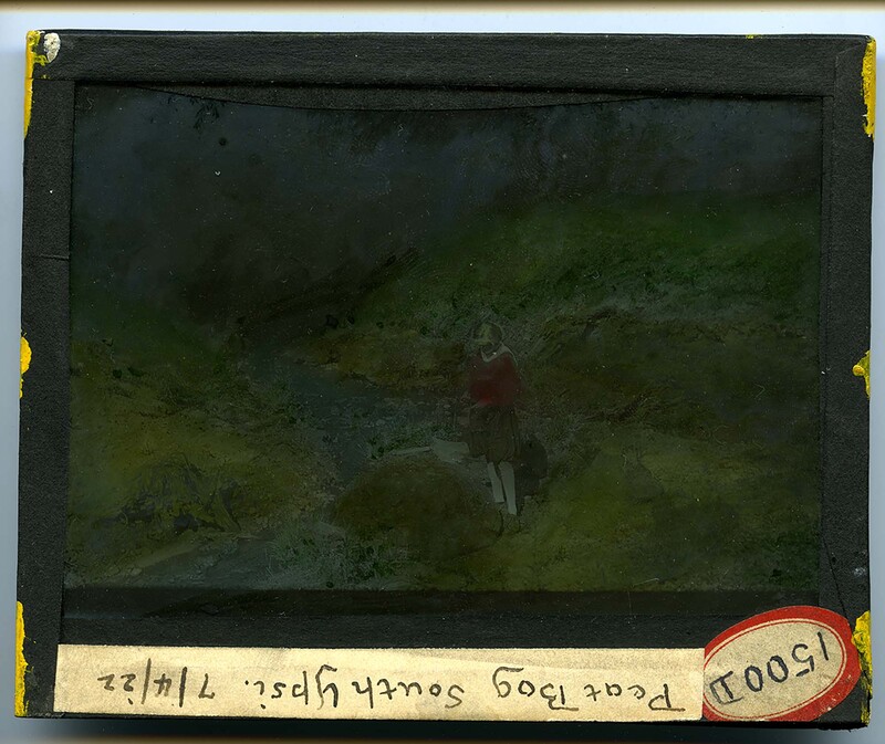
A girl stands next to a river south of Ypsilanti in 1922. It is noted that this area is a peat bog. The landscape is rocky and covered with grass and dense trees. The river cuts through the rock bed.
A girl stands next to a river south of Ypsilanti in 1922. It is noted that this area is a peat bog. The landscape is rocky and covered with grass and dense trees. The river cuts through the rock bed.
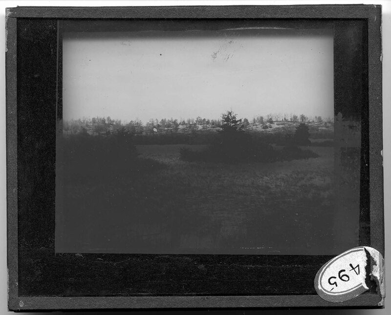
Spagnous swamp in Maine where the water is almost gone. Large pine trees stand at the edge of the Swamp but only rushes grow near the water. It is noted that this is what a Sphagnous swamp looks like towards the end of its life. Mountain peaks can be seen in the background.
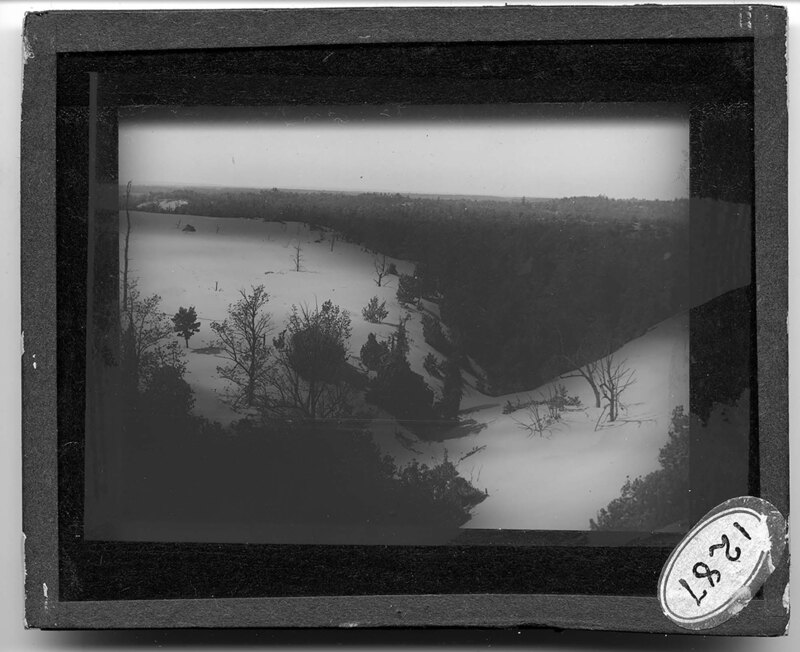
A Spagnous and Ericad Swamp in Northern Indiana. The landscape is relatively flat but is hilly in the background. Trees and rushes cover the swamp and it is most likely winter because the trees are missing their leaves.
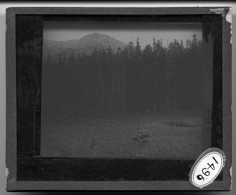
Mountainscape of the Elk Mountains in Colorado. Pearl Mountain, at 13,484 ft., is in the center of the picture and several of the peaks in the background are snowcapped. The remnants of rock slides can be seen on the side of the mountain and pine trees cover the base of the peaks. It is noted that the timberline is at 12,000 ft.
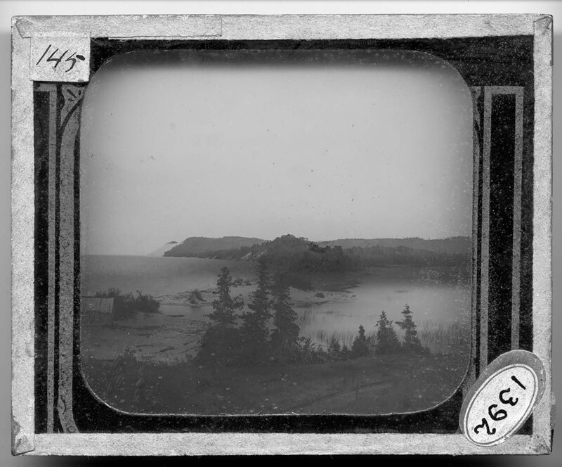
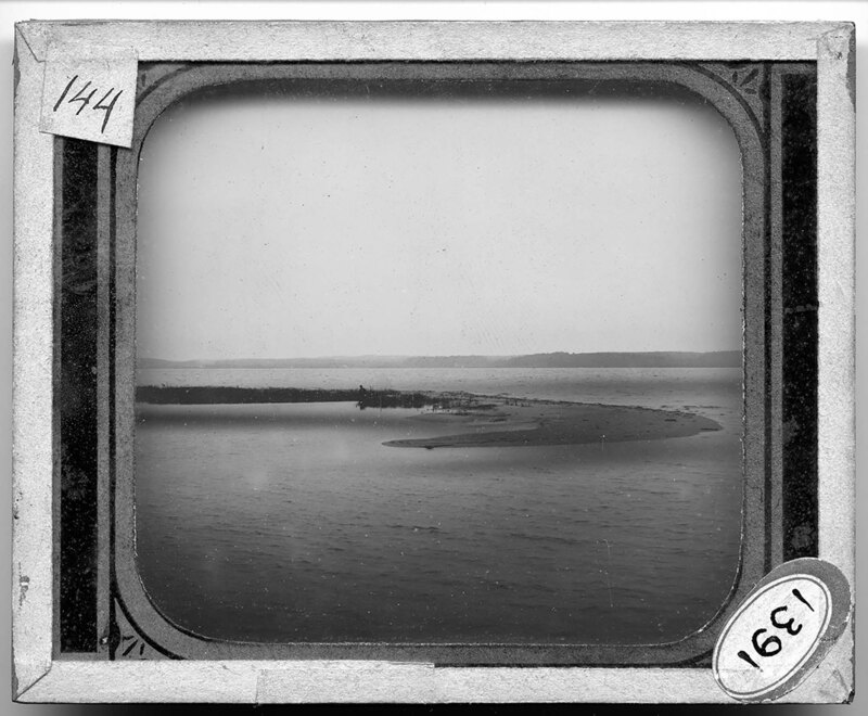
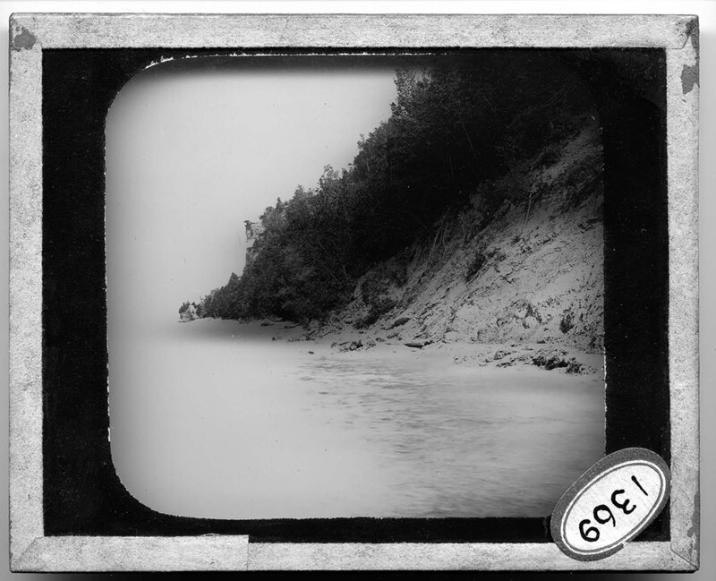
A sandy bar joins the Sleeping Bear Bluffs and Empire, Michigan. A small shack can be seen on the shoreline in the foreground. Dune grass and trees cover the landscape of both the mainland and the bluffs. A bare sand dune can be seen in the background but most of the dunes are covered with trees.
"Duck Point" in Grand Traverse Bay in Lake Michigan. The point is a small sandy island near the shoreline of Lake Michigan and dune grass covers half of it. A second shoreline can be seen in the background.
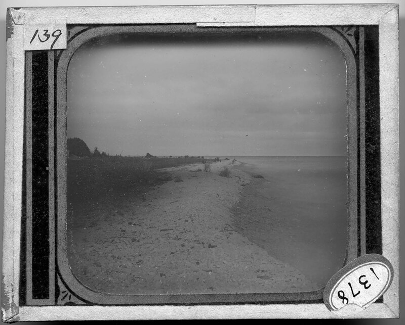
A limestone pebble beach on Mackinac Island, Michigan. Grass covers the landscape and a small house can be seen in the background, near a stand of trees.
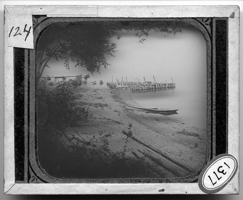
The western shore of Cauuga Lake in New York. Two row boats sit on the rocky beach near a wooden pier that reaches out into the lake. Trees and grasses cover the landscape.
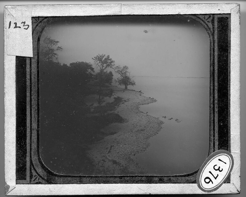
A rocky shoreline along Lake Ontario in Griffin Bay, New York. A small lagoon can be seen next to the shoreline and is surrounded by trees and grasses. There is no wind on the lake and a second shoreline can be seen in the background.
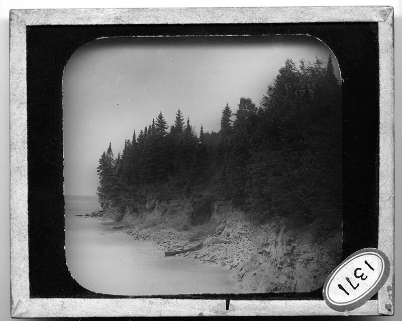
A rowboat sits on the rocky shore of an island near Marquette, Michigan. Large sandstone cliffs rise above the lake, and they are covered with pine trees and scrub bushes. Large boulders that have fallen from the cliff litter the beach.
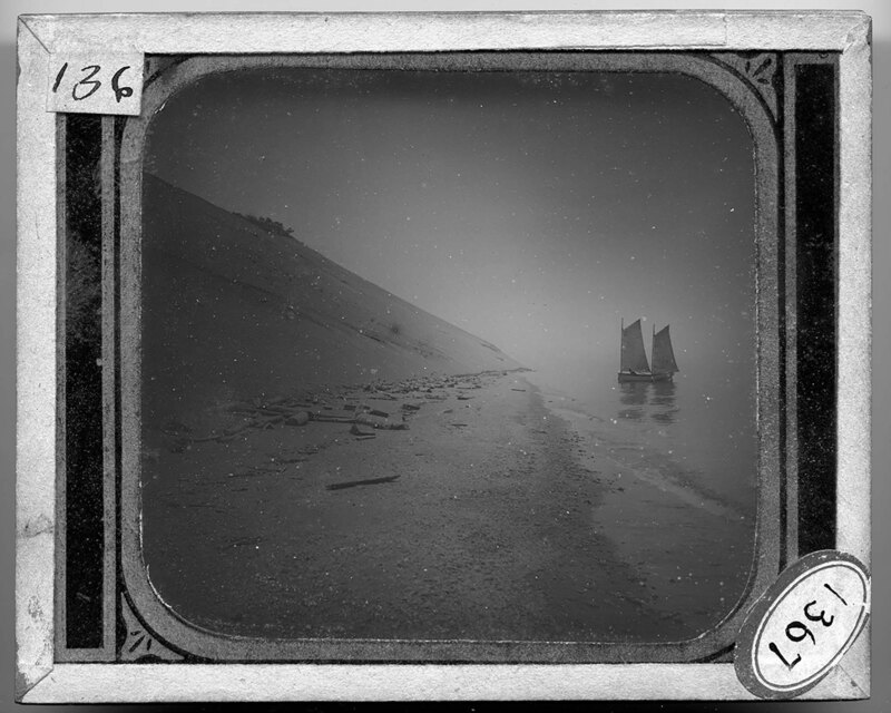
A sail boat floats near the eastern shore of Lake Michigan at Sleeping Bear Dunes. A steep dune rises to the left and the small beach is littered with rocks and tree debris. The dune is bare except for a small stand of trees near the top.
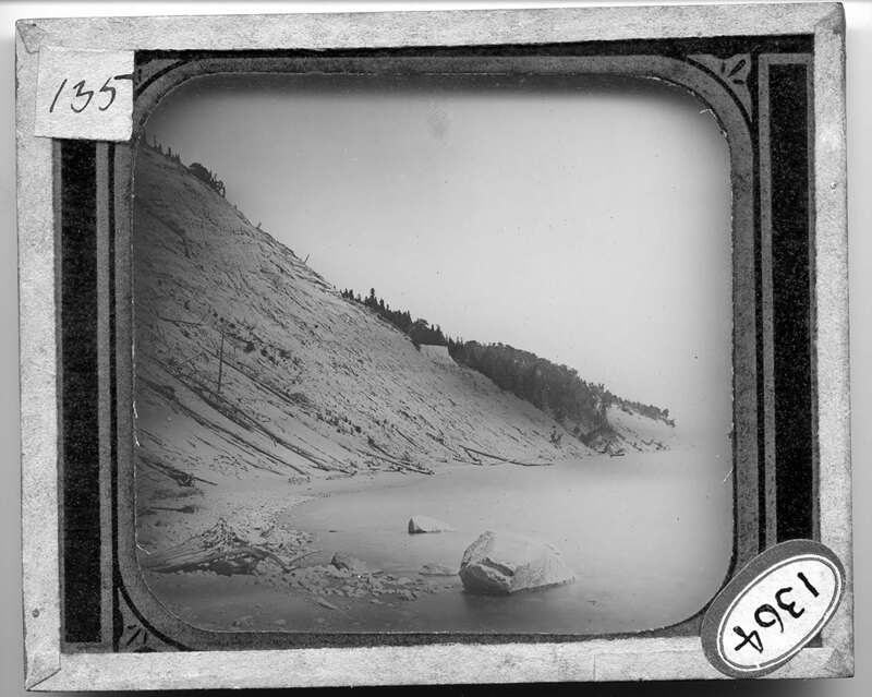
Steep sea cliffs on South Manitou Island in Lake Michigan. The steep dune leaves little beach next to the lake but the small beach is covered with rocks and pebbles, along with tree debris. Trees can be seen growing on the dune in the background.
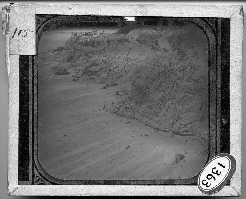
Exposed glaciated rock bed near Lake Ontario in New York. Striated markings can be seen in flat rock surface, which has been exposed as the bank receded. Large boulders and trees can be seen on top of the bank along with tree debris and dirt.
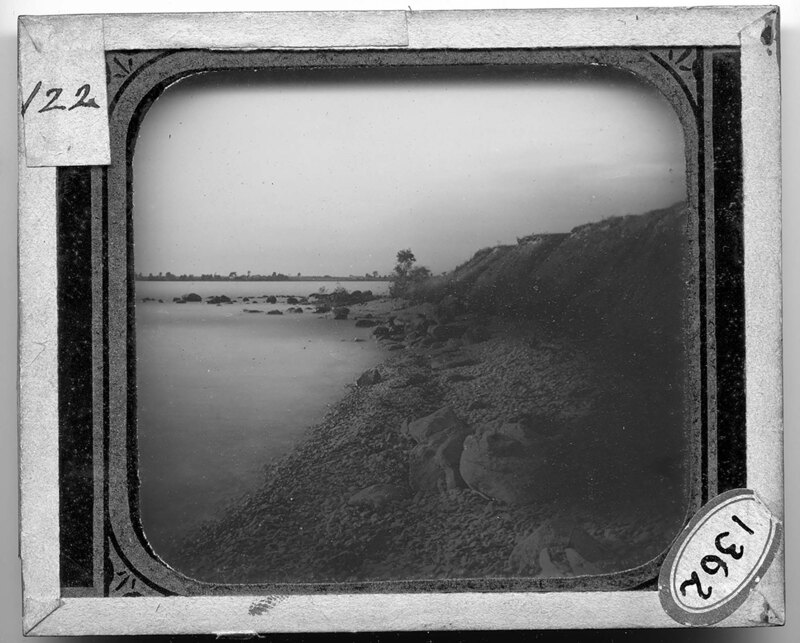
The rocky Lake Ontario shoreline of Griffin Bay, New York. Large boulders and smaller pebbles make up the short shoreline, which turns into a steep earth embankment. A second shoreline can be seen in the background, dotted with trees.
Large dune encroaching on a pine forest. As the dune moves, it covers the landscape around it, killing the trees and other vegetation. Nothing grows on the dune.
Extensive scrub bushes cover most of the dune and trees can be seen on top of the dune. Power lines and buildings can be seen in the background, next to Lake Michigan.
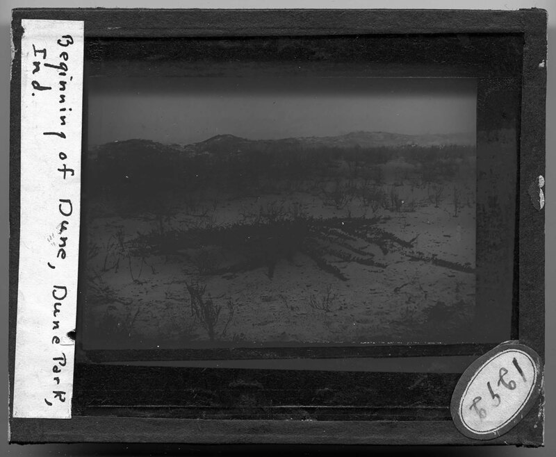
The beginning of a dune in Dune Park, Indiana. Dune grass and scrub bushes grow out of the sand, which extends down to Lake Michigan in the background. The sand is littered with vegetation debris.
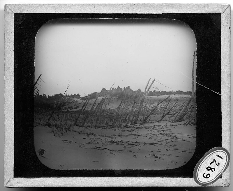
Dead tree trunks stick up out of the sand dune near Lake Michigan. The trees were likely covered with sand as the nearby dune moved across the landscape, killing the trees and burying their trunks, until the dune moved again exposing the trees. Tree debris litters the beach and several other dunes can be seen in the background, covered with trees.
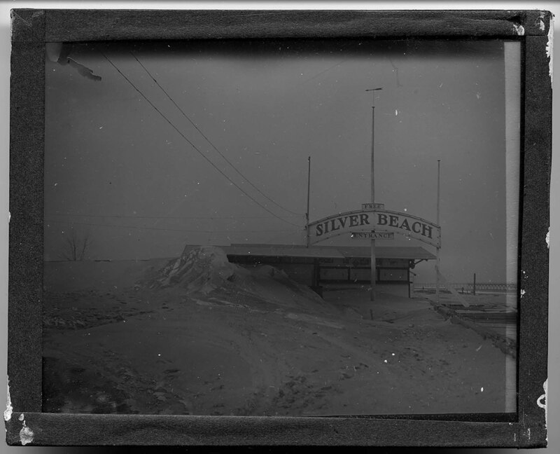
A sand dune covers most of the Silver Beach Entrance booth near St. Joseph, Michigan. A long pier stretching out over Lake Michigan can be seen in the background, and the wooden pier next to the entrance booth has been badly damaged.
Sandy landscape overlooking Lake Michigan in the background. Trees and shrubs grow up through the sand dunes and cover most of the land below the sandy plateau, which is presumably a moving dune. Dead trees stick up out of the dune after having been buried by the sand.