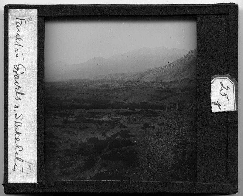
Landscape image taken North of Salt Lake City, Utah. Mountains rise in the background and the landscape is rocky with sparse vegetation. People can be seen in the bottom center of the image hiking up one of the hills that appear to be common in this area. It is noted the image is showing the fault in gravels.
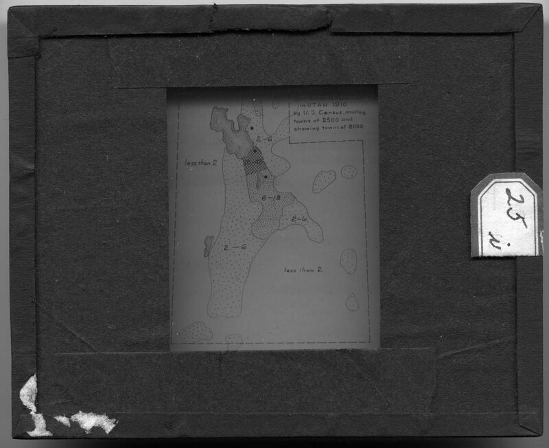
Map depicting the distribution of Utah's population in 1910, according to the U.S Census. The map omits towns with less than 2500 people and shows towns with more than 8000 people. There is no legend to describe what the different drawing textures mean but Utah's Great Salt Lake is shown with elevation marks in the top left portion of the slide.
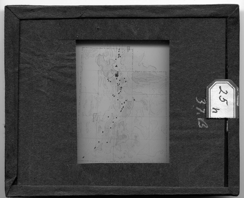
Map of Utah showing population numbers in cities across the states. There is no legend on this map but a similar legend, presumably used to create this map, can be found on slide "010_MJ_93_064c - Utah. The Oasis of Utah map." Landscape features are also depicted on this map.
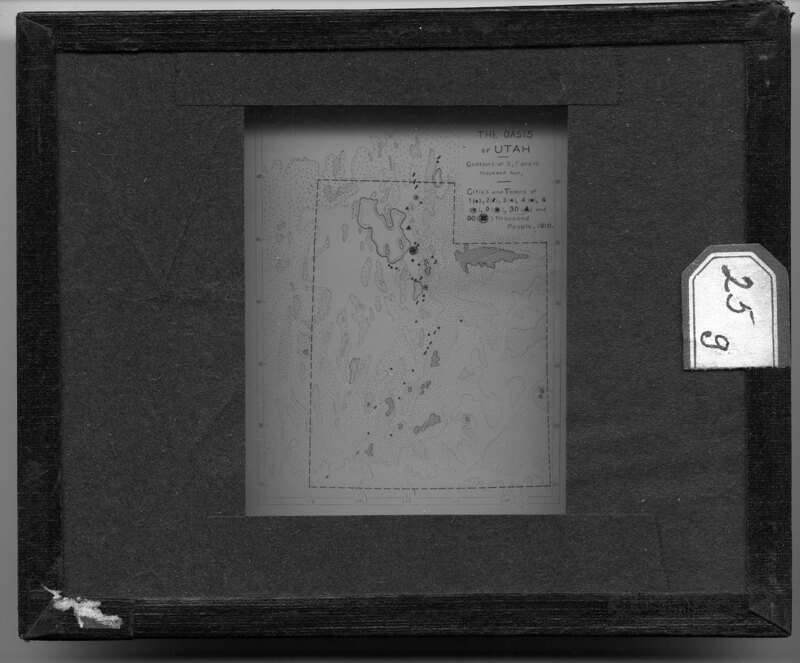
Map depicting the various landscape features of Utah. Shapes are used to show populations in cities across the state with data from 1910. Different drawing styles are used to show the rough topography of the states and the slide is labeled "The Oasis of Utah."
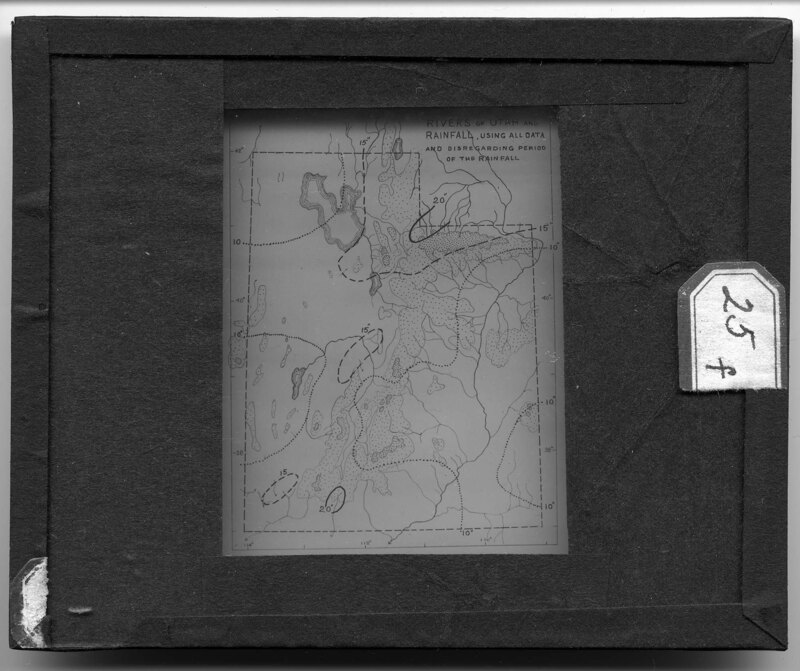
Map depicting the prominent rivers in Utah. It is noted that rainfall amounts are also noted but are based on all data collected up until the map was drawn and there is no particular period of time used when considering the measurements. Various styles of lines are used to depict inches of rain and they are drawn around regions of the state to show where the most rainfall occurs.
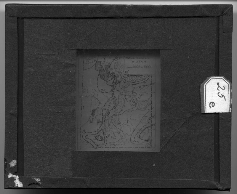
Map depicting the annual rainfall in Utah from 1905 to 1909. The map is divided into regions based on the amount of rain each part of the state receives and various landscape features are shown with different drawing designs.
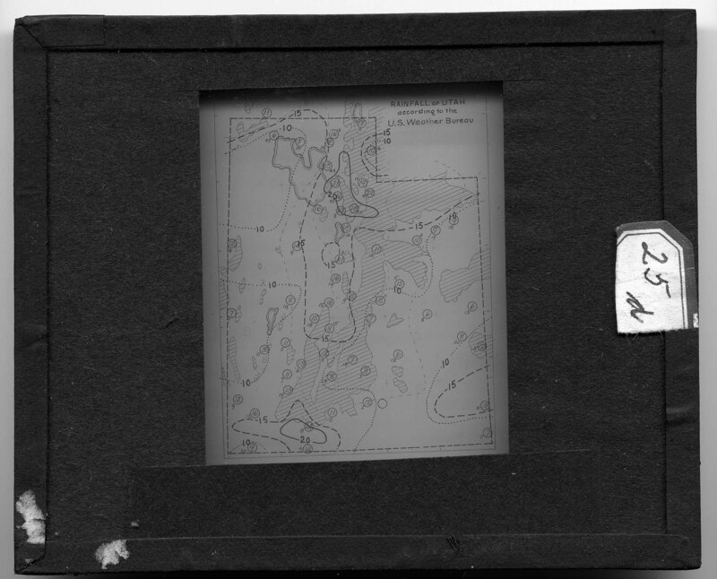
Map depicting rainfall amounts in Utah, based on statistics from the U.S. Weather Bureau. The date is unclear for when this information was collected but the map is divided into regions based on the amount of rainfall each portion of the state receives.
Average rainfall in Utah by five year periods. It is noted on the slide that rainfall percentages have increased every five years when the measurements were taken.
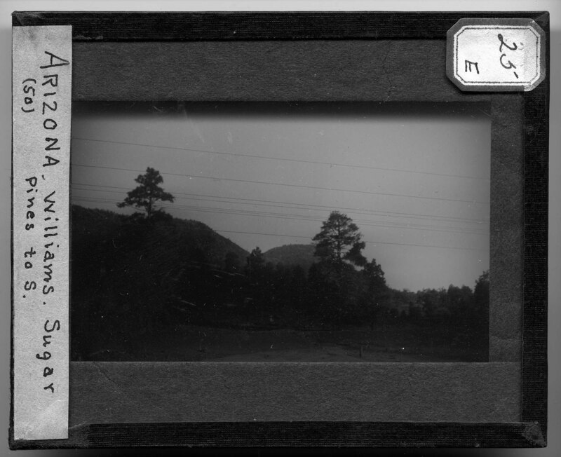
Old growth trees in a forest in Arizona. Possibly Sugar Pines, the evergreens dominate the landscape which is covered with short grass and scrub bushes. The land is flat and appears to be arid.
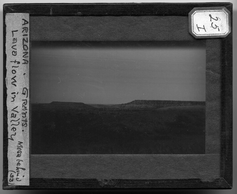
Rocky landscape in Arizona. It is noted there is a lava flow that can be seen in the valley with the mesa behind it. This area appears to be arid based on the sparse vegetation found on the hills and the plateau in the background. Power lines cross over the landscape next to the roadway.
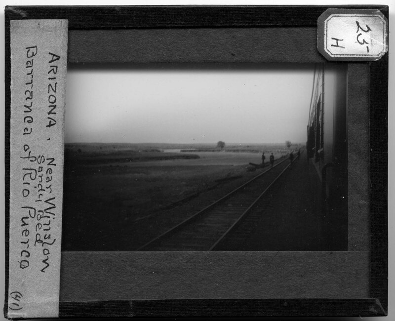
The Rio Puerco Barranca near Winslow, Arizona. A barranca is a narrow, winding river gorge and the river can be seen cutting through the flat, barren landscape. Railroad tracks can be seen in the foreground and the image was taken out of the window of a train car. People can be seen standing on the tracks looking out over the landscape.
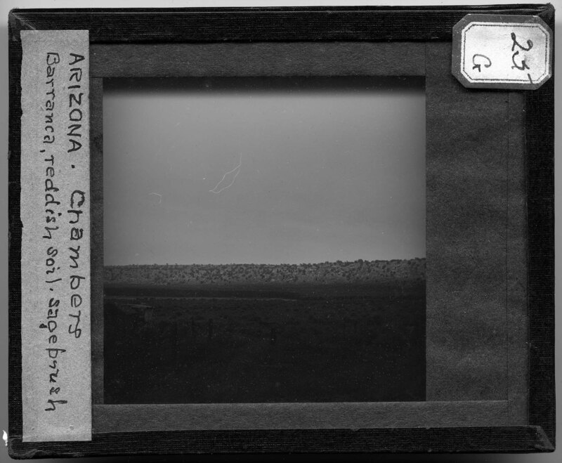
Landscape image of a barranca near Chambers, Arizona. A barrnaca is a narrow, winding river gorge, and it is noted this one cuts through a red soil and sagebrush landscape. The river can be seen in the middle of the picture, with a small farm in the foreground and a ridgeline in the background. The landscape appears to be arid based on the vegetation that covers the ground.
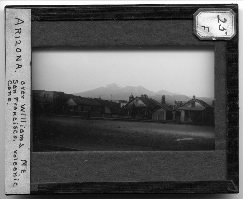
Streetscape with Mt. San Francisco in the background over Williams, Arizona. Houses and storefronts line the dirt roadway which runs beside two railroad tracks. In the background, Mt. San Francisco and the San Francisco Peaks, a volcanic mountain range in North Central Arizona, rise above the town. Snow covers the tallest peak.
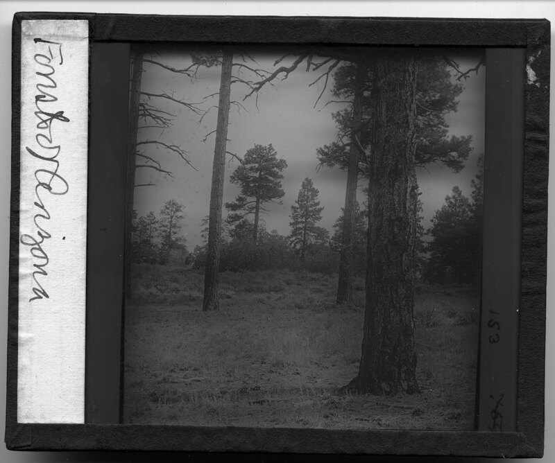
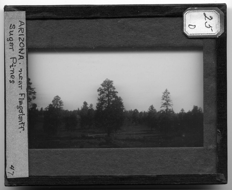
Sugar Pines near Flagstaff, Arizona. The pines appear to have been planted in somewhat straight rows across the landscape and are all relatively the same age, based on their similar heights. Sugar Pines are the tallest and largest evergreen trees in the United States and are native to the Pacific coast region of the country.The landscape is rocky and covered with sparse vegetation. Large hills can be seen in the background and a waterway can be seen in front of the trees in the foreground.
Sugar Pines near Flagstaff, Arizona. The pines appear to have been planted in somewhat straight rows across the landscape and are all relatively the same age, based on their similar heights. Sugar Pines are the tallest and largest evergreen trees in the United States and are native to the Pacific coast regiion of the country.The landscape is rocky and covered with sparse vegetation. The picture was taken from a moving car.
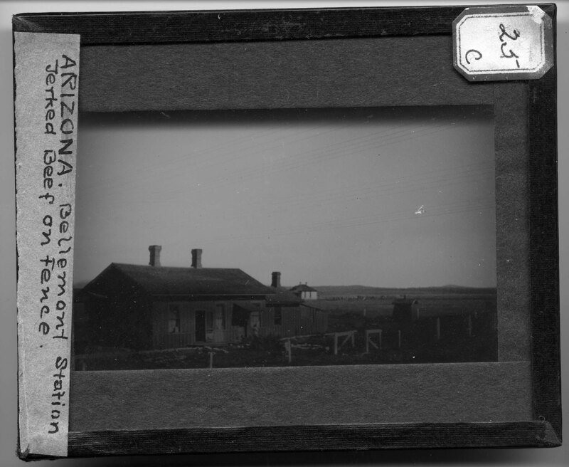
Bellemont Station in Bellemont, Arizona. The station is a vernacular building with two front entrances and three windows. Two additions can be seen on the side of the buildings and rock lined walkways lead to the main entrance. The landscape is flat with sparse vegetation. A small farm and house can be seen in the background. Power Lines cross over the top of the building.
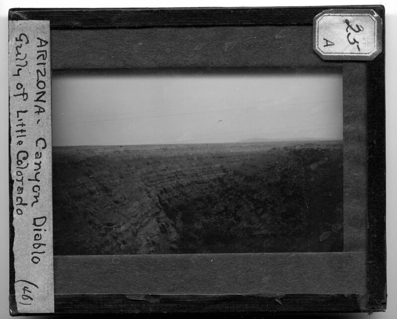
Canyon Diablo in Arizona. The canyon has been carved by the Little Colorado river at the bottom of the valley and the rocky landscape appears to have been cut into shelves. The landscape is flat until the canyon starts and mountains can be seen in the background.
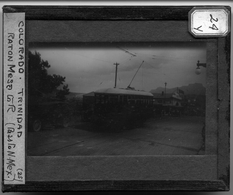
Streetscape of Trinidad, Colorado. A trolley passes through the middle of the street, attached to power lines above. Passenger cars can be seen behind the streetcar, both parked and driving. Store fronts and the train station can be seen in the background. Large mountains rise up behind the town.
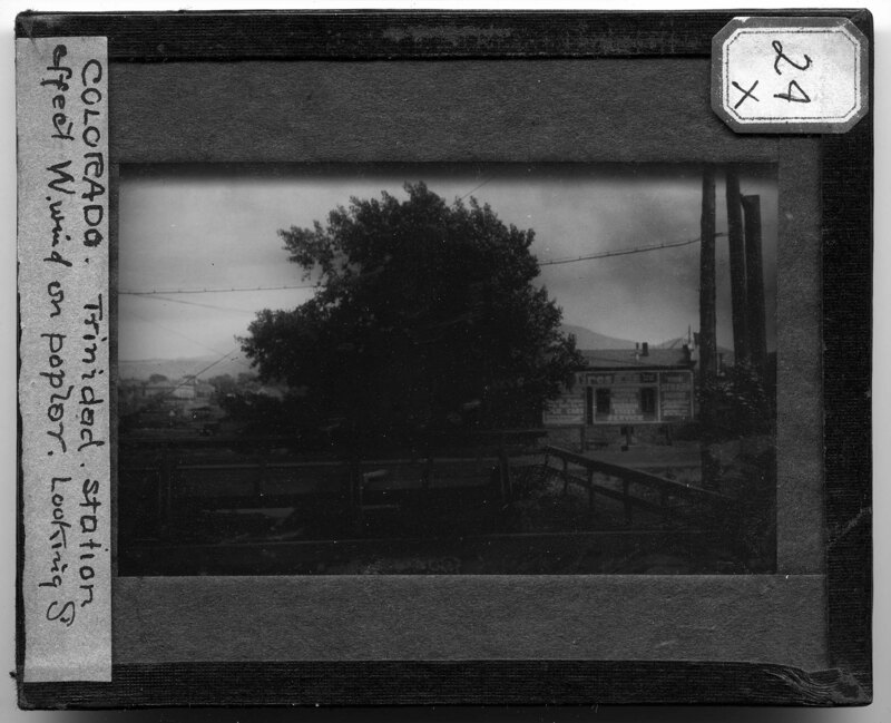
Train station in Trinidad, Colorado. It is noted the picture is showing the wind effect on the poplar tree in the foreground. Two wooden bridge cross over a valley in the swale under the roadway and the station can be seen in the background. Mountains rise up behind the town and electrical wires run across the roadway.
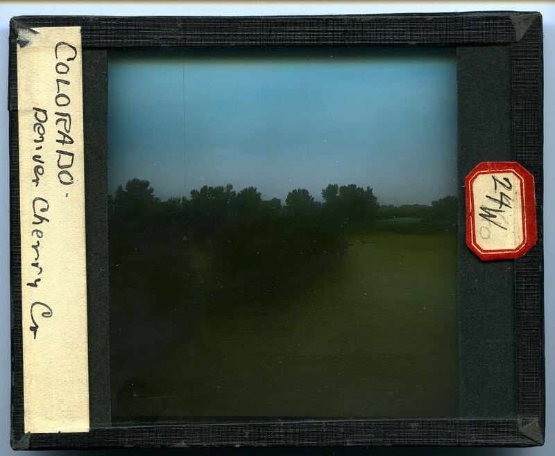
Cherry Creek near Denver, Colorado. The creek is severely flooded and has overflowed the banks. Trees can be seen rising out of the rushing water and dirt islands can be seen in the background.
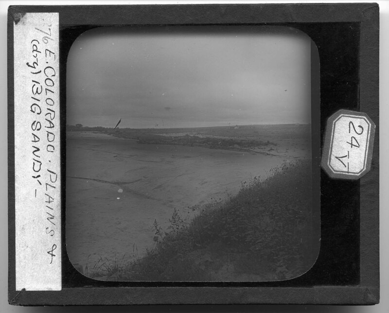
Arid landscape in Colorado. It is noted that the picture shows the plains and Big Sandy. Sparse ground cover can be seen in the foreground with a sandy landscape to the left. There are few trees and a small farm can be seen in the distance. Cultivated fields can be seen in front of the farm.
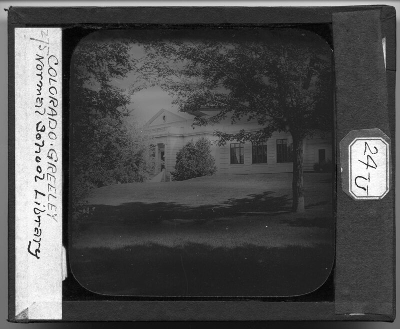
The Normal School Library in Greeley, Colorado. The building is constructed using a Greek Revival style with a large pedimented front entryway and features a large circular dome projecting from the roof line. Trees cover the grounds in the front of the building.
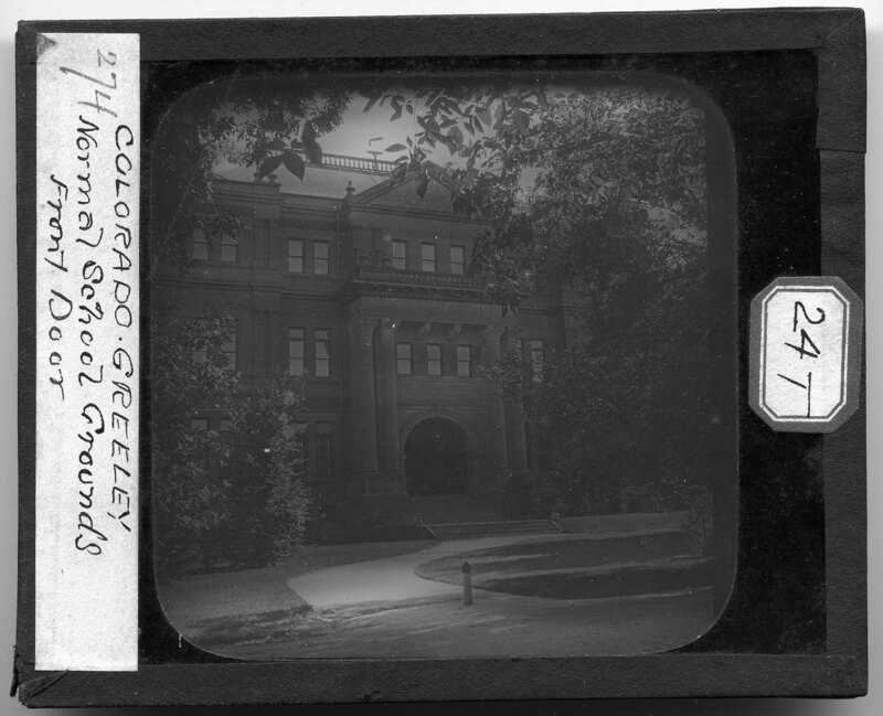
Main entrance of the State Normal School in Greeley, Colorado. The archway above the door reads, "State Normal School Erected A.D. 1892." A two story classical Corinthian entryway with a denticulated and carved bracket pediment supported by six circular columns can be seen above arched entryway to the school. The building appears to be three stories with a decorated facade and cresting on the roofline. Large trees grow in a courtyard in front of the school and walkways lead to the main entrance.
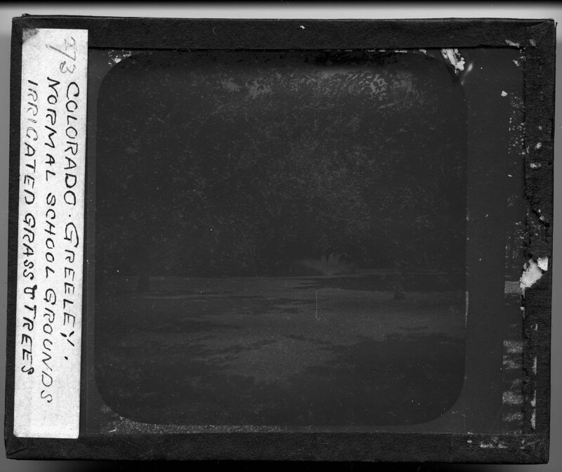
Normal School grounds in Greeley, Colorado. A sprinkler can be seen watering the grass and large trees surrounds the walkways going through the courtyard.
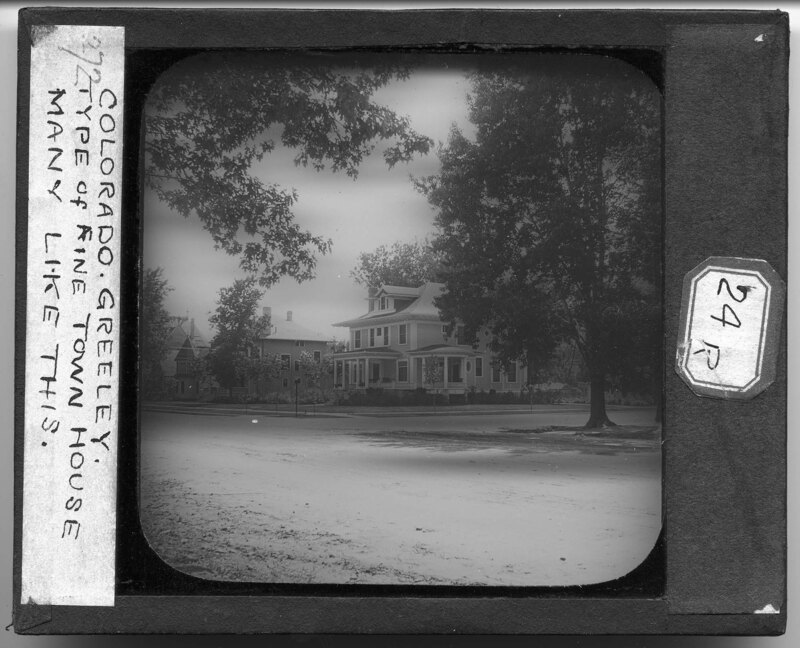
Streetscape in Greeley, Colorado. It is noted these houses are considered fine town houses and they are common in this area. A large American Foursquare style house can be seen in the foreground with two and a half stories, two porches, and an elaborate front roof dormer. Similar houses can be seen in the background. The roadway is compacted dirt and large maple trees have been planted along the sidewalks.
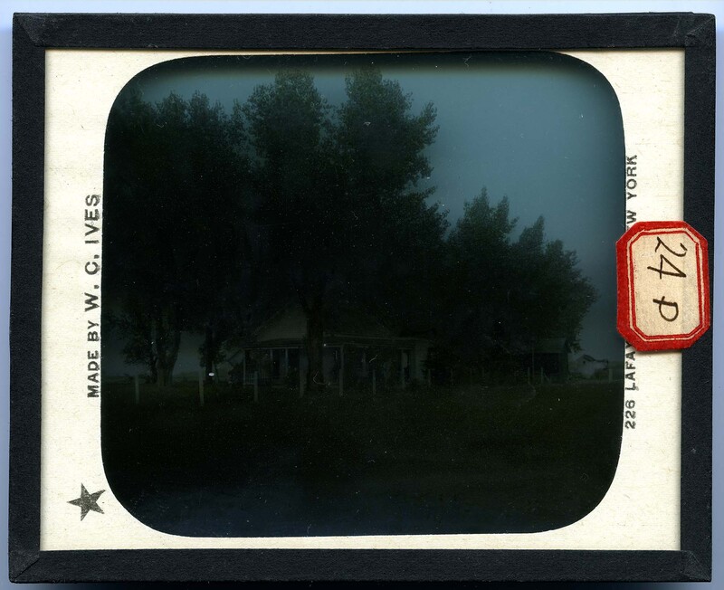
Farmhouse in Colorado. The house appears to be a one and a half story vernacular style farm house with several outbuildings behind the house. Large trees screen most of the buildings and a wooden and wire fence surrounds the property. Cultivated fields surround the farm and the landscape is mostly flat with little vegetation other than crops.
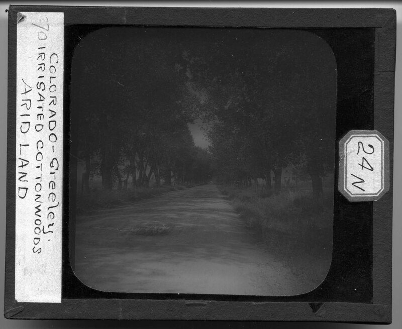
A row of cottonwoods along a dirt road in Greeley, Colorado. It is noted the land is arid but the trees have been irrigated. The roadway is rutted from vehicles and a farm can be seen to the right behind the row of trees. A wooden and barbed wire fence separates the roadway from the fields on either side of the road.
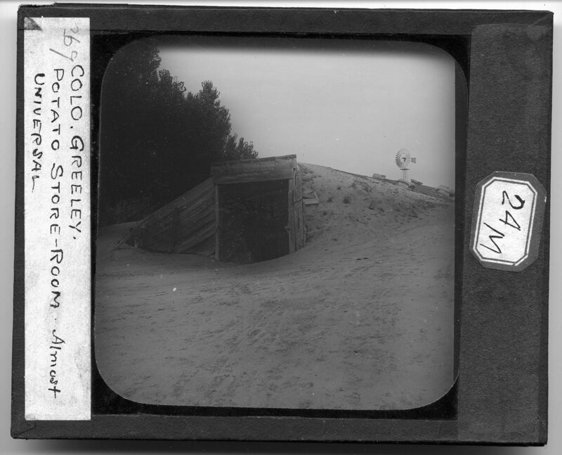
A potato store-room in Greeley, Colorado. It is noted this style of storage shed is a common design throughout the area. A large bank of sand and soil has been constructed on top of a wooden room in order to create cooling insulation for the harvested potatoes. A wooden door and frame lead into the cellar and a windmill can be seen in the background.
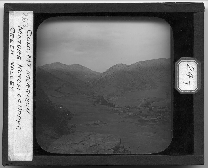
Upper Creek Valley and Mt. Morrison in Colorado. Large mountains can be seen in the background, sparsely covered with vegetation. A small town can be seen at the base of the mountains and a river cuts through the valley of the peaks and leads to the town.
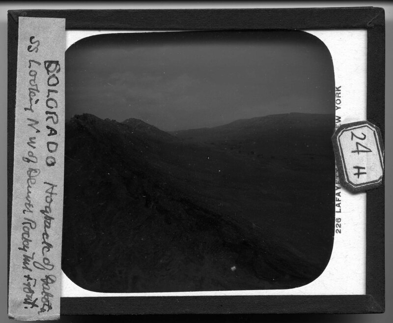
A rocky ridgeline, or "hogback," near Dakota, Colorado. The ridgeline appears to be rising out of the ground to the left of the picture and the landscape is sparse with ground cover and few trees. A river can be seen in the valley between the two ridgelines in the picture.
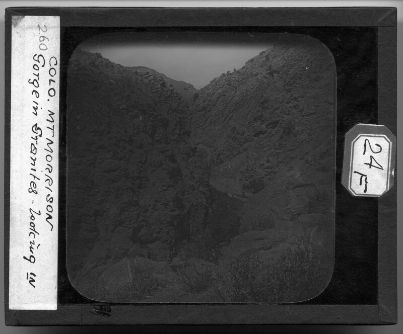
At the bottom of a granite river gorge near Mt. Morrison in Colorado. The landscape is very rocky with little vegetation. Large boulders surround the narrow river winding through the gorge and electrical poles have been built next to the river. Hills rise in the background.
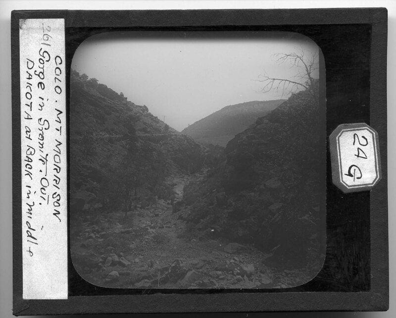
A rocky granite gorge on Mt. Morrison in Colorado. The landscape is barren with few scrub bushes and the image was taken looking down into the gorge. A single electrical pole can be seen at the base of the gorge nest to a small river.
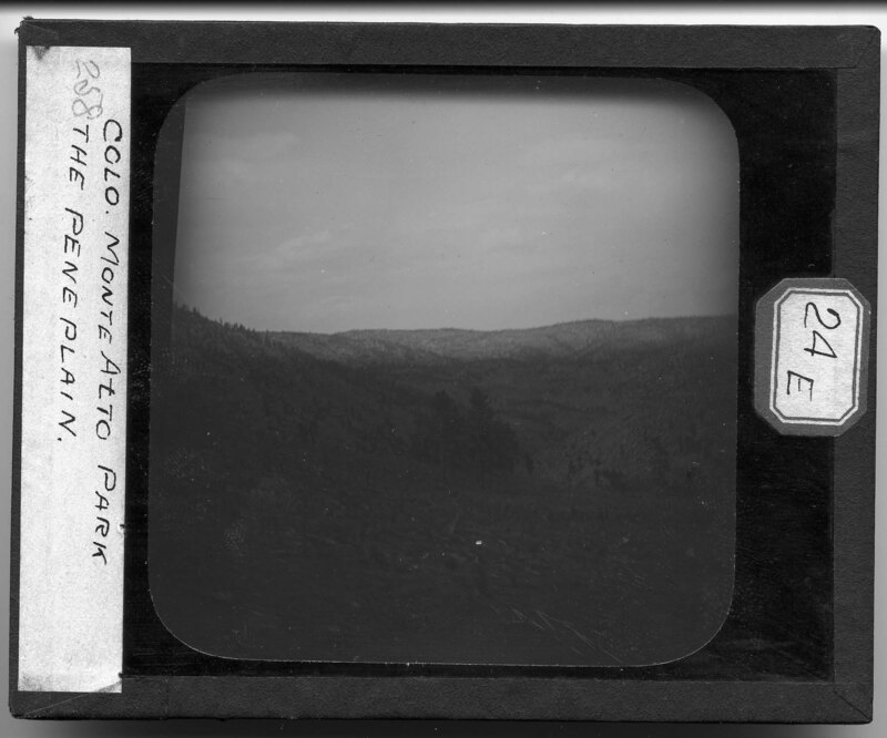
The peneplain near Monte Alto Park in Texas. The rocky landscape is very hilly with few trees. Sparsely covered hills rise in the background and the picture was taken from a moving car.
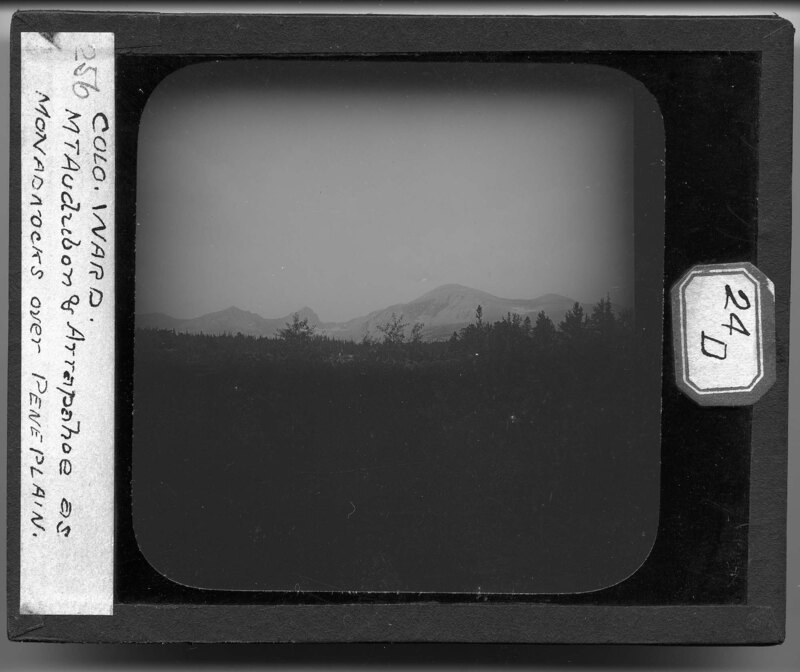
Mt. Audubon and Arrapahoe near Ward, Colorado. The peaks are described as "monadnocks" or isolated hills rising above a peneplain. The rocky landscape is covered with dense vegetation and the peaks appear to be barren of trees. Mt. Audubon can be seen to the right in the picture, while Mt. Arrapahoe can be seen to the left.
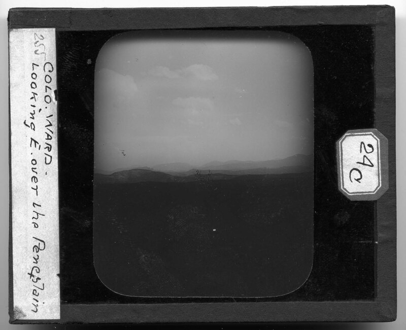
Landscape image looking over a peneplain near Ward, Colorado. The landscape is very hilly in the foreground and mountainous in the background. Trees can be seen on the hillside but are not present on the mountains. A small creek bed and be seen winding through the trees in the foreground.
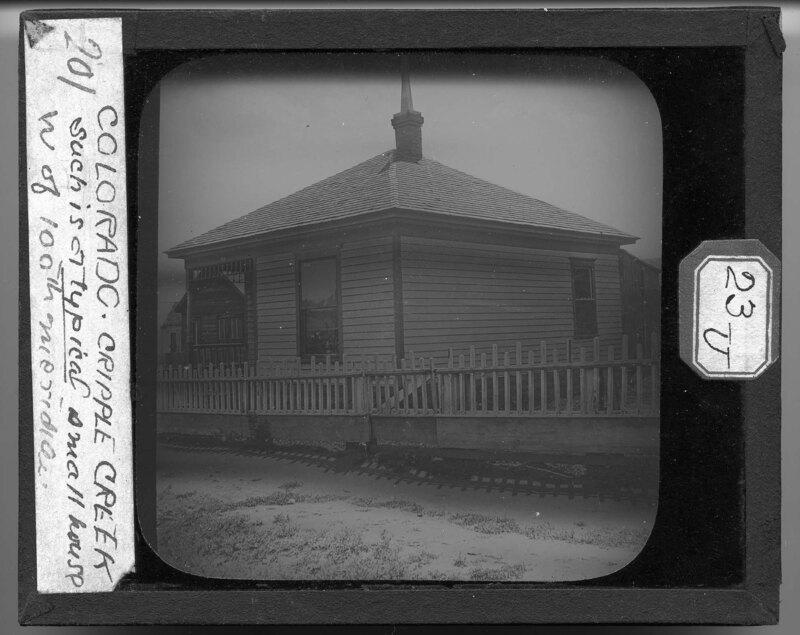
A pyramid style house that is typical past the 100th meridian in Cripple Creek, Colorado. The house is a one story structure with a side front porch and two bays. A large flue can be seen coming out of the chimney on top of the roof and a wooden fence surrounds the property. Several timber built structures can be seen in the background.
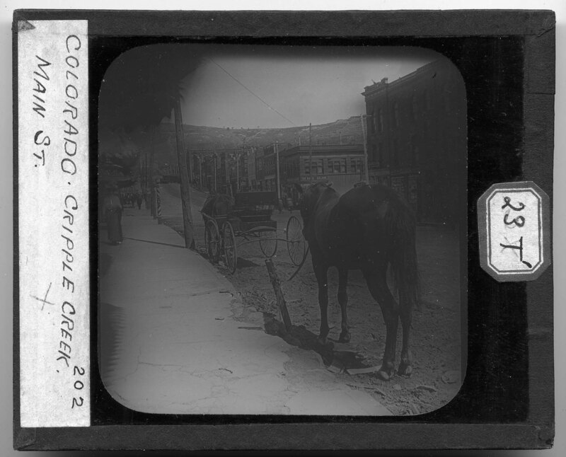
Two horses wait outside the business along main street in Cripple Creek, Colorado. Storefronts line both sides of the dirt street and pedestrians can be seen walking on the sidewalk outside of the businesses. A canvas awning shields the storefront in the foreground and power lines cross the street running from store to store. Mountains can be seen in the background.
Town in Colorado. Most of the houses are built directly next to each other and appear to be similar architectural styles. The town has been built in the valley of two hills in the mountains and a few houses have been built on the hills in the foreground.
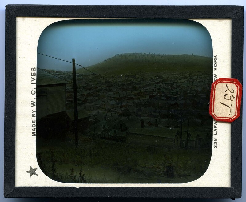
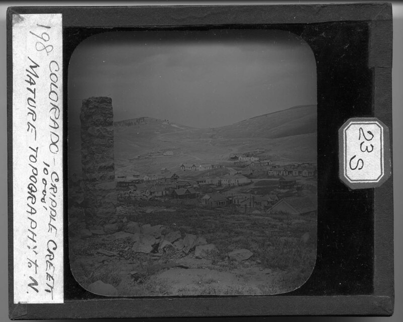
The town of Cripple Creek, Colorado. The town has been built in the valley of the hills around it and the structures appear to be frame built houses and out buildings. There are no trees except for on the one peak in the background and a stone wall marker stands above the town in the foreground. Several road lead from the town over the hills.
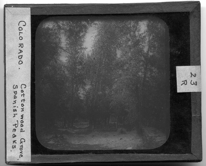
A cottonwood grove near the Spanish Peaks in Huerfano County, Colorado. The trees cover most of the dirt path that cuts through the grove and appear to have been planted in some sort of linear fashion. A wooden fence can be seen in the background running next to the path.
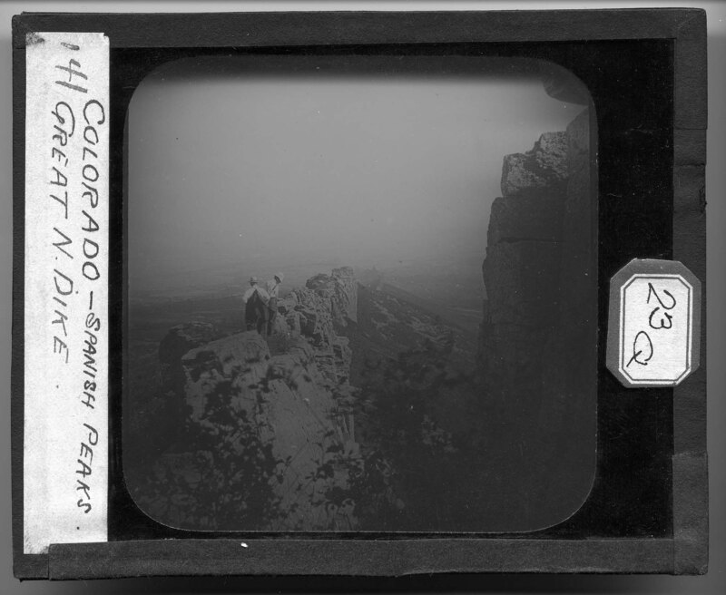
Two men stand on the top of the Great North Dike near the Spanish Peaks in Huerfano County, Colorado. The remnants of the dike stretch for miles into the distance as the wall follow the slope of the hillside. Trees and grasses grow around the dike wall and cover most of the landscape.
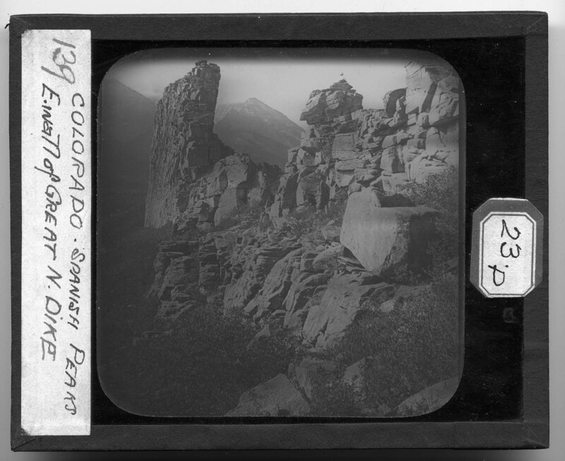
The east wall of the Great North Dike near the Spanish Peaks in Huerfano County, Colorado. The remnants of the dike are rocky and comprised of stacked stone. Grass grows around the rocks and mountain peaks can be seen in the background.
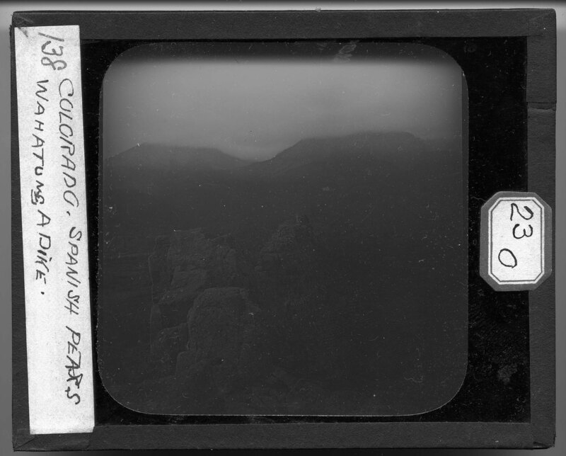
Mountainscape looking at the Spanish Peaks in Huerfano County, Colorado. The remnants of the Wahatunga Dike can be seen in the foreground and the two mountain peaks in the background. Trees and grasses cover the landscape which is hilly before reaching the mountains.
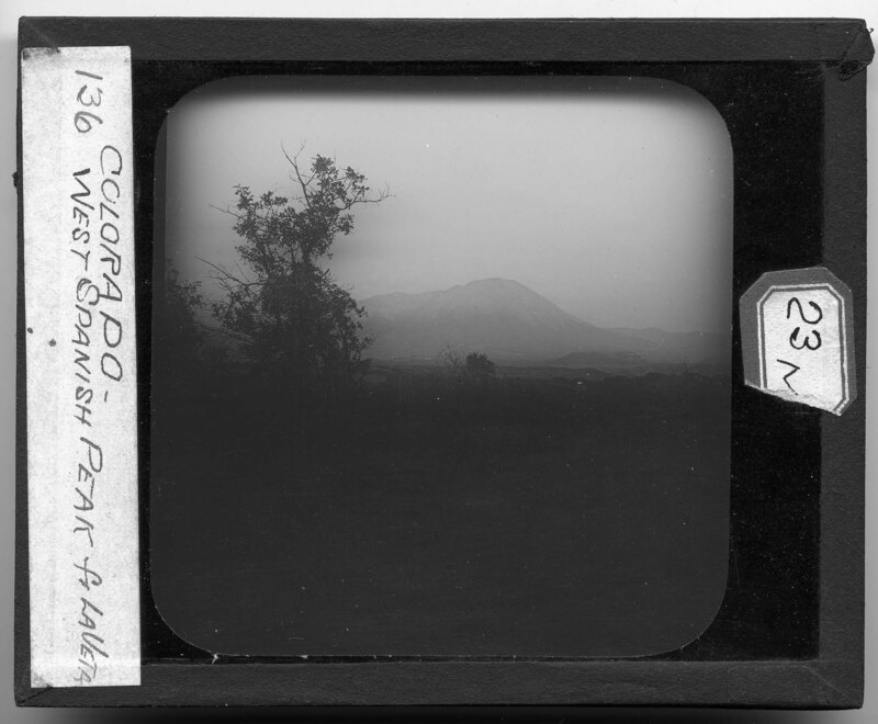
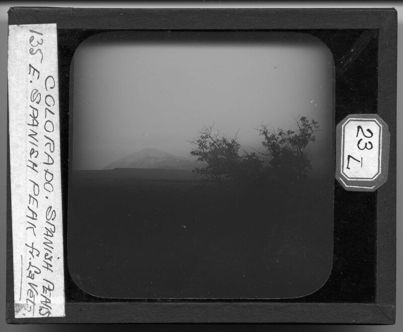
Mountain peaks rise in the background behind La Veta, Colorado. Grasses and trees cover the relatively flat landscape in the foreground which leads to hills and mountains in the background.
Mountain peaks rise in the background behind La Veta, Colorado. Grasses and trees cover the relatively flat landscape in the foreground which leads to hills and mountains in the background.
A rocky valley in the Rocky Mountain Range near Eldorado Springs, Colorado. The landscape is mountainous and rocky with few trees. A wooden walkway can be seen coming down from the peak of a mountain to the right and a small town can be seen at the base of the mountains in the background.
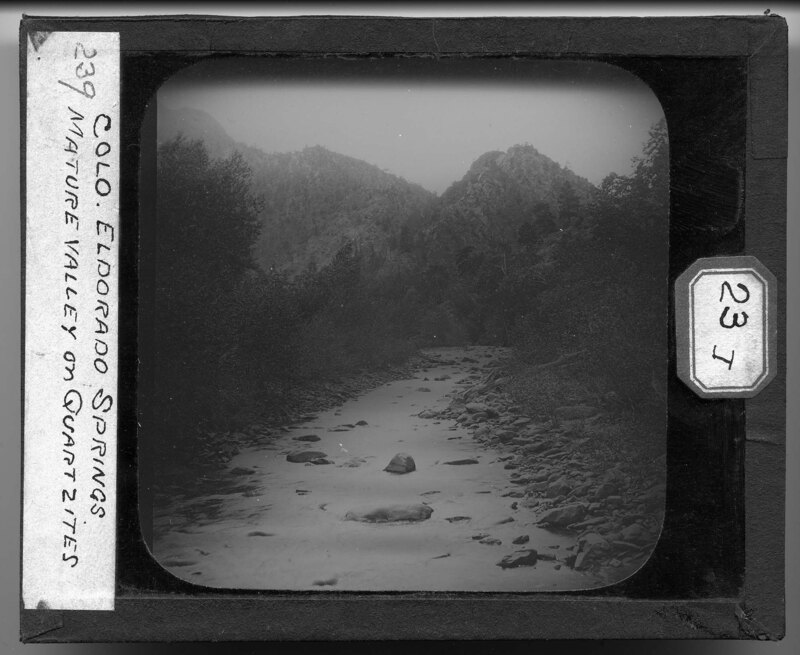
River bed in Eldorado Springs, Colorado. It is noted that this is a mature valley of quartzites. Dense foliage covers the banks of the river and large rocks make up the river bed. Mountains rise in the background and they are covered with trees and other foliage.
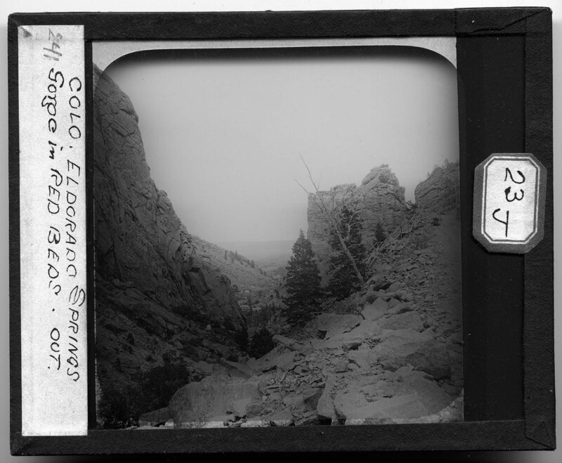
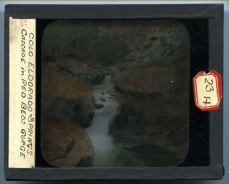
Cascades through the red beds gorge at El Dorado Springs, Colorado. A wooden walkway has been constructed over the cascading river, which cuts through large boulders on either side of the river. There is little vegetation and the landscape appears to be mountainous and rocky.
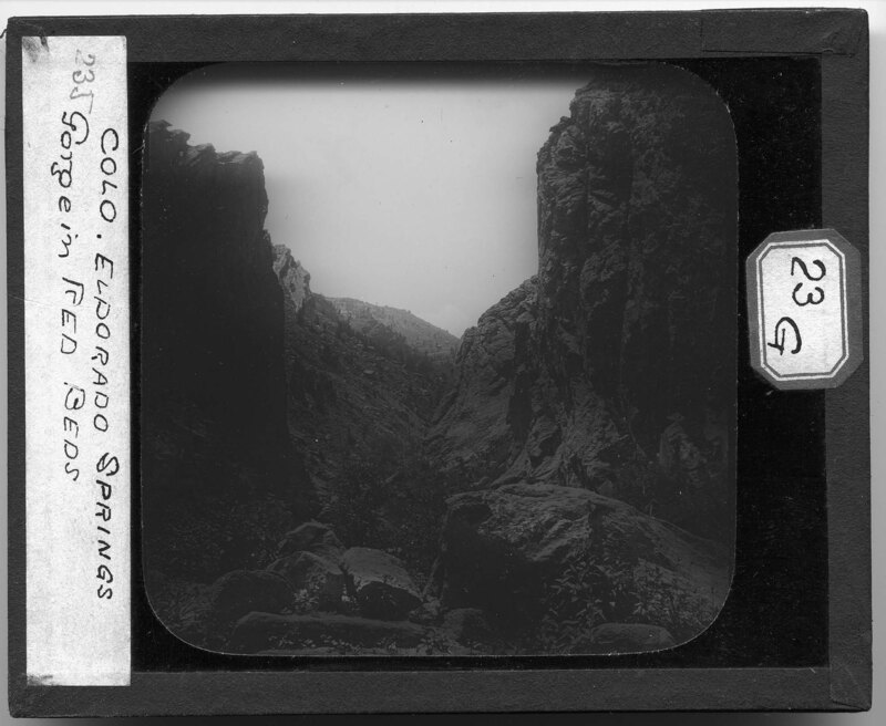
A large gorge between two mountain faces in Eldorado Springs, Colorado. It is noted that the mountains have a red color. The landscape is rocky and jagged on the cliff faces with large boulders piled together in the foreground and sparse foliage growing at the base of the mountains.
Mountainous landscape in Colorado. A large gorge has formed between two red rock cliff faces and the landscape appears to be rocky with little vegetation. A hipped roof structure can be seen at the base of the gorge to the left and several other houses can be seen to the right.
The village of Palmer Lake, Colorado. Built on the plains in the Rocky Mountain Range, Palmer Lake appears to be a small town with only a couple of properties or farms. Mountains rise in the background and are covered with foliage, while most of the plain around the town has no trees and is covered with grass.
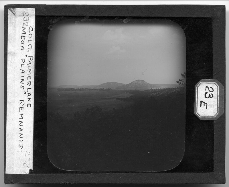
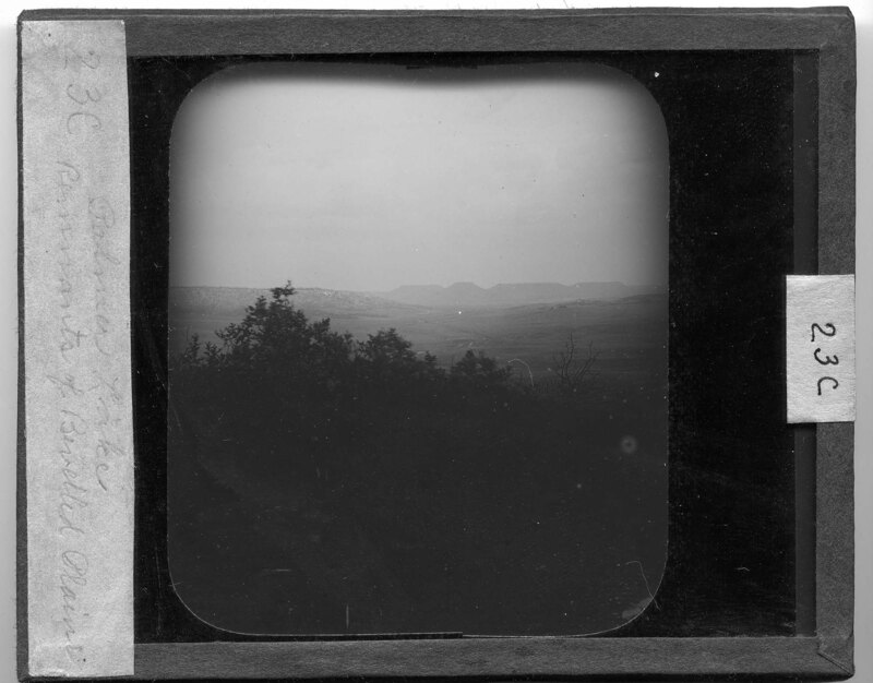
The mesa plains remnants of Palmer Lake, Colorado. The landscape is relatively flat and situated between the Rocky Mountain Range. Dense foliage covers the hills around the plain but in the valley there are no trees and only grass covers the ground.
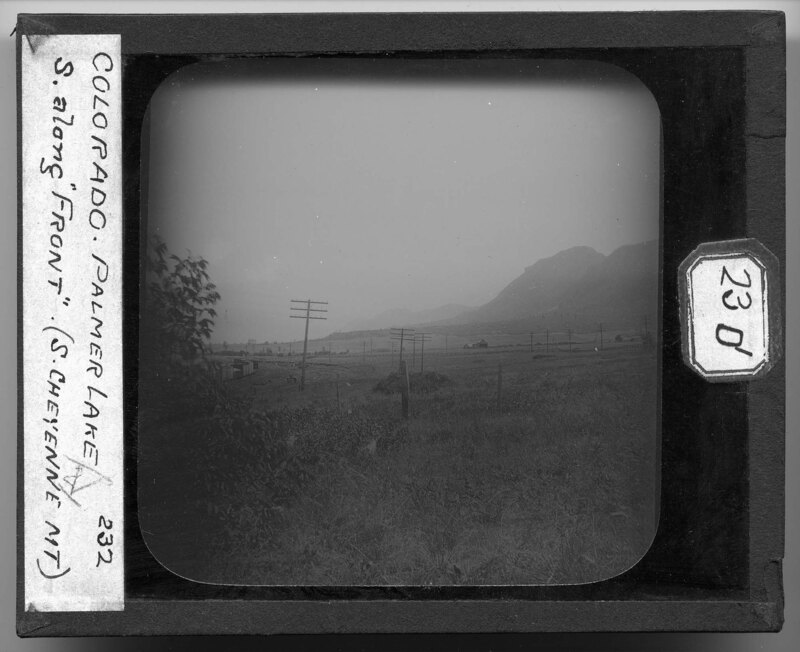
The landscape of Palmer Lake, Colorado. Built in a plain in the Rocky Mountains, the land is relatively flat with no trees. Several rail lines can be seen in the foreground along with power line poles. Tall grasses cover the ground and a farm can be seen in the distance. Cheyenne Mountain can be seen in the background.
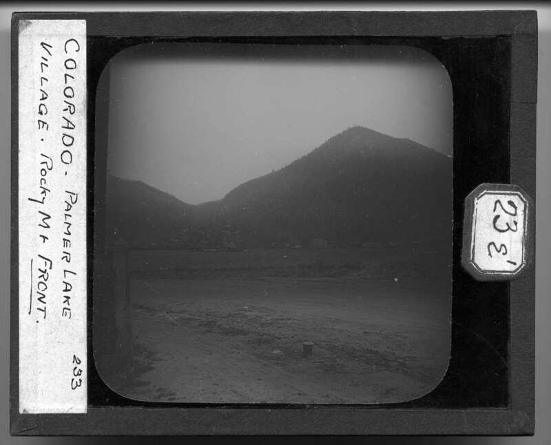
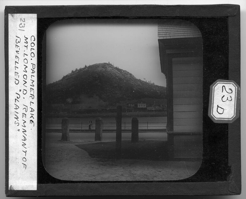
The town of Palmer Lake, Colorado. Mount Lomond can be seen in the background, rocky and covered in foliage. Several house have been built at the base of the mountain and a train can be seen across the waterway running through the town.
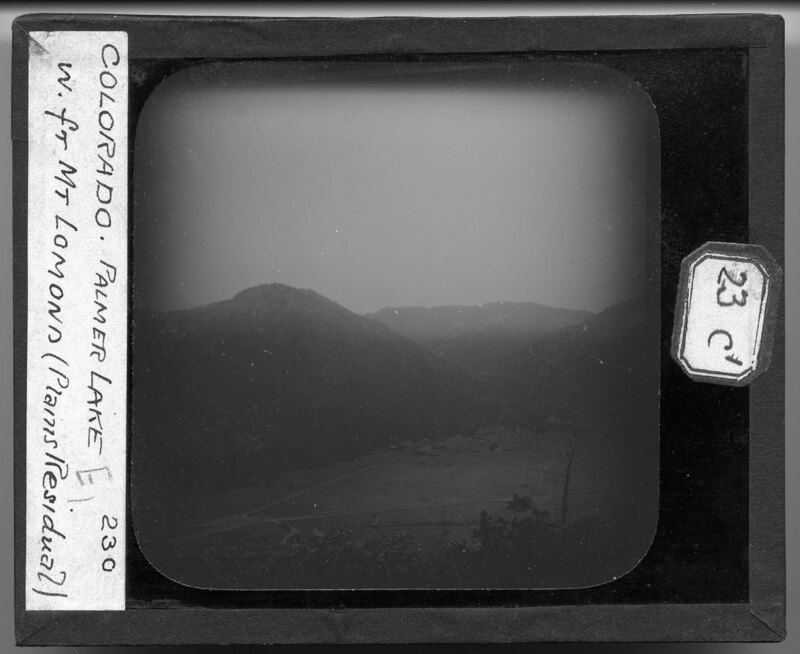
Looking west from Mount Lomond at the plains of Palmer Lake, Colorado. It is noted that the flat land between the mountains is the residual aftermath of a bevelled plain. Several houses can be seen in the valley along with dirt roads and out buildings. There are no trees on the plain but the mountain sides are covered in foliage.
Aerial landscape image of Palmer Lake, Colorado. It is noted that the flat landscape between the mountains is a remnant of a bevelled plain. Dense trees grow on the hills in the foreground and grasses and short shrubs cover the plain in the background.
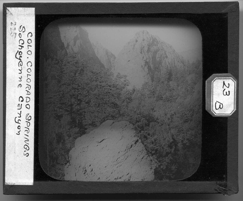
The south Cheyenne Canyon in Colorado Springs, Colorado. The landscape is mountainous and densely covered in pine trees. A large boulder can be seen in the foreground and mountain peaks in the background.
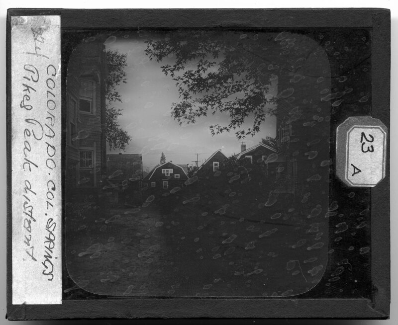
A neighborhood in Colorado Springs, Colorado. Several large houses line the dirt alleyway and two out buildings can be seen further down the street. It is noted that Pike's Peak can be seen in the distance.
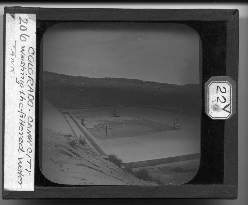
A worker cleans the filtered water tank at the Water Works in Canon City, Colorado. The tank has been drained and the worker is washing the tank, which appears to be approximately 10 feet deep. Mountains can be seen in the background and the landscape is rocky with some scrub bushes.
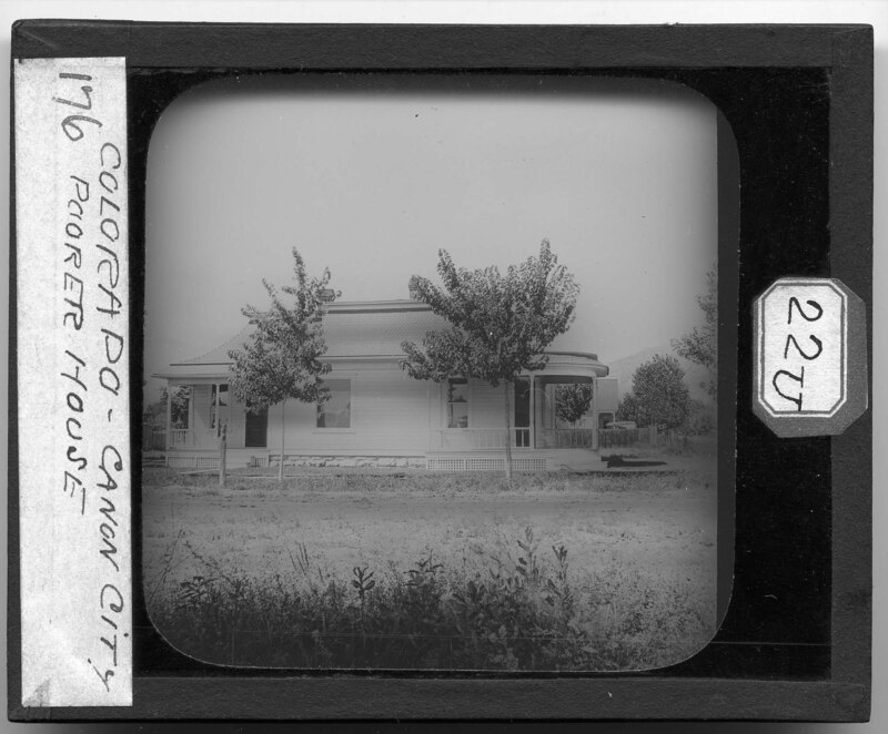
A middle class house in Canon City, Colorado. A large front porch lets breezes to blow through the house and a vernacular style mansard roof can be seen on top of the house. The yard around the house is sparse with scrub plants and a few trees. Mountains can be seen in the background.
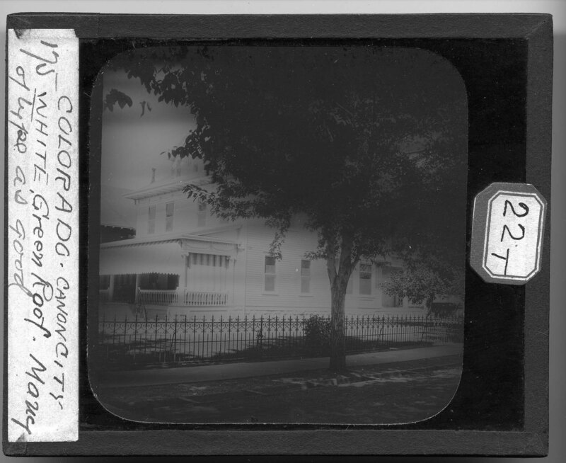
A four over four house in Canon City, Colorado. It is noted that the house is white with a green roof and it is a common type in the town. A large front porch is shielded from the sun by large canvas sheets and a wrought iron fence surrounds the property. Trees have planted beside the dirt road and offer shade for the paved sidewalk.
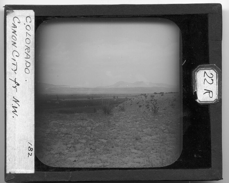
Looking northwest over Canon City, Colorado. The landscape is relatively flat between the mountains and several agricultural fields can be seen in the valley. The landscape is rocky and covered in short scrub bushes.
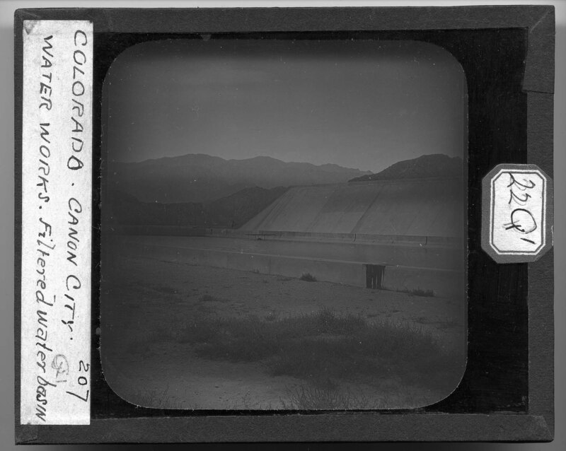
The filtered water basin at the water works in Canon City, Colorado. The water is purified and stored in the basin for use by the town and surrounding areas. Mountains can be seen in the background and the landscape is rocky with little vegetation.
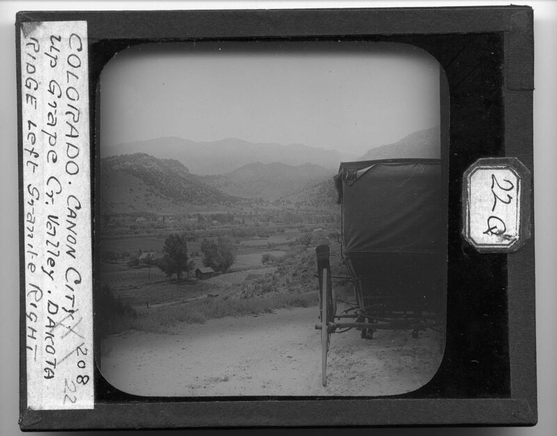
A horse and buggy sit on the dirt road overlooking Canon City, Colorado. It is noted that the Dakota Ridge can be seen to the left and Granite Ridge to the right. The landscape is mountainous and rocky with some agricultural fields and trees. Several farms can be seen in the valley of the mountains.
Streetscape of 15th Street in Canon City, Colorado. Large Oak trees line the paved sidewalk and small trenches have been dug next to the trees to allow for irrigation. The roadway is unpaved and houses can be seen on the left side of the street. A sign reading, "S.O. 15th St." hangs on a tree stump next to the road.
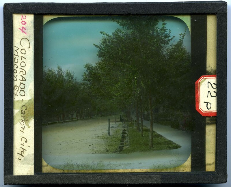
Streetscape of Macon Street in Canon City, Colorado. Trees line the paved sidewalks and small trenches have been dug next to the trees to allow for irrigation. The roadway is unpaved and houses can be seen on either side of the street.
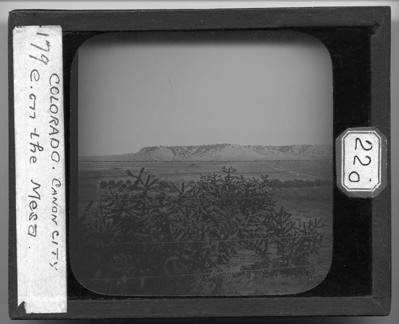
Looking east over the mesa surrounding Canon City, Colorado. A large cactus plant can be seen in the foreground behind a barbed wire fence. The mountains rise in the background and the landscape is covered with grass and few trees.
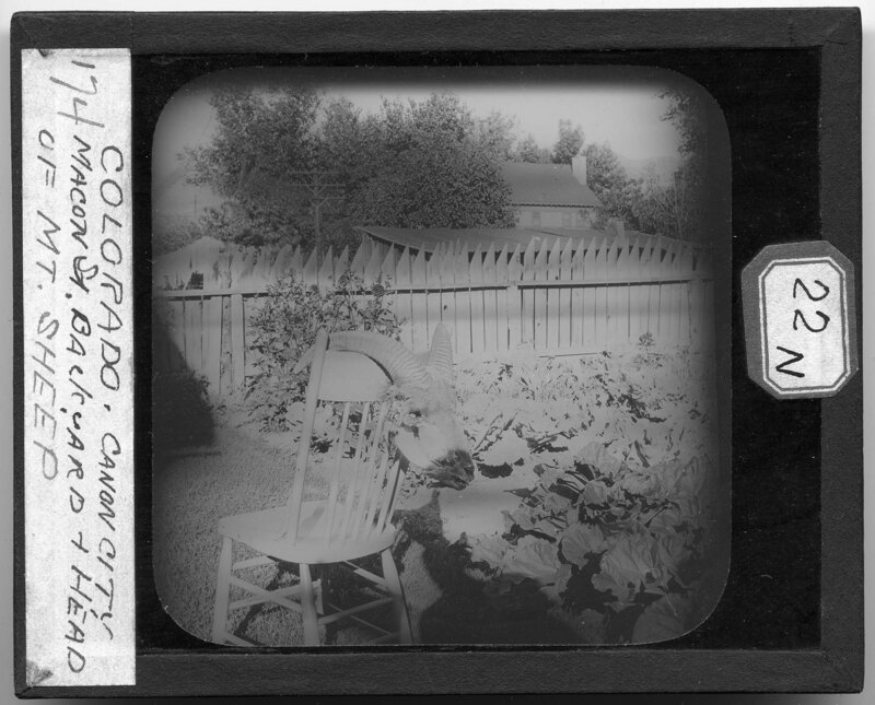
The backyard of a house along Mancon Street in Canon City, Colorado. A mountain sheep head has been draped over the back of a chair and is sitting next to a garden patch. A wooden picket fence can be seen in the background, along with a house and several outbuildings or sheds.
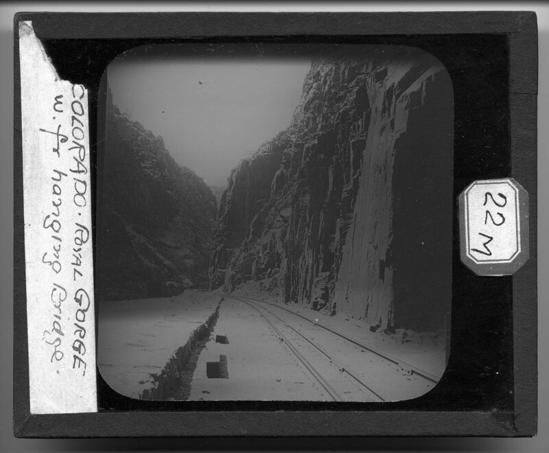
Looking west from the hanging bridge that crosses the Arkansas River in the Royal Gorge near Canon City, Colorado. Train tracks run along the steep cliff face of the gorge, which is rocky and barren. The Arkansas River can be seen to the left and a second bridge can be seen in the background at the base of the gorge.
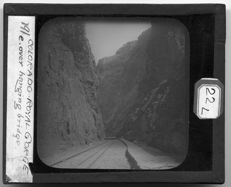
Looking east towards the hanging bridge that crosses the Arkansas River in the Royal Gorge near Canon City, Colorado. The steep rocky walls of the gorge surround the train tracks which have been built into the base of the cliff face. Power line poles can be seen jutting out of the side of the cliff and the iron triangular brace for the bridge can be seen in the background.
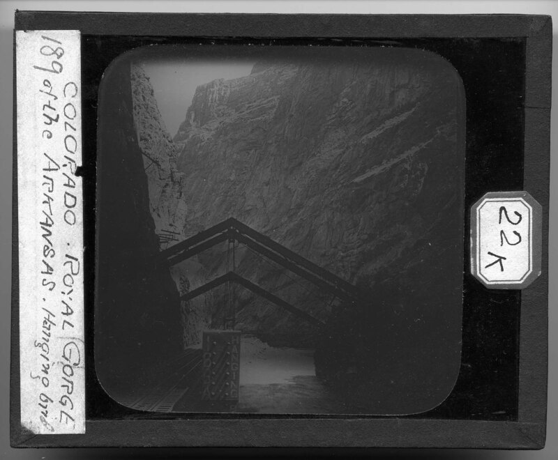
The 166A Hanging Bridge over the Arkansas River in the Royal Gorge near Canon City, Colorado. Power line poles can be seen jutting out of the side of the gorge and iron beams for a triangle over the river that hold up the railway bridge. The river can be seen flowing below the iron triangle braces and the walls of the gorge are rocky with no foliage.
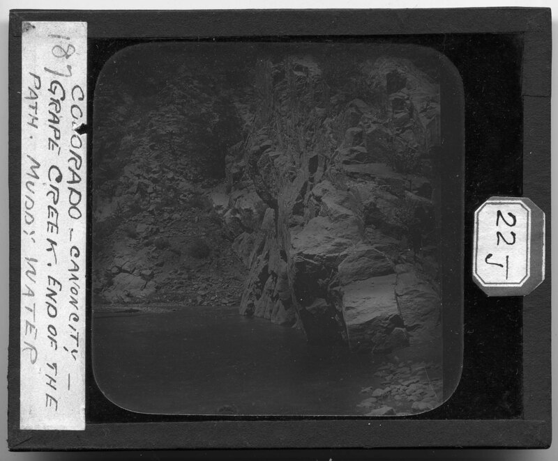
Grape Creek near Canon City, Colorado. The river flows next to a large cliff face that is jagged and rocky. Rocks and boulders have been piled on the banks of the river and it is noted the picture was taken at the end of the path. Grape Creek is the beginning of Royal Gorge and is a vital river for the area.
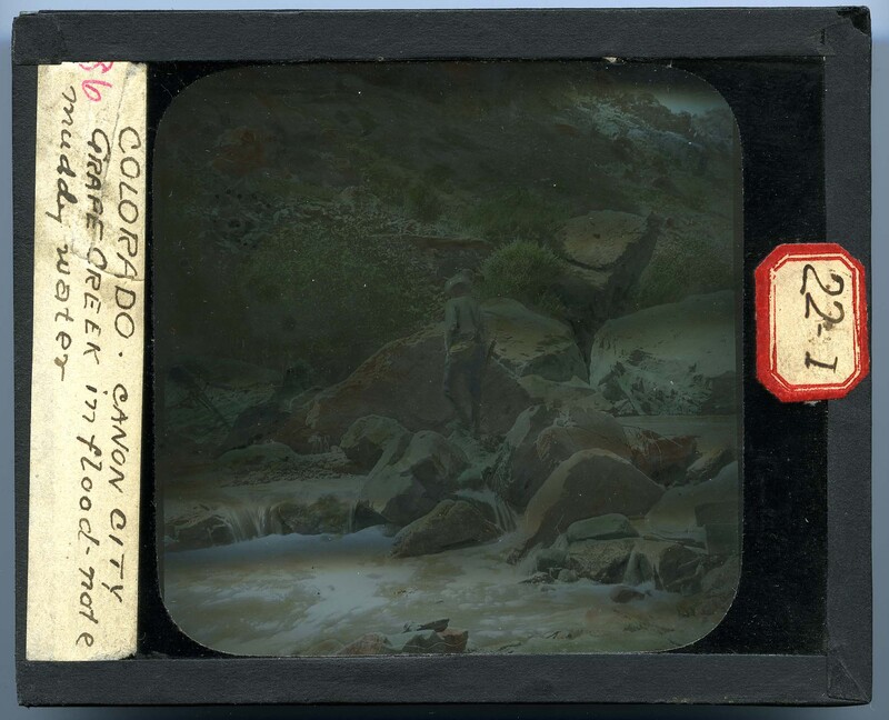
Grape Creek in Canon City, Colorado. It is noted that the river is high due to recent flooding and the water is more muddy. A man walks across the river on large boulders and the water rushes around the boulders. A steep, rocky cliff face can be seen in the background and there is little vegetation growing along the banks of the river.
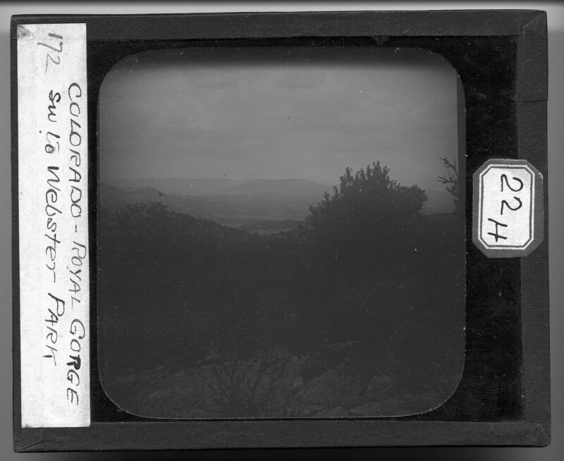
Looking southwest from Royal Gorge to Webster Park near Canon City, Colorado. Dense trees cover the mountainside and large boulders cover the ground. The Rocky Mountain Range can be seen in the background.