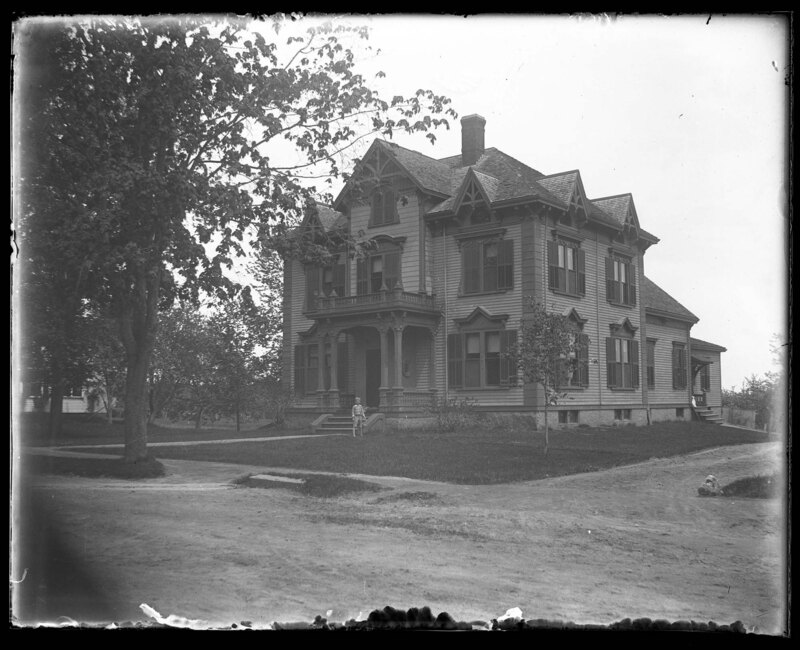
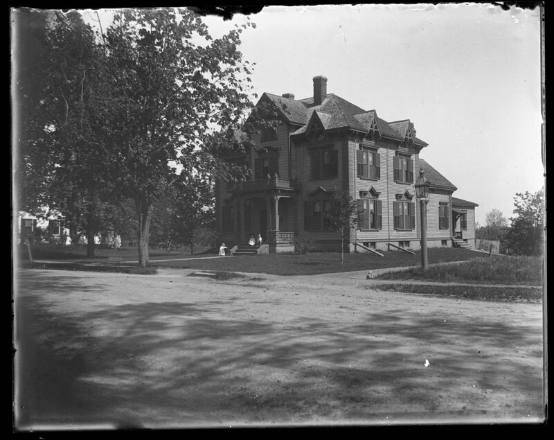
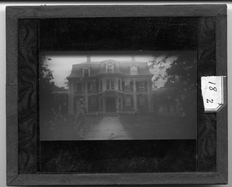
The Harden House in Elmwood, Massachusetts. The house is a two-story four-over-four style house with Queen Anne exterior elements. Gables can be seen over every bay around the house and a two-story portico covers the main entrance. Rear additions have been added to the house and manicured landscaping surrounds the house. A boy can be seen standing in the front yard next to the stairs.
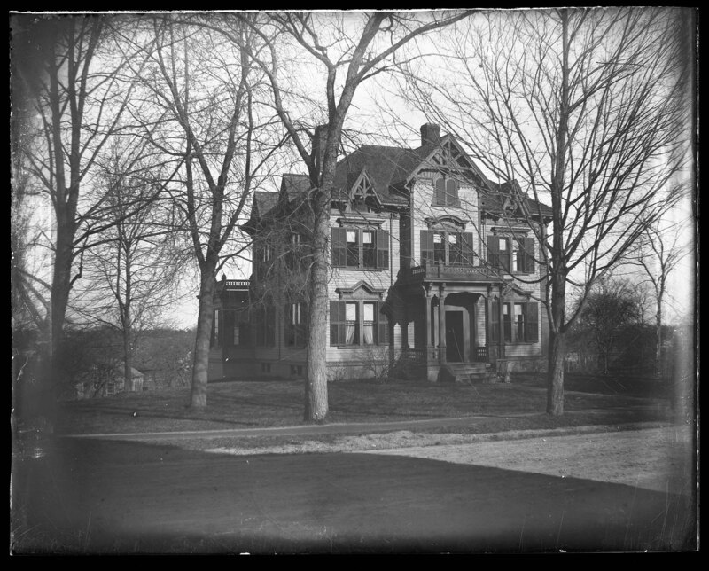
The Harden House in Elmwood, Massachusetts. The house is a two-story four-over-four style house with Queen Anne exterior elements. Gables can be seen over every bay around the house and a two-story portico covers the main entrance. Rear additions have been added to the house and manicured landscaping surrounds the house. Several structures can be seen in the background.
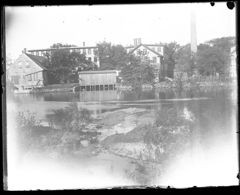
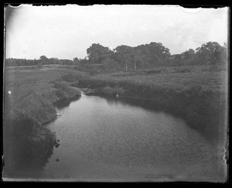
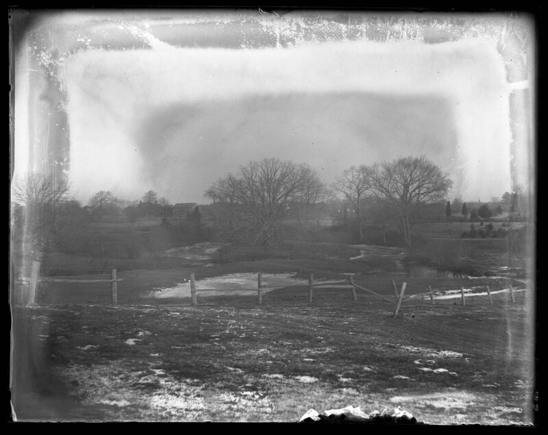
A small pond outside of a factory area in Brockton, Massachusetts. Several buildings sit on the banks of the pond and are most likely part of an industrial complex based on the cooling tower to the right. A wooden bridge was constructed to cross the water and a stone wall divides the waterline from the buildings. Scrub bushes can be seen in the foreground.
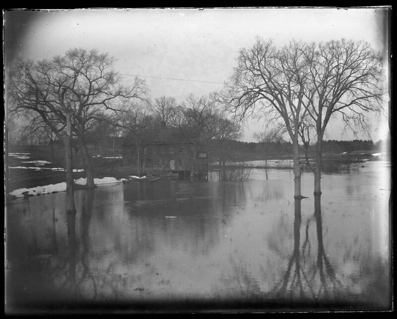
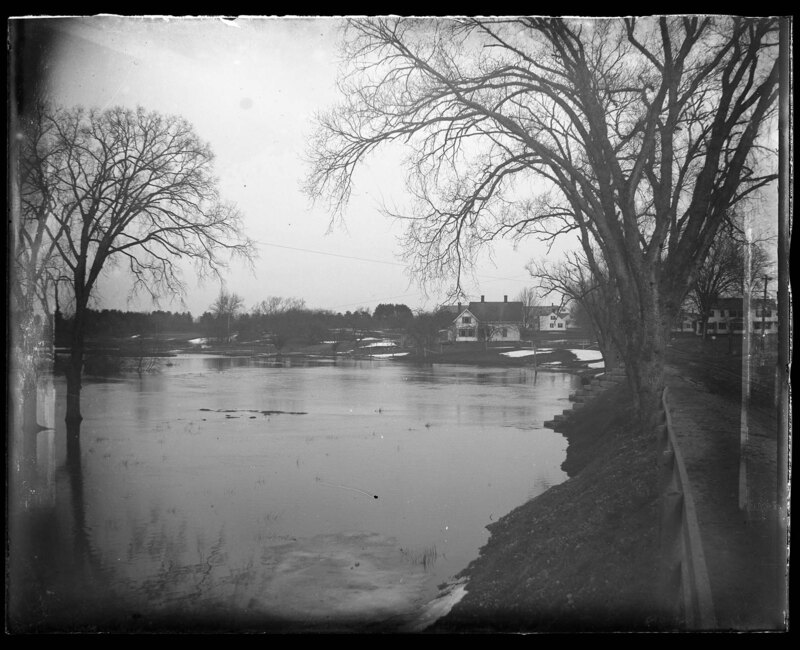
An old factory on the banks of the Mayfield River in Elmwood, Massachusetts. The river is severely flooded and has risen up to the base of the factory. Large oak trees can be seen sticking out of the water, showing where the normal water level should be. Snow covers some of the ground around the factory and grass can be seen sticking out of the water.
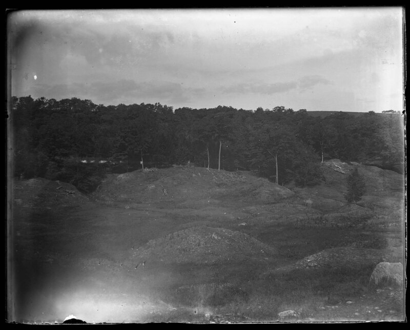
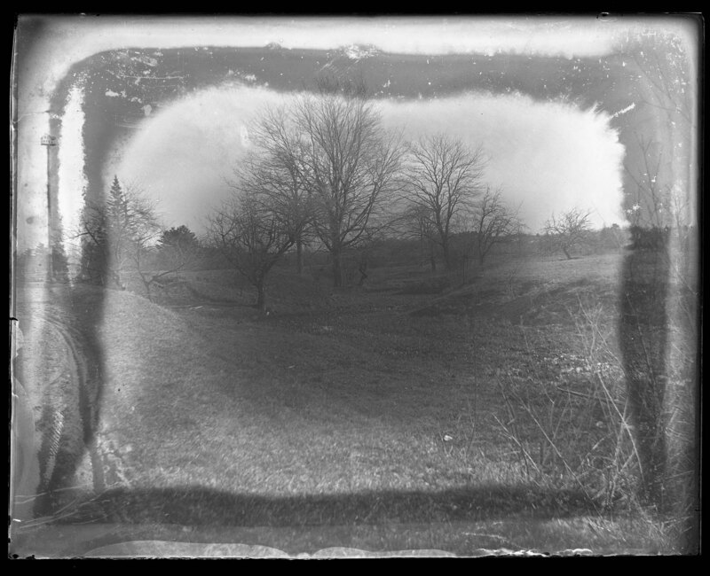
Looking down of a hilly landscape that is covered with grass and trees. Large hills dots the valley and appear to be covered with rocks. It is noted that the image was taken at the Gulf looking 12??? West, however, it is unknown where this picture was taken.
Looking down on a hilly landscape that is covered with grass and trees. Large hills dots the valley and appear to be covered with rocks. It is noted that the image was taken at the Gulf looking 12??? West, however, it is unknown where this picture was taken.
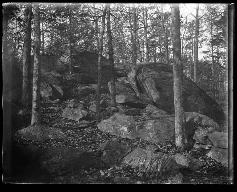
Large boulders rest of the hillside in Brockton, Massachusetts. Trees can be seen growing between the boulders but the landscape is largely rocky and barren. It is noted the image shows stone house hill.
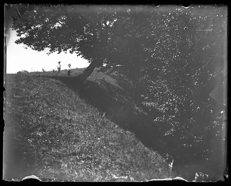
Two boys stand at the top of a steep hill in Gilmanton, New Hampshire. It is noted the picture was taken at the gulf shore. A large tree grows out of the hillside and overhangs most of the frame. Grass covers the landscape.
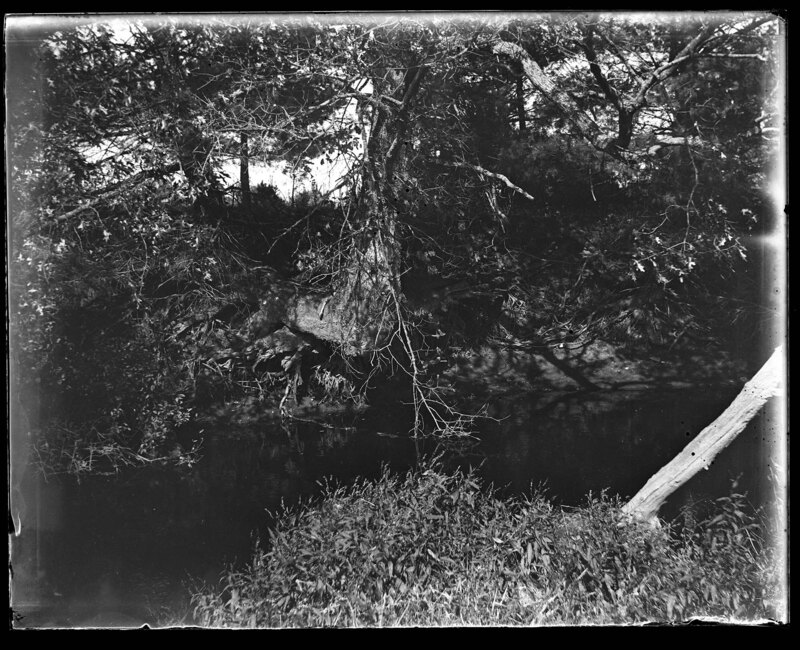
Falling bank of the Mayfield River in Elmwood, Massachusetts. A large tree is falling into the river due to bank erosion. Trees and scrub bushes grow on both banks of the river and overhang the water.
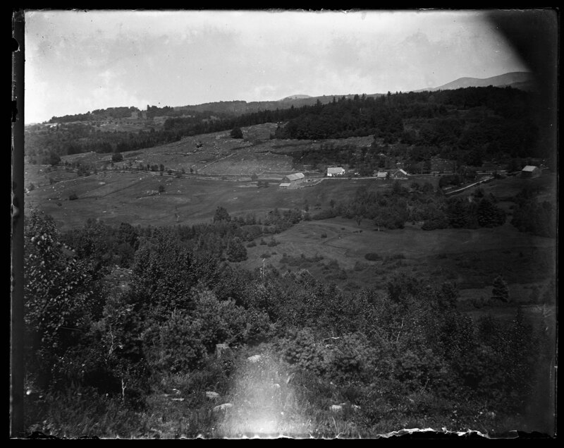
Overlooking the hilly landscape in Gilmanton, New Hampshire. Trees and grasses cover the rolling hills and a large stone wall can be seen in the foreground.
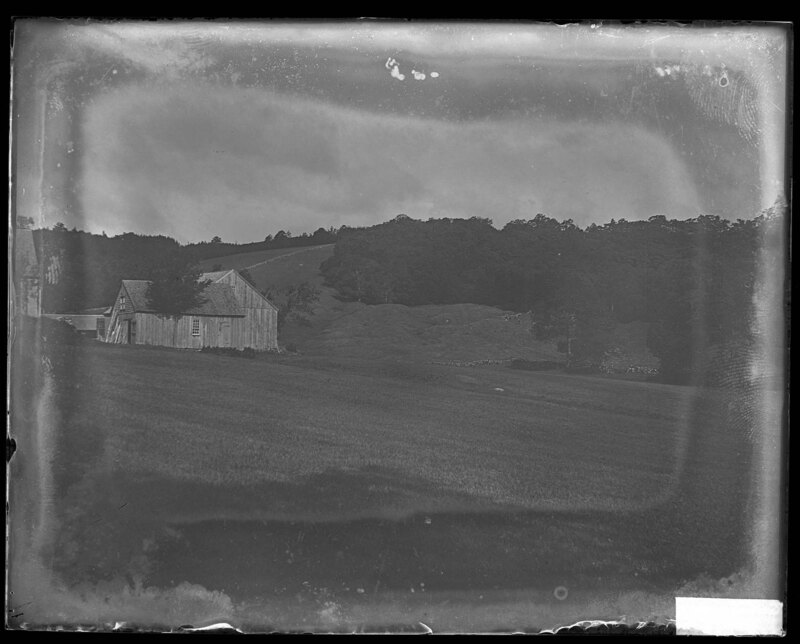
An English style barn sits on the rolling landscape of Gilmanton, New Hampshire. Large hills rise behind the barn and house to the far left. The landscape is grassy and covered with trees.
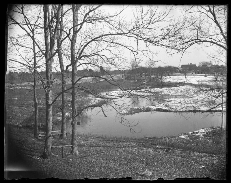
The frozen Mayfield River in Elmwood, Massachusetts. Snow covers the banks of the river and chunks of ice can be seen on top of the frozen river due to it melting and the current displacing pieces of ice. Grasses can be seen on the banks of the stream and several houses can be seen in the background.
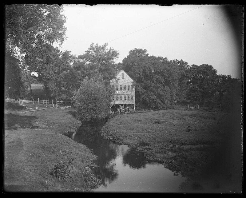
An old factory on the Mayfield River in Elmwood, Massachusetts. The sign on the front of the building has deteriorated so it is unreadable, however, it is likely the structure was some sort of mill because it was built directly on the river and would have used the water to power machines in the building. The structure appears to be abandoned and some of the windows have been broken in. Trees and grass cover the landscape around the river.
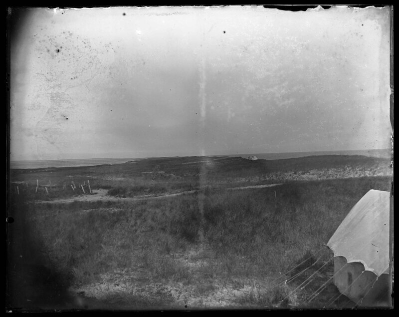
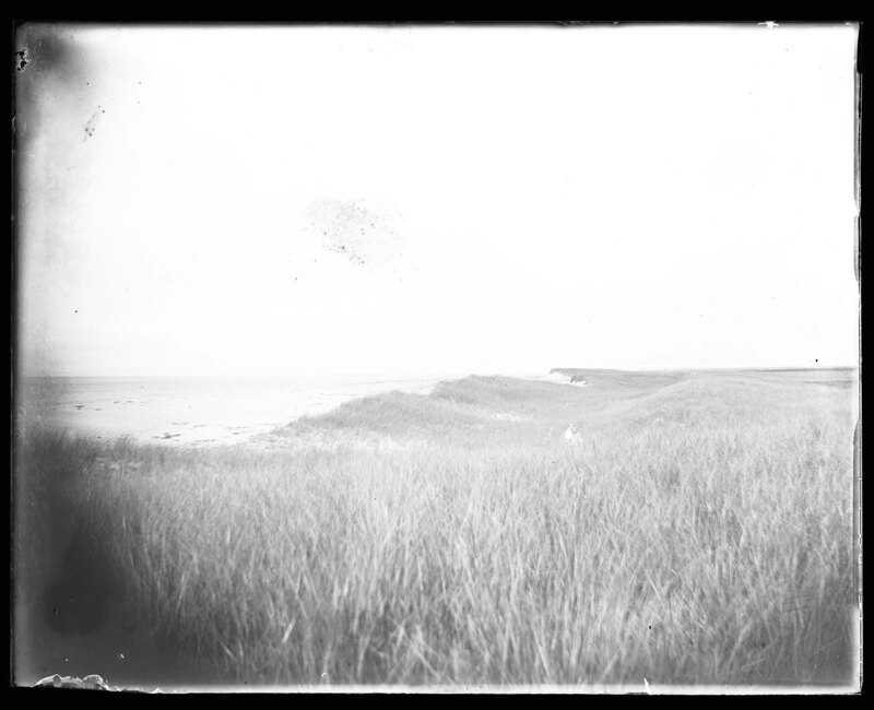
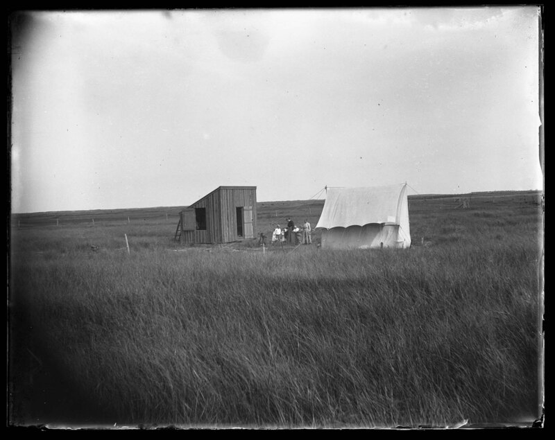
Looking at the coast line at Martha's Vineyard, Massachusetts. Martha's Vineyard is an island off the coast of Massachusetts, south of Cape Cod. The landscape is sandy and covered with prairie or dune grass. There are no trees and a large canvas tent has been pitched in the bottom of the frame. Wooden fences divide property boundaries in the background.
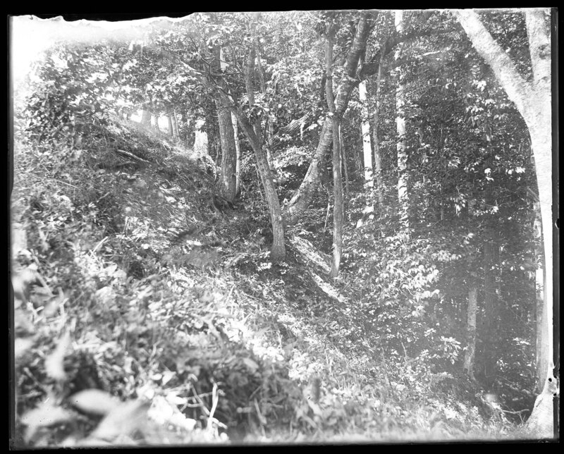
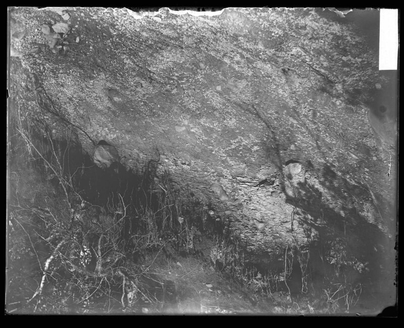
A rocky outcrop in Gilmanton, New Hampshire. Erosion has deteriorated the bedrock that plants and grasses grow on top of. The plants exposed roots can be seen above the eroded rock.
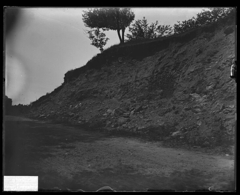
A dirt embankment near the Gilmanton Iron Works in Gilmanton, New Hampshire. The dirt embankment appears to be approximately 30' tall and boulders can be seen at its base. Trees and grass grow on top of the embankment. The area of Gilmanton Iron Works is an unincorporated community within the town of Gilmanton.
aerial image of the landscape of Gilmanton, New Hampshire. The landscape is very hilly and rolling with several structures at the base of the hills. Large boulders are scattered on the ground near the houses. Trees cover the hills and it is noted that there is flat land to the north.
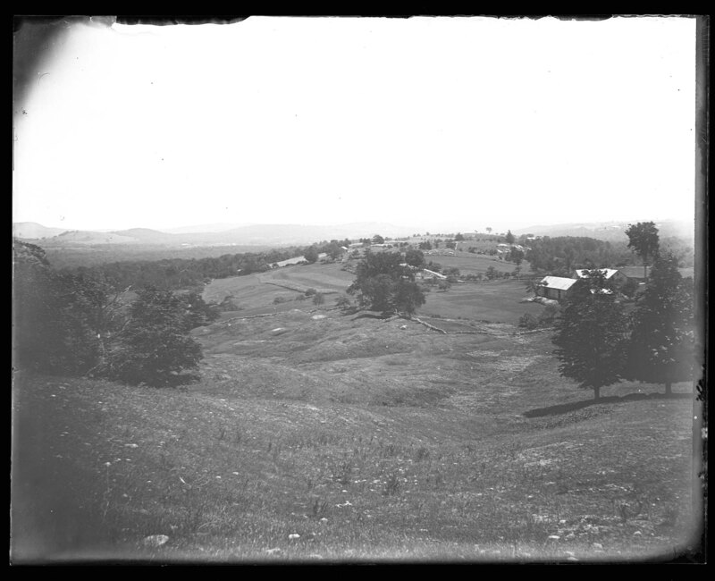
Landscape looking down on a valley from the top of a hill. Houses and outbuilds dot the rolling landscape that is covered with grasses and trees. Large hills can be seen in the background. It is noted that this was taken at the Gulf and shows slip deposits in the landscape. It is unknown where this picture was taken
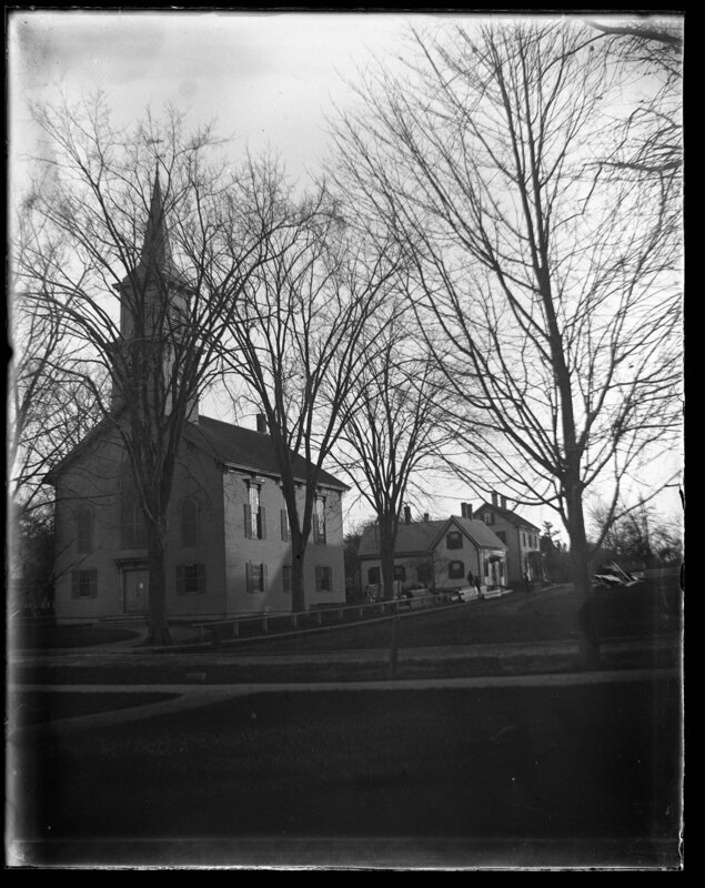
The Elmwood Church in Elmwood, Massachusetts. The church is a two-story structure with a large steeple on the front. A large Georgian style house can be seen in the background. Trees surround the church and dirt roads pass in front of the church and the house.
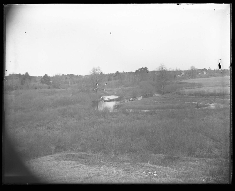
The Mayfield River in Elmwood, Massachusetts. It is noted that the river was low when this picture was taken. Grass, scrub bushes, and trees cover the banks of the river which winds through the hilly landscape. A little boy can be seen standing in the fields next to the river which gives perspective to its actual size.
Landscape of a river valley in Elmwood, Massachusetts. A winding stream cuts through the landscape and creates valleys between the grassy hills. Trees cover the hills and a wooden post fence divides a property boundary in the foreground. Several houses can be seen in the background along with shrubs and other scrub trees. It is noted that the picture is showing Bates' Slang.
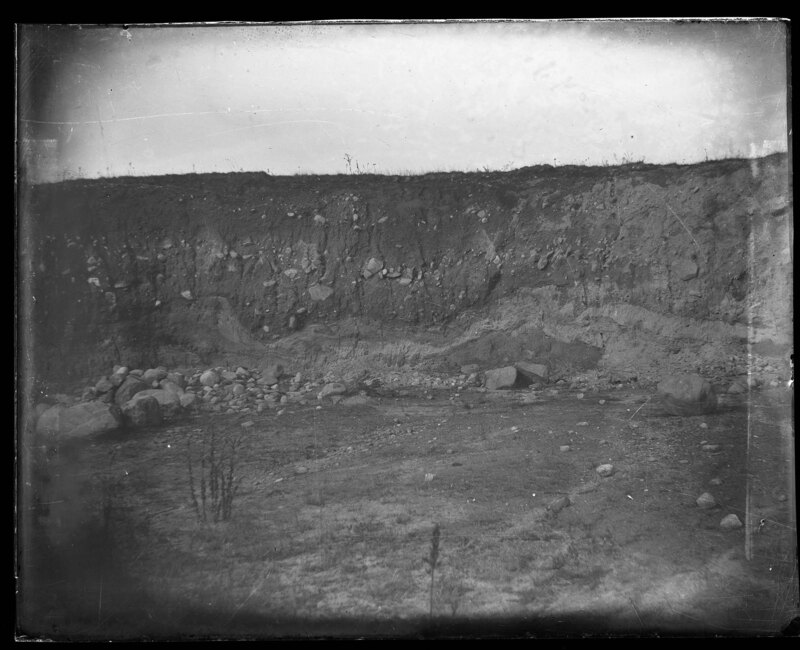
A dirt embankment near the Bridgewater Iron Works in Bridgewater, Massachusetts. The Iron Works was a foundry in operation from 1694 until 1988 and operated under several names during its history. The property was listed in the National Register of Historic Places in 2002. The dirt embankment appears to be approximately 15' tall and boulders can be seen at its base. Grass covers the ground in the foreground.
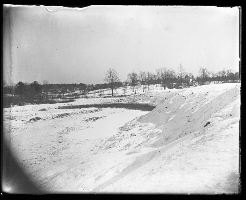
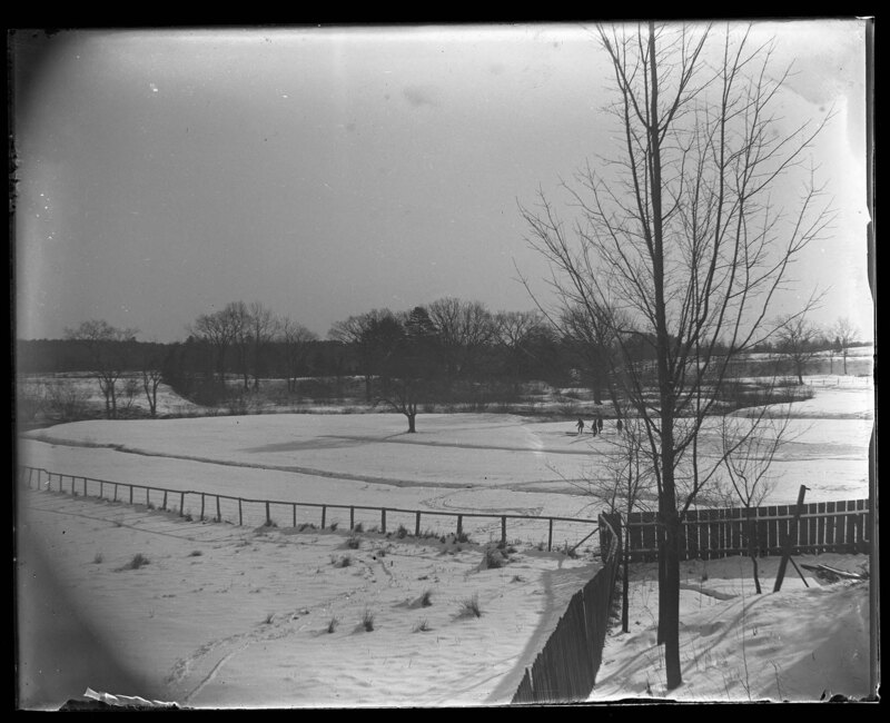
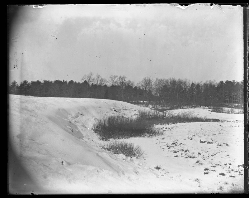
Children play on the Mayfield Floodplain east of the Elmwood Bridge in Elmwood, Massachusetts. The land is frozen during the winter and the stream partially freezes, which can be seen in the background. Trees dot the landscape and hills spread out around the river. Wooden fences can be seen in the foreground.
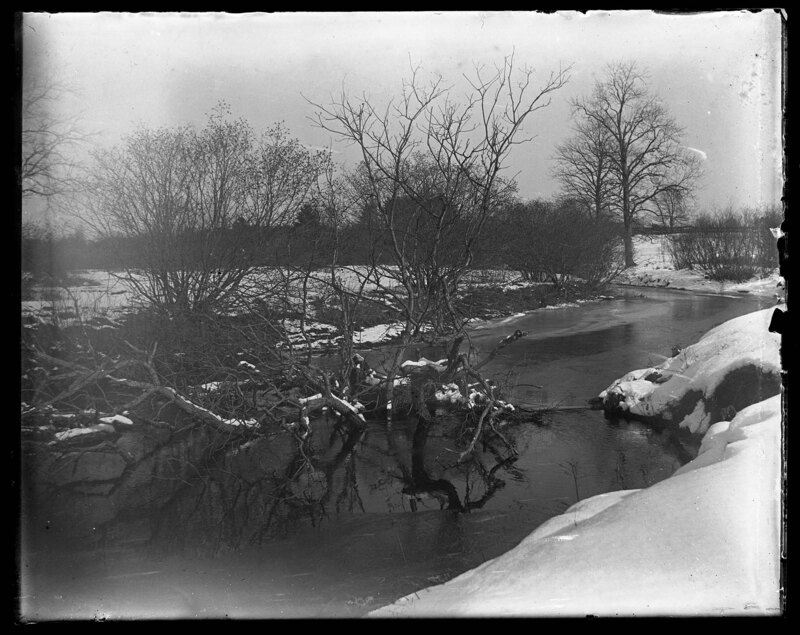
The partially frozen Mayfield River in Elmwood, Massachusetts. The stream is carrying ice chunks with the current as it begins to unfreeze. A large tree has slipped from the bank and fallen in the frozen river. Snow covers the landscape around the stream and trees grow on the banks.
The partially frozen Mayfield River in Elmwood, Massachusetts. The stream is carrying ice chunks with the current as it begins to unfreeze. A large tree has slipped from the bank and fallen in the frozen river. Snow covers the landscape around the stream and trees grow on the banks.
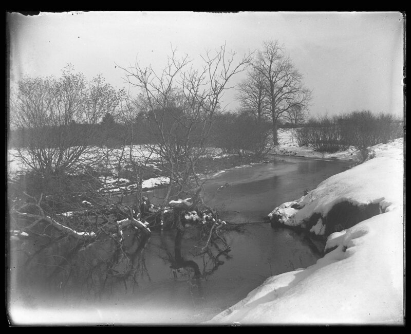
The partially frozen Mayfield River in Elmwood, Massachusetts. The stream is carrying ice chunks with the current as it begins to unfreeze. A large tree has slipped from the bank and fallen in the frozen river. Snow covers the landscape around the stream and trees grow on the banks. Several houses can be seen in the background.
The partially frozen Mayfield River in Elmwood, Massachusetts. The stream is carrying ice chunks with the current as it begins to unfreeze. Snow covers the landscape around the stream and trees grow on the banks. It is noted that it was 18??? outside when the picture was taken. Several houses can be seen in the background.
The frozen Mayfield River in Elmwood, Massachusetts. Snow covers the banks of the river and chunks of ice can be seen on top of the frozen river due to it melting and the current displacing pieces of ice. Grasses can be seen on the banks of the stream and trees grow in the background. It is noted that when the picture was taken it was 18??? outside.
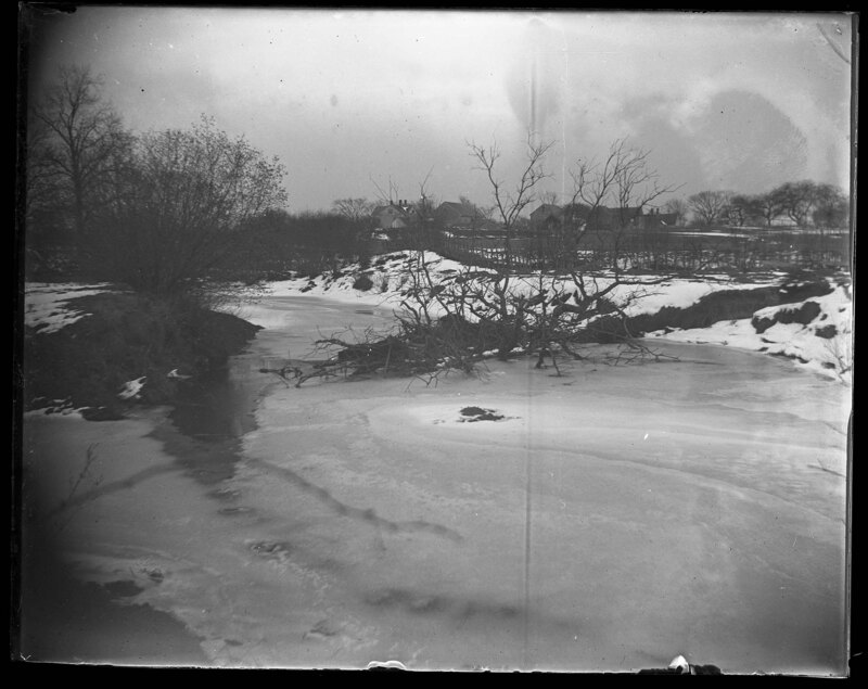
The frozen Mayfield River in Elmwood, Massachusetts. Snow covers the banks of the river and several trees have been frozen in the river after they slipped from the banks. It is noted that the bank itself is eroding and caving. A tree grove can be seen in the background.
The Mayfield River in Elmwood, Massachusetts. The river cuts through the hilly landscape and tall grasses cover the ground. Trees grow on the banks of the river and a wooden fence can be seen diving the stream from a pasture to the right. Several houses can be seen in the background. Wooden benches have been built between the trees in the foreground.
The Mayfield River in Elmwood, Massachusetts. The river cuts through the hilly landscape and tall grasses cover the ground. Trees grow on the banks of the river and a wooden fence can be seen diving the stream from a pasture to the right. Several houses can be seen in the background.
The Harden House in Elmwood, Massachusetts. The house is a two-story four-over-four style house with Queen Anne exterior elements. Gables can be seen over every bay around the house and a two-story portico covers the main entrance. Rear additions have been added to the house and manicured landscaping surrounds the house. Children sit on the front steps and a gas street light can be seen in the foreground.
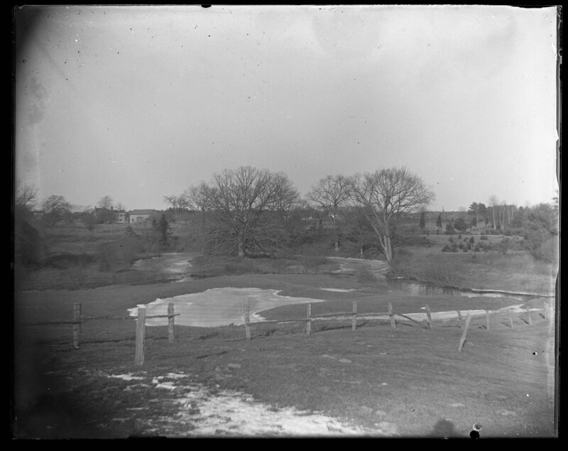
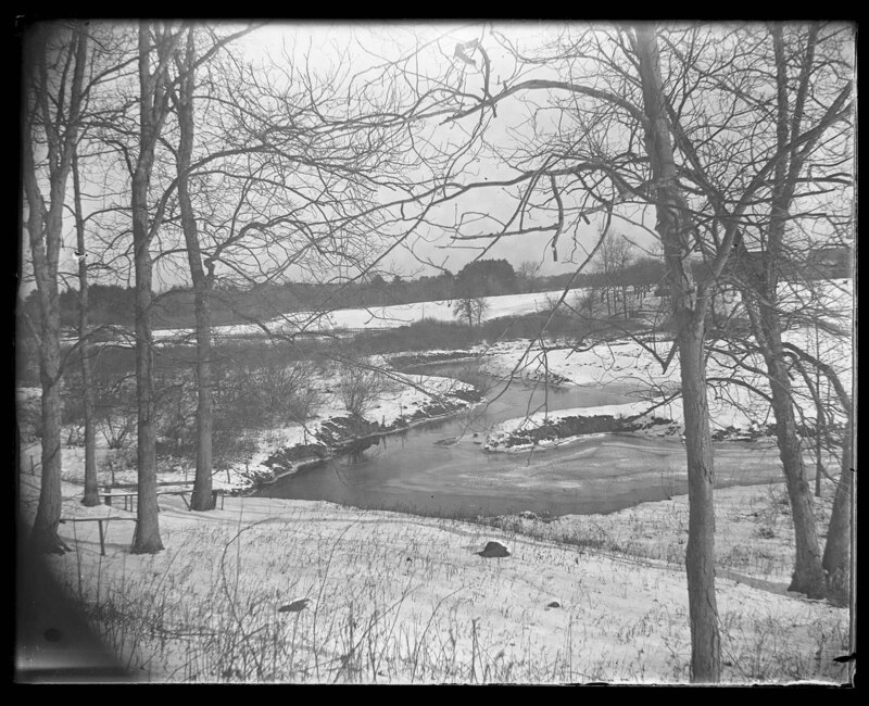
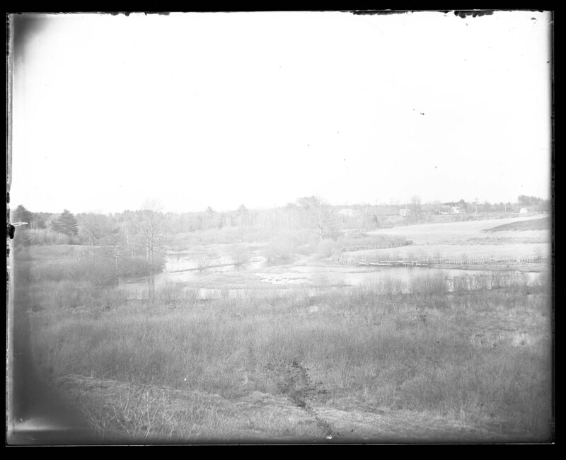
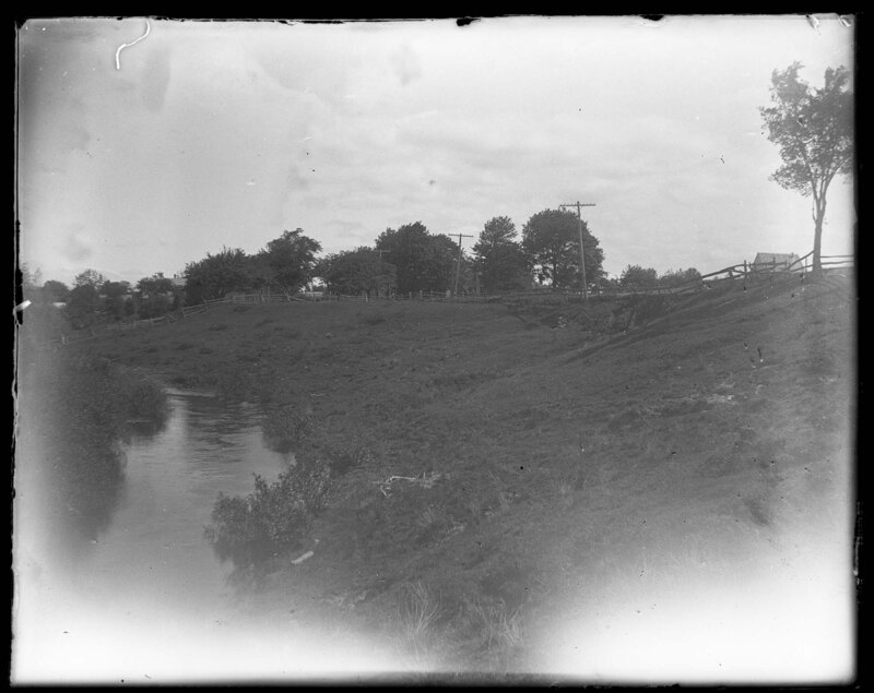
Natural levees of the Mayfield River in Elmwood, Massachusetts. The river winds through the hilly landscape and floods portions of the surrounding land. Grasses and trees grow around the river and a wooden fence divides the river from a pasture to the right. Several structures can be seen in the background.
The Mayfield River in Elmwood, Massachusetts. The river cuts through the hilly landscape and tall grasses cover the ground. Trees grow on the banks of the river and a wooden fence can be seen diving the stream from a pasture to the right. Several houses can be seen in the background. Wooden benches have been built between the trees in the foreground.
The Mayfield River in Elmwood, Massachusetts. The river cuts through the hilly landscape and tall grasses cover the ground. Trees grow on the banks of the river and a wooden fence can be seen diving the stream from a pasture to the right. Several houses can be seen in the background.
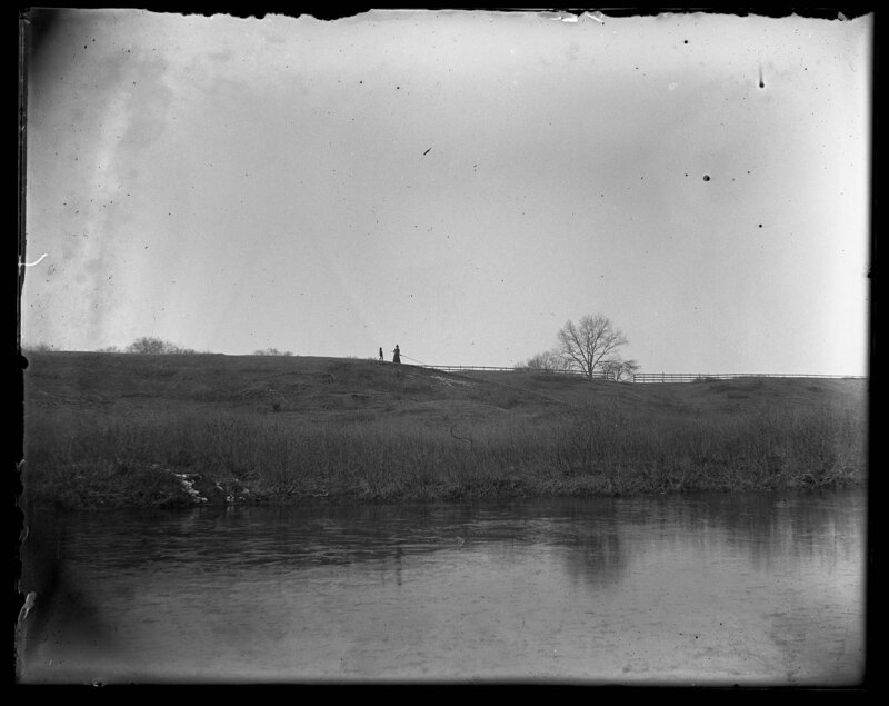
A woman and child stand on the top of a grassy bluff above a stream in Elmwood, Massachusetts. The landscape is hilly around the stream and a dirt embankment leads up to a road at the top of the bluff that can be assumed by the wooden fence seen in the background. Few trees dot the landscape and there are no structures around.
Landscape of a river valley in Elmwood, Massachusetts. It is noted that the name of this area is Gully-Rodd and it extends from Elmwood to Ginworks. The stream has dried up but left a lasting divot in the hills around the stream bed. Tree's grow on the "banks" of the stream bed and grass covers the entire area.
Landscape of a river valley in Elmwood, Massachusetts. A winding stream cuts through the landscape and creates valleys between the grassy hills. Trees cover the hills and a wooden post fence divides a property boundary in the foreground. Several houses can be seen in the background along with shrubs and other scrub trees. It is noted that the picture is showing Bates' Slang.
Landscape image showing a coastline and rolling hills around the coast. It is noted that the picture shows south beach, but it is unknown where the picture was actually taken. The water comes right up to the shoreline and there is no beach. The hills around the shoreline are covered with prairie grasses and there are no trees.
A lean-to bunk house and a canvas tent set built around a central yard with a water pump. The lean-to structure is constructed of vertical wooden planks and has a shingle roof. Two wooden ladders are leaning against the back of the structure. The landscape is relatively flat and is covered with prairie grass. There are no trees. It appears there is a large body of water in the background. It is unknown where this picture was taken, although possibly at Martha's Vineyard in Massachusetts based on the reference to this location found in the description of 010_MJ_91_032.
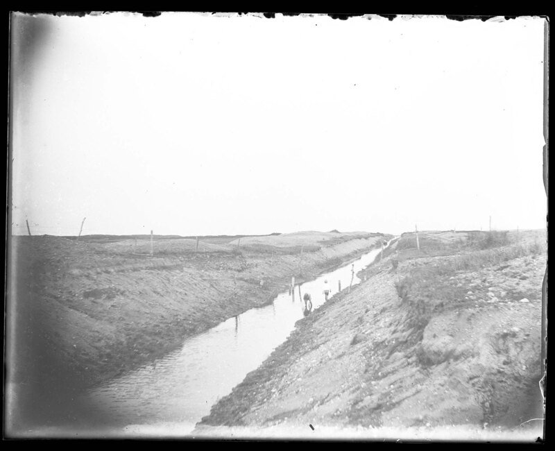
Children play in an irrigation ditch. The steep banks of the ditch are made of dirt and rock and the landscape around the ditch is grassy and sandy. There are no trees and wooden fence posts divide property boundaries. It is unknown where this picture was taken.
A family stands in the yard outside of their bunk house. A large canvas tent and a wooden lean-to style house have been constructed around a central yard with a water pump. The landscape is flat with no trees and covered with prairie grass. Wooden fences divide property lines in the background. It is unknown where this picture was taken, although possibly at Martha's Vineyard in Massachusetts based on the reference to this location found in the description of 010_MJ_91_032.
Landscape of rolling hills in Elmwood, Massachusetts. A house has been built into a hill towards the bottom of the picture and the trees cover the hills around the house. Grass covers the ground and a wooden fence can be seen in the background. It is noted that what is shown in the picture is a 55' flat.
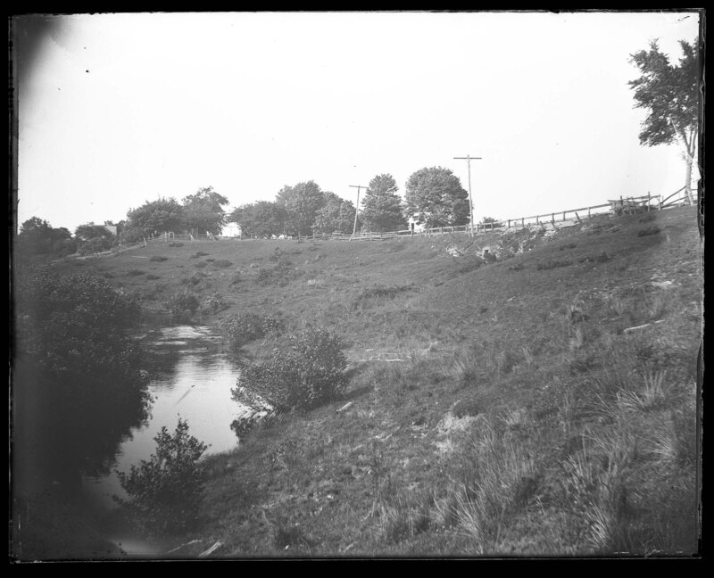
Dirt embankment above a stream in Elmwood, Massachusetts. The road is high enough so it avoids the flooding from the river and the dirt embankment is covered with grasses and scrub bushes. A house can be seen walking along the road at the top of the embankment and a wooden fence divides the drop-off from the road.
The Mayfield River in Elmwood, Massachusetts. The river cuts through the hilly landscape and meanders through the hills. Dense trees and other foliage cover the hills and a dirt embankment creates a road above the river.
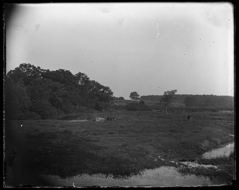
Cows graze in the field near the Mayfield floor plain in Elmwood, Massachusetts. The landscape is low-lying and most likely floods easily. Grass covers the rocky ground and a large tree grove can be seen to the left.
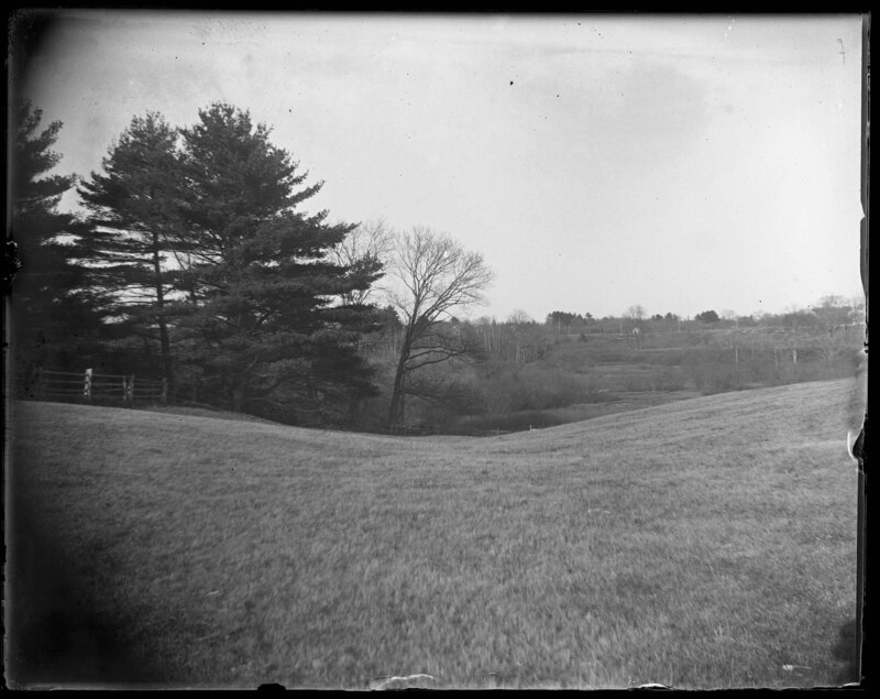
Hilly landscape in Elmwood, Massachusetts. A stream drains into a low-lying area of the landscape and creates a marshy area. Wooden fences cross the hills, creating property boundaries and houses can be seen sitting on top of the hills in the background. The landscape is grassy and covered with trees.
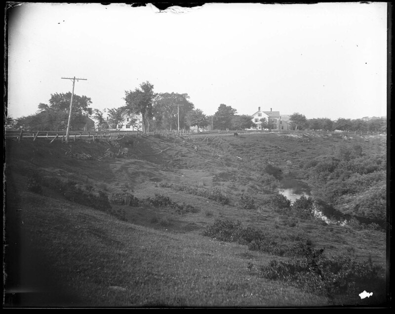
Stream cutting through the landscape in Elmwood, Massachusetts. A road sits on top of a dirt embankment and is well out of the floodplain of the stream. A wooden fence lines the road and several house can be seen in the background. Grass covers the ground around the stream and trees can be seen in the background.
Stream cutting through the landscape in Elmwood, Massachusetts. A road sits on top of a dirt embankment and is well out of the floodplain of the stream. A wooden fence lines the road and several house can be seen in the background. Grass covers the ground around the stream and trees can be seen in the background.
Stream cutting through the landscape in Elmwood, Massachusetts. A road sits on top of a dirt embankment and is well out of the floodplain of the stream. A wooden fence lines the road and several house can be seen in the background. Grass covers the ground around the stream and trees can be seen in the background.
Landscape in Elmwood, Massachusetts. Several houses can be seen on the hills above a small stream that cuts to the plain. Grass covers the ground and trees dot the landscape.
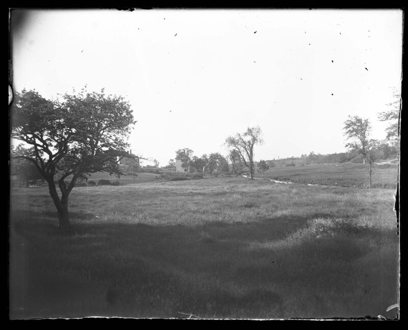
Landscape that is sloped to allow for easier drainage in Elmwood, Massachusetts. A fence divides a forest from the grassy field in the foreground and the shape of the land suggests there is a natural waterway to flows through here. The landscape in the background is relatively flat and appears to be the collecting place for the water as it flows down the landscape.
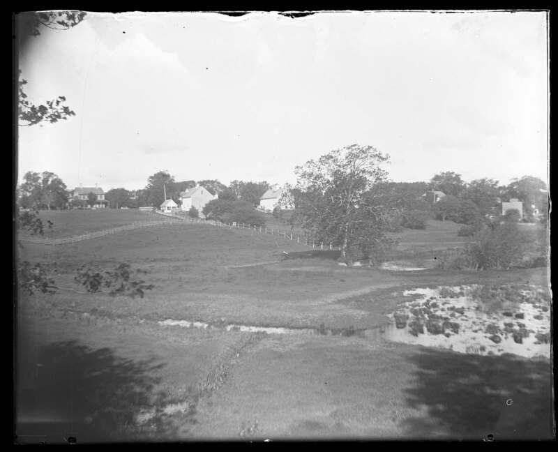
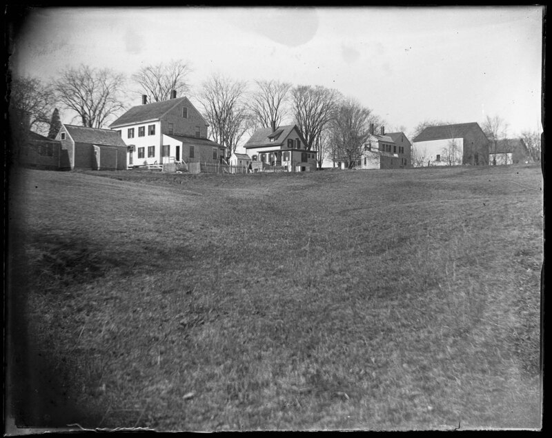
A row of New England style houses in Elmwood, Massachusetts. The landscape suggests there is a natural waterway leading down from the houses due to the shape of the small hills in the foreground. Grass covers the landscape and there are only trees surrounding the houses.
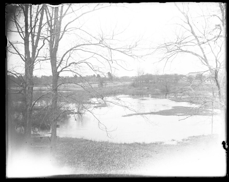
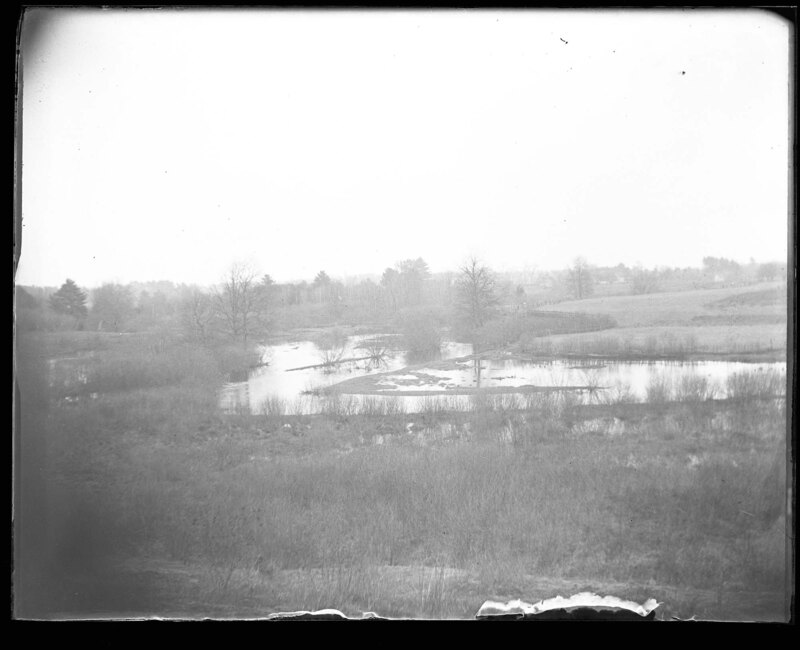
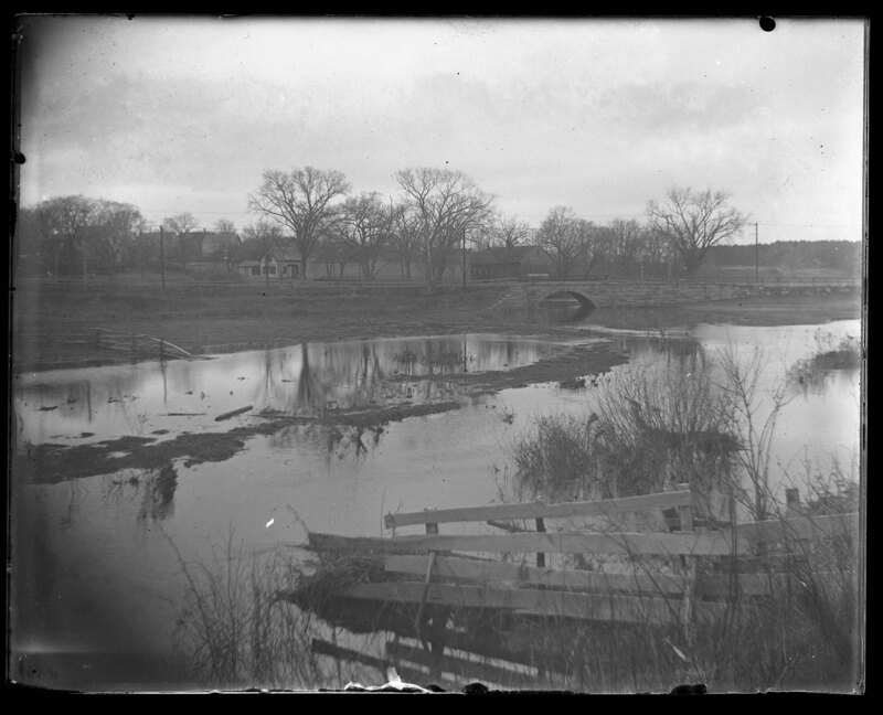
A flooded landscape in Elmwood, Massachusetts. The stream running under a stone bridge in the background appears to have flooded to surrounding landscape and logs and other debris can be seen floating in the valley. Several wooden fences have been destroyed by the water although the road appears to have avoided the flooding. Several houses can be seen in the background surrounded by trees.
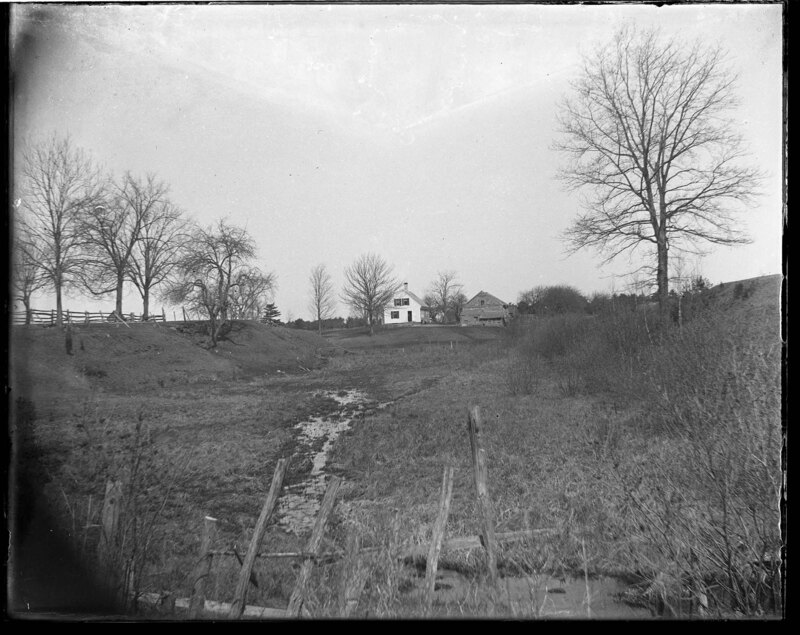
A river gully near Chamberlin's Bridge in New England. The shallow gully is covered with grass and scrub bushes while a small stream cuts through the landscape. A house and a barn can be seen in the background.
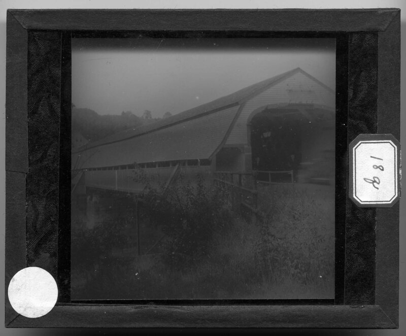
Large covered bridge in New Hampshire. The bridge is made of crossed wooden beams that make up the trellis of the bridge's frame and a covered walkway has been added to the side of the bridge to allow for pedestrians to cross the river. The bridge sits on stone pillars and has a gambrel style roof. A house can be seen in the background across the bridge. Slide labeled with text, "Made by G.R. Swain, 713 E. University Ave., Ann Arbor, Michigan." Swain was staff photographer at U of M from 1913 to 1947.
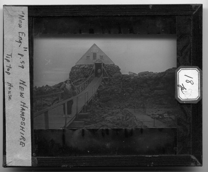
A woman poses for the camera outside of the Tip Top house in Sargent's Purchase, New Hampshire. It is located in Mount Washington State Park and is considered to be the oldest surviving building on the summit of Mount Washington. It was originally opened as a hotel but now is used as a museum to display the mountains history. The structure is made of stacked stone and holds a triangular style roof with an entrance and three windows. A long wooden walkway leads up to the structure and passes a stone foundation to the right. Large boulders are stacked around the structure and there are no trees or grass. Slide labeled with text, "Made by G.R. Swain, 713 E. University Ave., Ann Arbor, Michigan." Swain was staff photographer at U of M from 1913 to 1947.
A woman stands next to a corn field in Berkshire Fields, Massachusetts. The field is divided from the road by a wooden fence and the grass next to the road is almost covering the fence. Dense foliage covers the landscape to the right of the road and a church steeple can be seen in the background. The woman is wearing a long skirt, a button-up shirt and a flowery hat. Large hills can be seen in the background. Slide labeled with text, "Made by G.R. Swain, 713 E. University Ave., Ann Arbor, Michigan." Swain was staff photographer at U of M from 1913 to 1947.
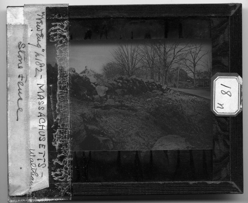
A stone fence in Walkham, Massachusetts. The fence follows the path of a road to the right and has no infill to keep the stones in place. Parts of the wall have fallen down and need to be reconstituted. Several Four over Four style structures can be seen in the background and trees line the street on either side. Slide labeled with text, "Made by G.R. Swain, 713 E. University Ave., Ann Arbor, Michigan." Swain was staff photographer at U of M from 1913 to 1947.
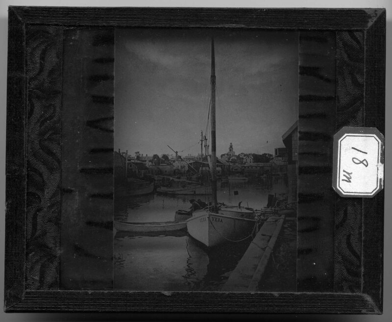
Nantucket Harbor in Nantucket, Massachusetts. Ships are moored to the docks along the harbor and a shipped named, "Vera," can be seen in the foreground. Houses and other buildings sit on the banks of the harbor and follow New England architectural traditions. Slide labeled with text, "Made by G.R. Swain, 713 E. University Ave., Ann Arbor, Michigan." Swain was staff photographer at U of M from 1913 to 1947.
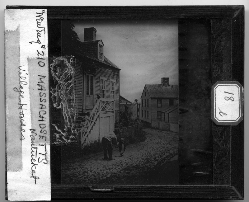
Village houses in Nantucket, Massachusetts. The houses are all New England style houses with varying forms and styles. A man talks to a child in the cobble stone street while several other children wait on the steps of the house in the foreground. Fences surround the properties that are built into the hills that the town rests on. Slide labeled with text, "Made by G.R. Swain, 713 E. University Ave., Ann Arbor, Michigan." Swain was staff photographer at U of M from 1913 to 1947.
Artemas Ward's house in Waterford, Maine. The house is a two story Four over Four style with two rear single story additions. The other houses on the street appear to be similar styles and a fence surrounds the Ward property. Trees cover the property and a dirt road passes in front of the house. Slide labeled with text, "Made by G.R. Swain, 713 E. University Ave., Ann Arbor, Michigan." Swain was staff photographer at U of M from 1913 to 1947.
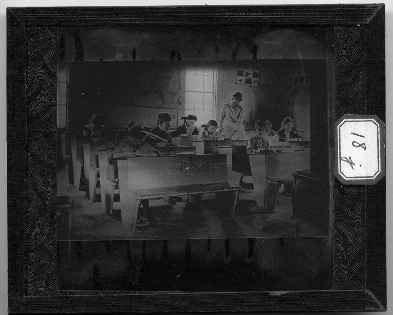
A one-room school house in Waterford, Maine. Children sit at wooden bench style desks and they appear to be varying ages. The teacher helps a student in the middle of the classroom and a wood stove can be seen at the front of the room . Art work and a map cover the walls towards the back of the room. Slide labeled with text, "Made by G.R. Swain, 713 E. University Ave., Ann Arbor, Michigan." Swain was staff photographer at U of M from 1913 to 1947.
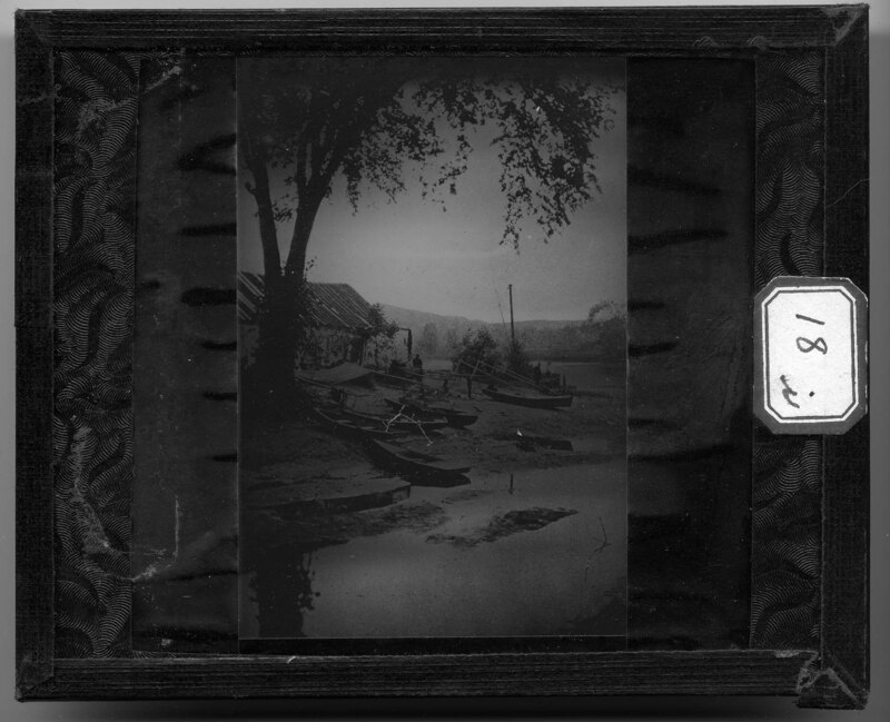
Low tide on the Connecticut River in Connecticut. Several row boats have been stranded on the river bottom until the tide comes back in. A small structure can be seen on the bank and several men walk around the rowboats. Trees and other foliage cover the banks of the river in the background. Slide labeled with text, "Made by G.R. Swain, 713 E. University Ave., Ann Arbor, Michigan." Swain was staff photographer at U of M from 1913 to 1947.
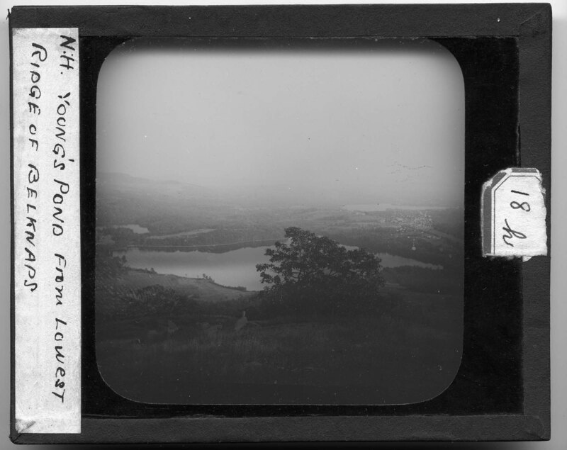
Young's Pond near Belknap Mountain in Belknap, New Hampshire. The landscape is very hilly and rocky with grass and trees covering the hills. Cleared fields can be seen at the base of the mountain and other ponds can be seen in the background. It is noted the picture was taken from the lowest ridge of the Belknap's.
Looking down of the landscape surrounding Belknap Mountain in Belknap, New Hampshire. Several ponds can be seen at the base of the mountain and trees cover the landscape. The ground is rocky and covered with grass. The landscape around the mountain is relatively flat with some hills.
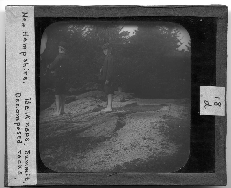
Two boys stand on the summit of Belknap Mountain in Belknap New Hampshire. It is noted that the rock is very deteriorated and in piles around the existing stone formations. The boys are not wearing any shoes and are standing on one of the rock formations at the summit. Pine trees can be seen in the background.
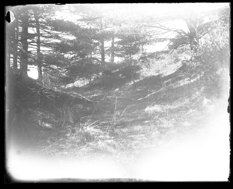
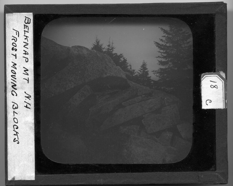
Blocks of stone on the landscape in Gilmanton, New Hampshire. The blocks are slowly moving down the grade of the hill and are pinning other stone beneath their weight. It appears that the stones may have all been part of one formation that cracked and shifted over time. Lichen grows on the surface of the stones and large pine trees can be seen in the background.
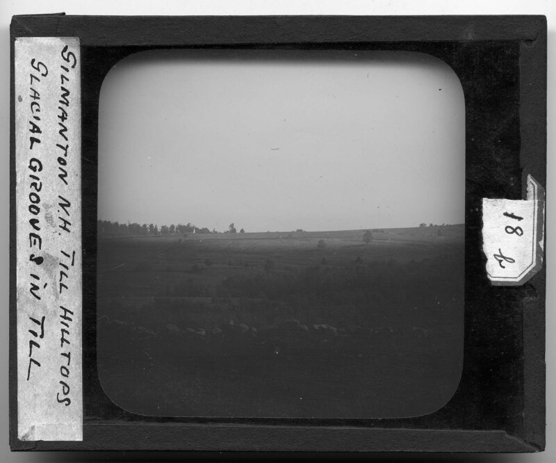
Landscape in Gilmanton, New Hampshire. A stone wall can be seen in the foreground and grassy fields extend into the background. It is noted that the landscape patterns are caused by glacial grooves. Tree groves dot the landscape and there are no structures around.
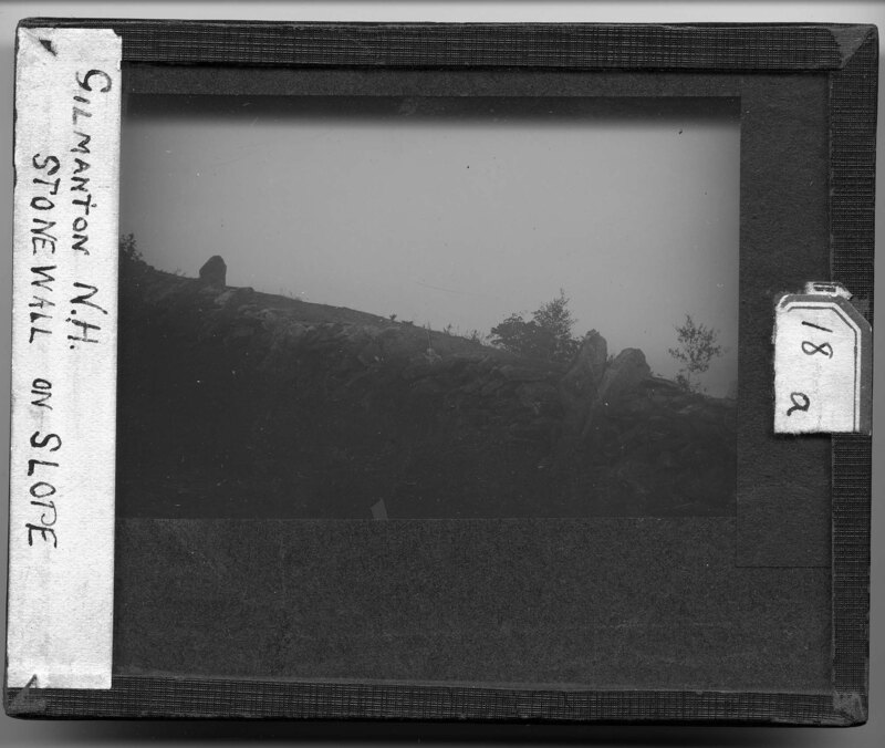
An uncoursed fieldstone wall in Gilmanton, New Hampshire. The wall most likely signifies a boundary between properties but has been constructed on the slope of a hill so large sheets of rock periodically brace the other stone from falling down the slope. The stones have all been piled on top of each other and rely on friction and gravity to stay in place. Fields and several trees surround the wall.
2nd Empire Style house in New England. The house is an elaborate two story Four over Four structure with an extended two story front bay surrounding the main entrance and extending through the roof, which is a shingled Mansard roof style. Two interior chimney rise out of the ridge line on the roof and pedimented wall dormers can be seen on the roof. The front facade has a denticulated cornice and two story pilasters. The first floor windows are floor to ceiling height while the second story has more standard sized windows. Two wings extend off the side of the house and it appears that the structure is abandoned because the lawn is not maintained and the walkway is cracked. Several women can be seen looking in the windows of the house. Slide labeled with text, "Made by G.R. Swain, 713 E. University Ave., Ann Arbor, Michigan." Swain was staff photographer at U of M from 1913 to 1947.
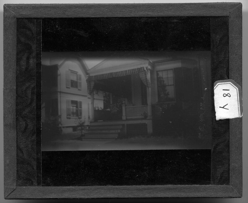
Home of Ex-President Coolidge in Northampton, Massachusetts. Four steps lead up to the small portico surrounding the main entrance of the house. Canvas screens can be let down in order to shade the porch and a rocking chair can be seen sitting on the porch. The house may be a Tri-Gabled L style house with the main entrance being in the ell. An oriel window can be seen on the front facade. Slide labeled with text, "Made by G.R. Swain, 713 E. University Ave., Ann Arbor, Michigan." Swain was staff photographer at U of M from 1913 to 1947.