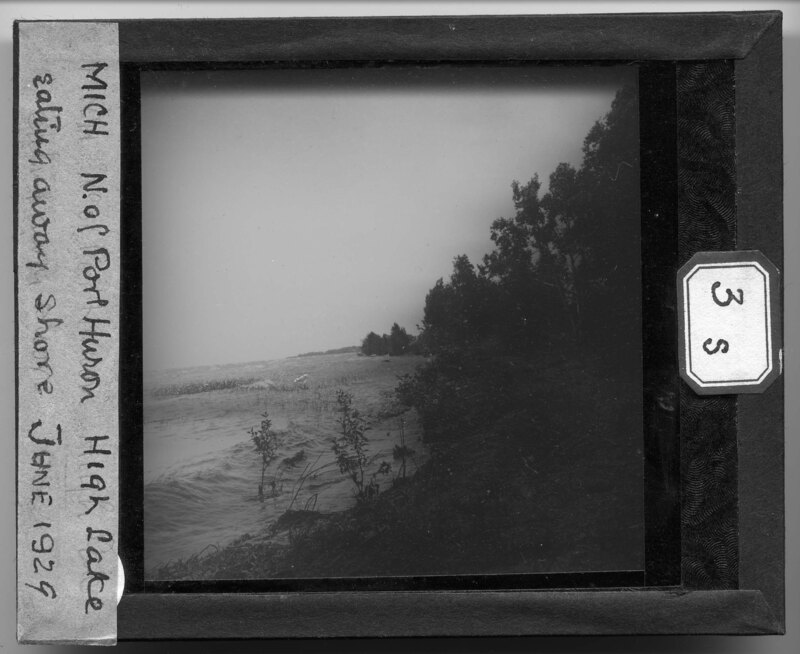
Shoreline of Lake Huron north of Port Huron, Michigan. The lake is very high and it is eroding the shoreline and dumping debris further up on the banks. Dune grass and scrub bushes can be seen sticking out of the lake, showing how high it is in comparison to its normal depth.
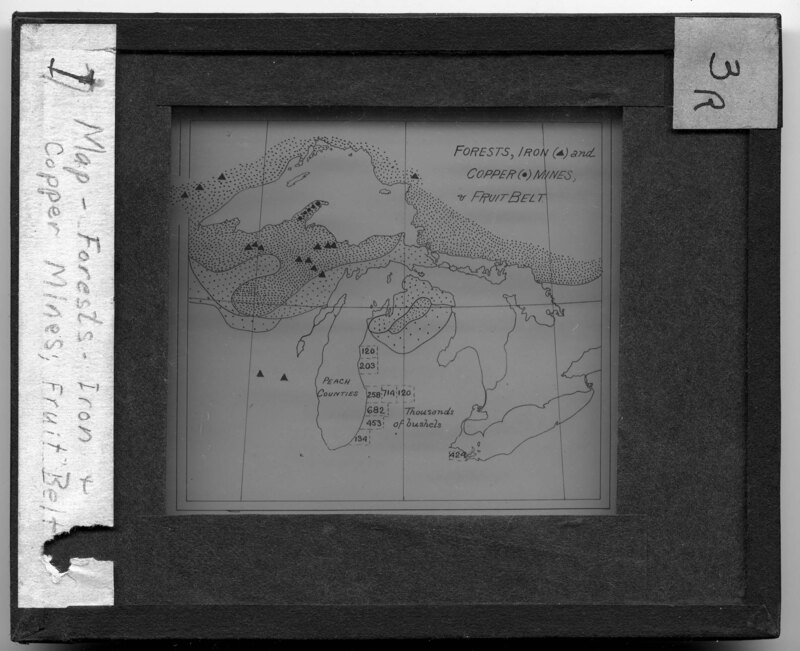
Hand drawn map of the forests, iron and copper mines, and the fruit belt of Michigan. The map notes the number of bushels produced in fruit belt and the location of copper and iron mines around the state.
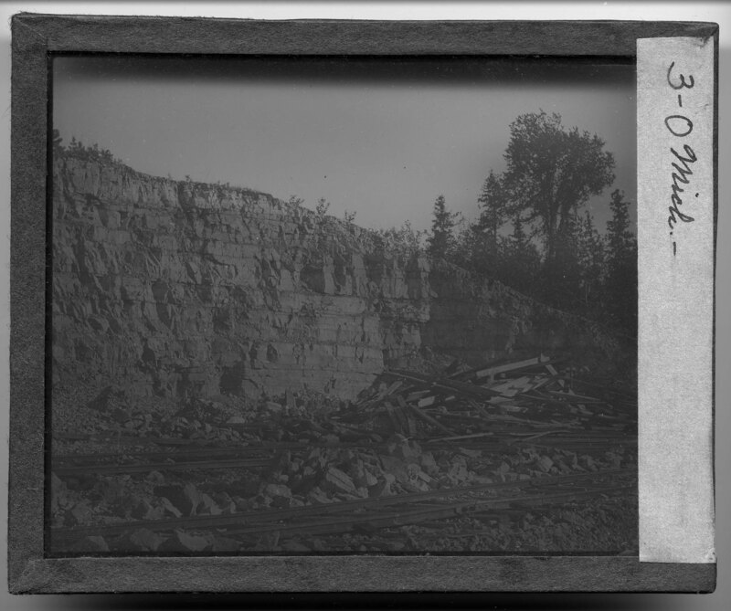
A rocky outcrop in the thumb area of Michigan. Cut timber is stacked next to rail lines and heavy boulders are piled in between the two rail lines. A shale rock wall can be seen in the background.
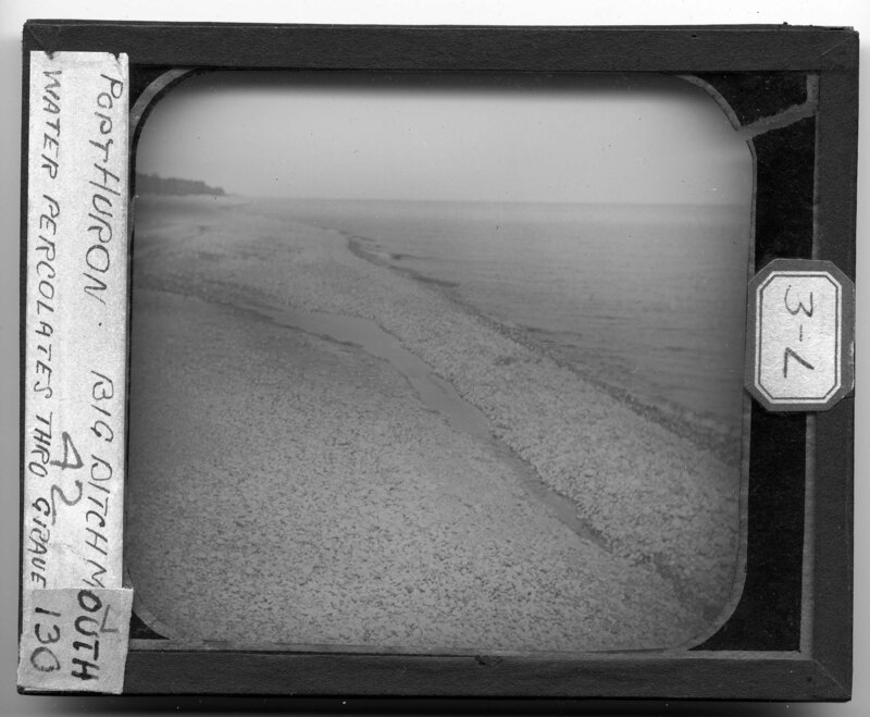
Rocky shoreline along Lake Huron in Port Huron, Michigan. Water cuts through the beach rocks going towards the lake from the ditch mouth out of the frame. Trees can be seen growing away from the beach in the background.
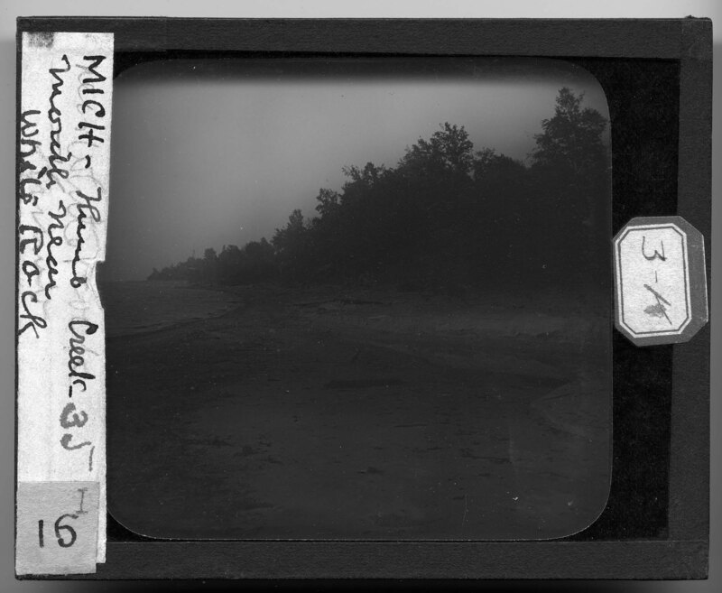
Shoreline of Lake Huron near White Rock, Michigan. The beach is sandy and littered with debris from the lake. Water has carved out a crevice in the sand, exposing the different layers of sand that make up the beach. Trees and dune grass grow on the dune behind the beach, where heavy drift wood timbers have washed up on shore.
Two men walk along the Lake Huron shoreline in the thumb area of Michigan. They are most likely surveyors who traveled with Mark Jefferson as he documented Michigan. A rocky beach touches the lake while a rocky, clay bluff rises up next to the beach. Scrub bushes and dune grass grow on the outcrop and help keep the dune in place. Debris litters the beach.
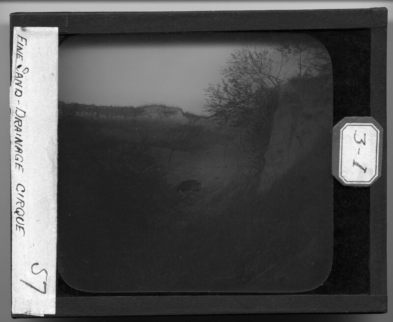
A sand dune along the Lake Huron shore in the thumb area of Michigan. Fine sand has been compressed and shaped to form the dune and an exposed part shows the different layers of sand that make up the dune. Dune grass and scrub bushes grow out of the dune, helping to hold the sand in place.
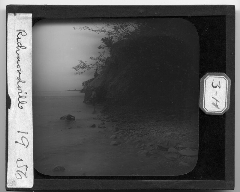
The Lake Huron shoreline at Richmondville, Michigan. A man is wading into the lake next to a shale rock outcrop along the shoreline. Rubble rocks cover the beach and trees grow out of the side of the rock face.
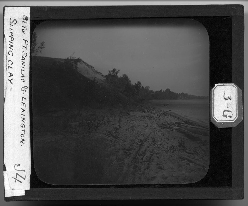
Shoreline of Lake Huron between Lexington and Port Sanilac, Michigan. There is very little beach before the landscape begins to rise up from the lake. The beach is covered in dune grass and debris from the lake while the sandy bluffs are dotted with trees and scrub bushes. Sand has fallen down the cliff face and left the dune exposed.
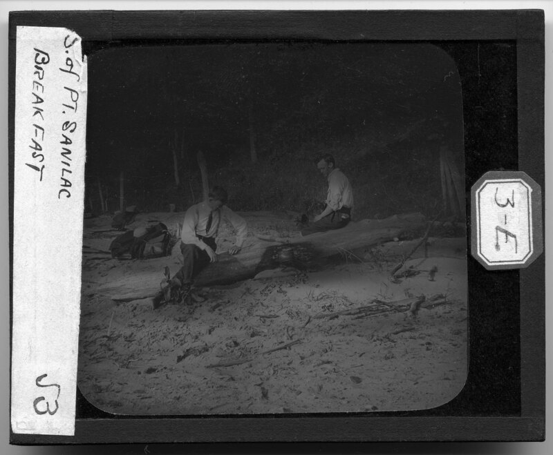
Two men are sitting on a driftwood tree trunk heating up food in a metal pot. They have built a fire in the sand and it has charred the side of the tree trunk. The beach is sandy and littered with debris while the hill behind them is covered in dune grass and trees.
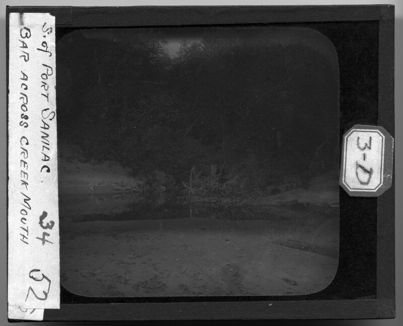
The mouth of a creek in Port Sanilac, Michigan where it meets Lake Huron. The water has cut a trench in the sandy beach and left debris around the mouth of the creek. Dense foliage grows on the banks surrounding the creek and the beach is littered with debris.
View of the Lake Huron shoreline at Port Sanilac, Michigan. It is noted the picture was taken at 4 am and is looking down the coastline of the lake, which is relatively flat near the water and then begins a large incline. Trees and scrub bushes grow on the rocky landscape.
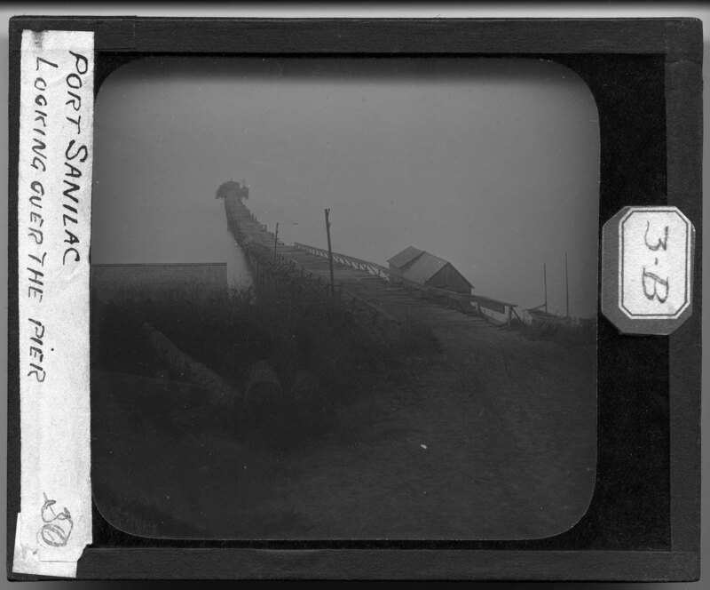
Pier on Lake Huron in Port Sanilac, Michigan. The pier is wooden plank construction and leads out to a small lighthouse in the lake. Two sailboats are moored to the shoreline. From the vantage point of the photographer, the dirt embankment drops off to meet the shoreline and a roof can be seen at the same height as the embankment.
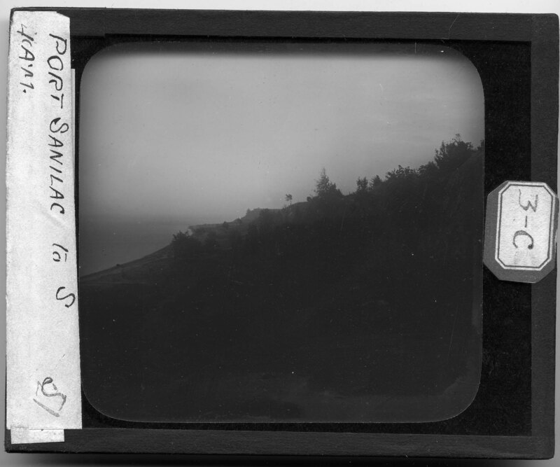
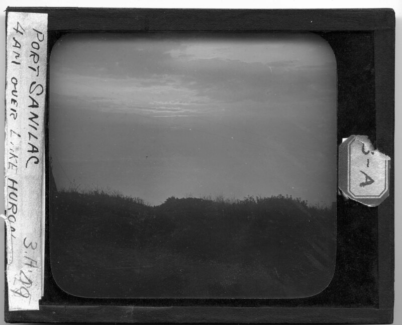
View of the Lake Huron shoreline at Port Sanilac, Michigan. It is noted the picture was taken at 4 am and is looking out over the lake. A rutted dirt road leads down to the shoreline and grass grows on the embankment above the lake.
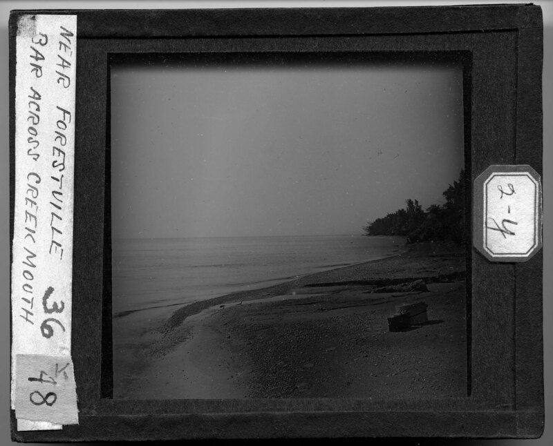
The shoreline of Lake Huron where the mouth of Shale Creek meets the lake in Forestville, Michigan. The beach is sandy and mixed with rocks eroded by the water. Two boxes can be seen in the foreground and trees grow along the shoreline in the background.
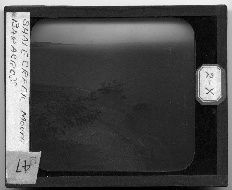
The mouth of Shale Creek in White Rock, Michigan. The stream meets Lake Huron and then travels through the steep of the landscape near the shoreline. Shale rock has been eroded by the stream and caused a rocky section of the beach to form. A lighthouse can be seen in the background.
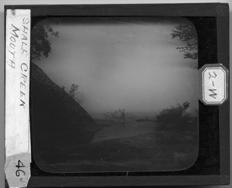
The mouth of Shale Creek in White Rock, Michigan. The stream meets Lake Huron and then travels through the steep of the landscape near the shoreline. Shale rock has been eroded by the stream and has caused collections of the rocks to form near the stream. A man sits on the rocks near the stream looking out over the lake. Trees and scrub bushes surround the stream.
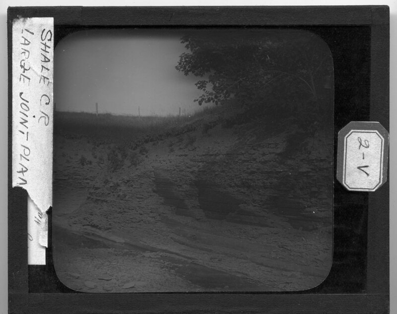
Shale Creek embankment in White Rock, Michigan. Shale rock has been eroded by the stream and has caused piles of rock to collect along the stream. Rock patterns can be seen in the exposed embankment. Trees and scrub bushes grow on the banks of the stream.
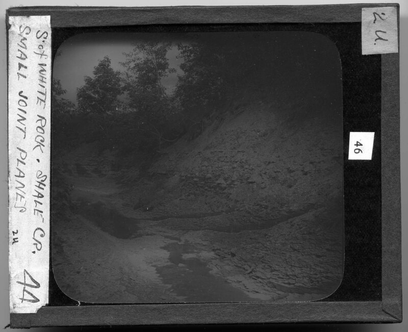
Shale Creek in White Rock, Michigan. Shale rock has been eroded by the stream and has caused piles of the rock to collect along the banks. Trees and scrub bushes grow on the embankments of the stream.
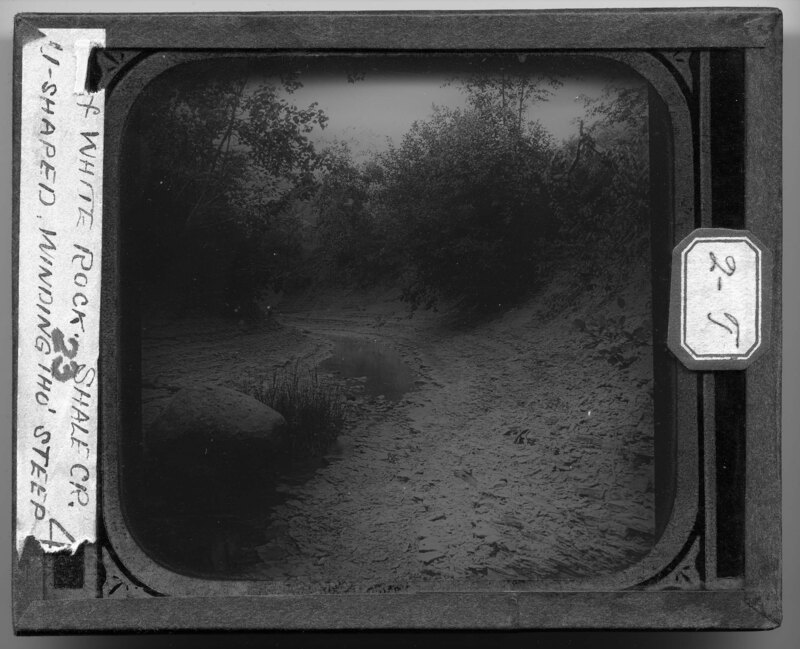
Shale Creek in White Rock, Michigan. Shale rock has been eroded by the stream and has caused piles of the rock to collect along the banks. Trees and scrub bushes grow on the embankments of the stream and it is noted the stream winds through the steep near Lake Huron.
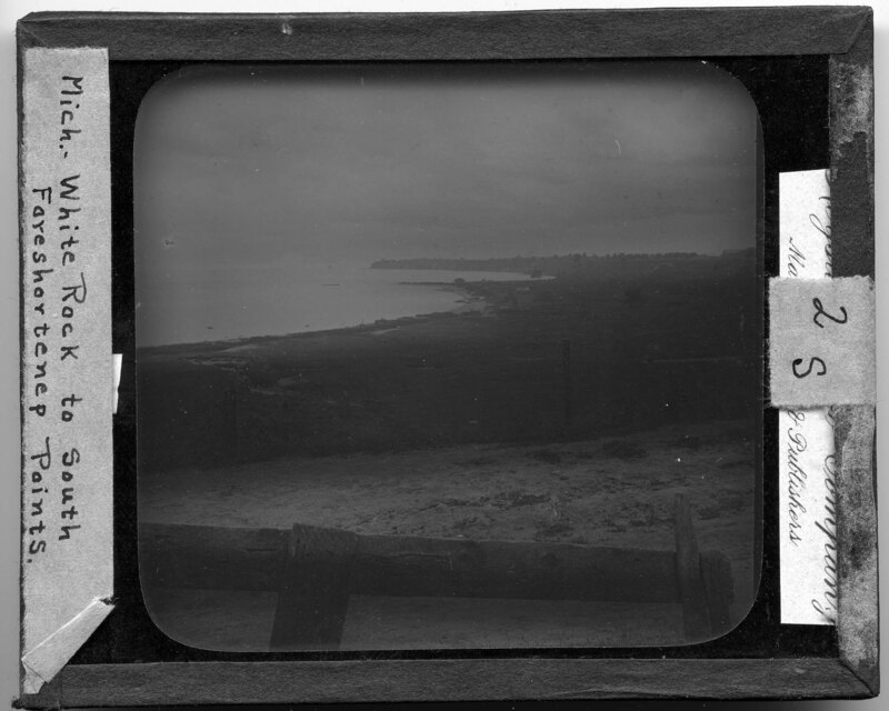
Shoreline of Lake Huron south of White Rock, Michigan. The lake has created sandy outcrops that reach out into the lake and trees and scrub bushes grow along the shoreline. A cultivated field can be seen in the foreground and waterways cut through the land as it reaches the shoreline.
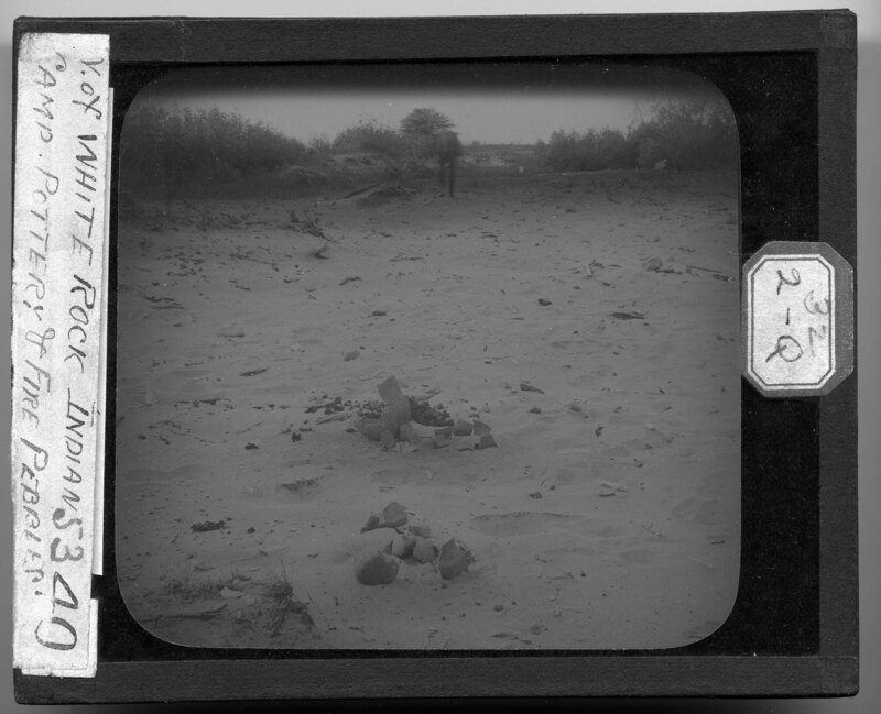
Indian camp on the beach north of White Rock, Michigan. Pottery shards and fire pebbles have been collected and stacked in the picture. A man can be seen in the background walking along the beach. Dune grass, trees, and scrub bushes make up the landscape of the beach.
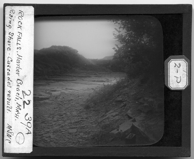
Stream crossing over a shale rock bed in Harbor Beach, Michigan. From the water eroding the shale, rock falls have occurred along the embankments surrounding the stream, creating rocky piles around the stream. Grass and trees grow along the banks and a metal case can be seen sitting in the bottom of the picture.
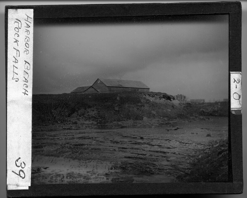
Landscape of a river crossing a shale rock bed in Harbor Beach, Michigan. Dirt embankments can be seen on either side of the stream and a wooden barn can be seen on top of the hill near the stream. Water has eroded the stream bed, exposing the shale rock.
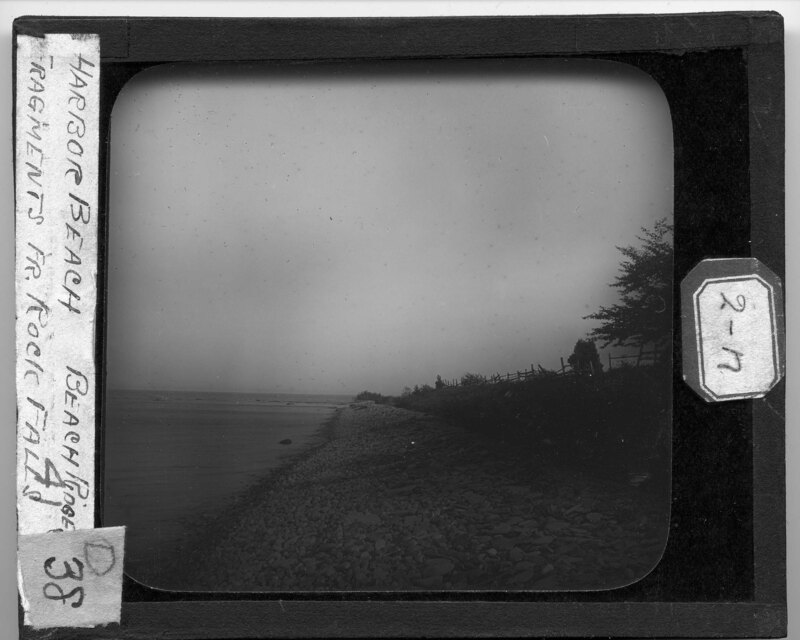
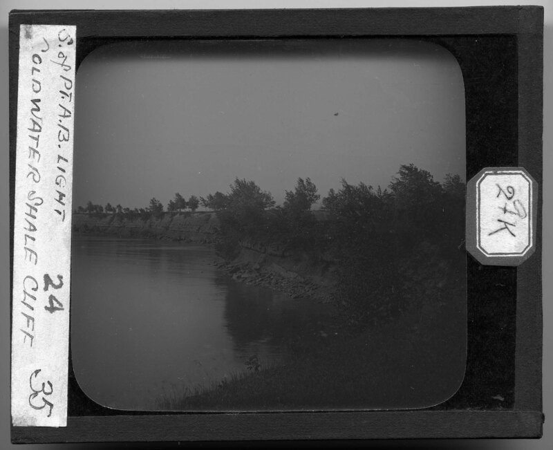
Rocky shoreline of Lake Huron at Harbor Beach, Michigan. The rocks have been smoothed by the water and separate the lake from the grassy embankment to the right. A wooden fence sits at the top of the embankment and trees are growing along the shoreline. It is noted the rocks that make up the beach are fragments from rock falls.
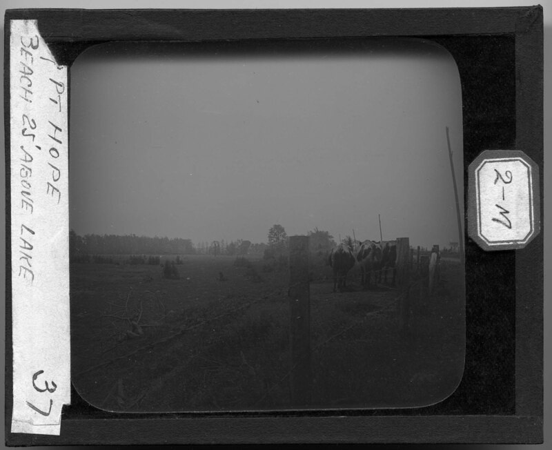
Cows stand in a pasture surrounded by barbed wire and wooden posts in Port Hope, Michigan. The landscape is dotted with trees and scrub bushes and is covered by grass. It is noted the picture is showing the beach along the lakeshore 25' above the water.
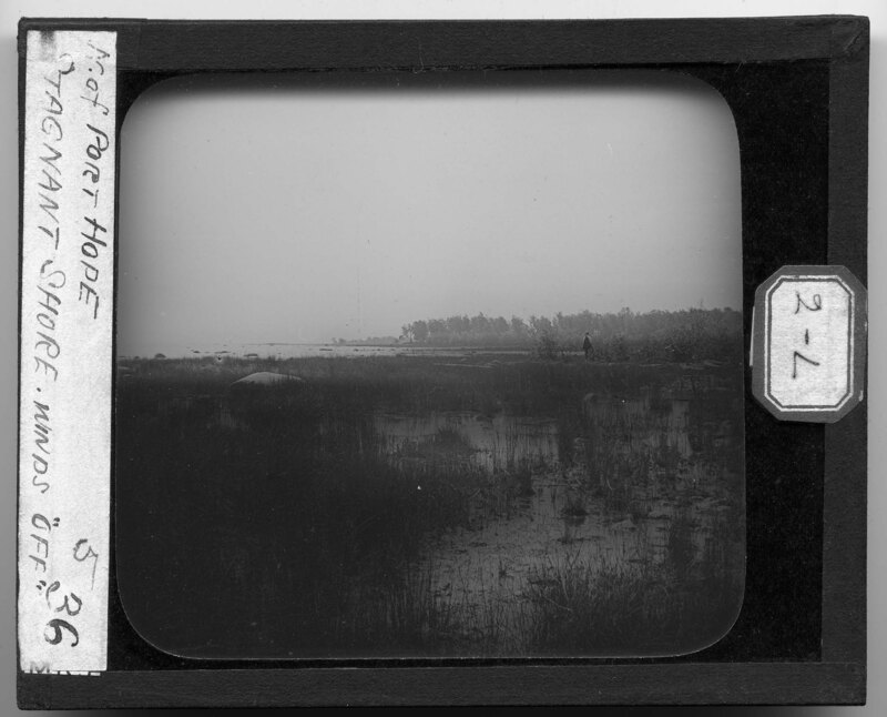
A marshy area along the Lake Huron coast north of Port Hope, Michigan. Dune grass grows in the stagnant water and large boulders can be seen in the marsh and out in the lake. A man is standing in the marsh to the right. Trees grow along the shoreline.
The rocky shoreline south of the Point Aux Barques Lighthouse in Point Aux Barques, Michigan. Trees and grass grow on the tops of the rocky outcrops and it is noted the shoreline is mostly made of shale. It appears to be very windy because the trees are being bent by the wind.
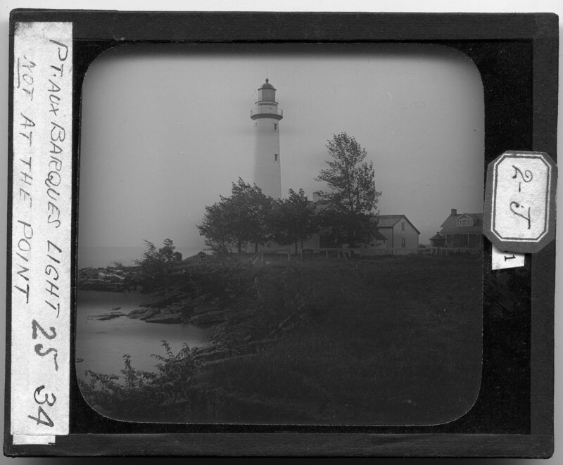
The Point Aux Barques Lighthouse in Michigan. One of the oldest operating lighthouses on the Great Lakes, the lighthouse tower was constructed in 1857 from brick and the frame construction keeper's house. A light saving station was added to the site in 1875. Picture showing the lighthouse, the keeper's house to the right, and the life saving station to the right of that. It appears to be very windy because the trees are blowing in the wind. The shoreline is rocky and grass grows along the banks.
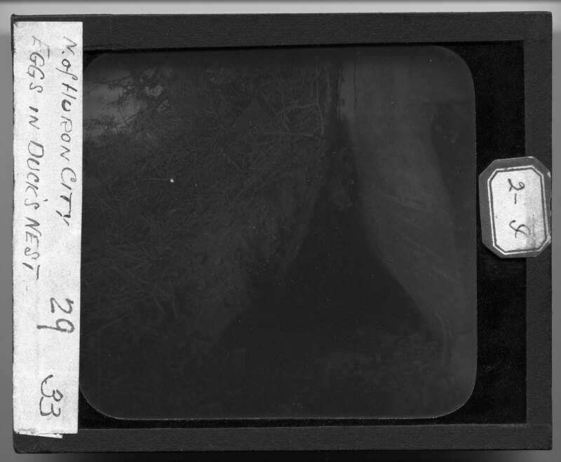
Looking into the hole in the rocky embankment where a Red Headed Duck nest can be seen on the Lake Huron shoreline near Huron City, Michigan. Several eggs can be seen in a bed of feathers set into the rocks and grass grows around the opening to the nest.
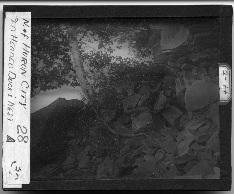
Rocky embankment on the shores of Lake Huron north of Huron City, Michigan. It is noted the picture is showing a Red Headed duck nest, however, it is challenging to see where the nest is. There is a hole made by the rocks a right and up from the center of the picture and the nest is in that hole. A birch tree grows out of the embankment and grass grows around the opening in the rocks where the nest is located.
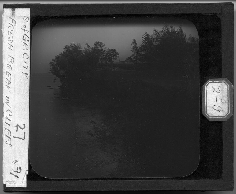
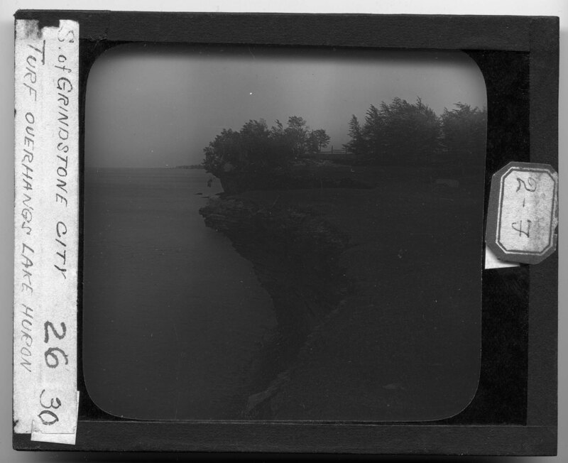
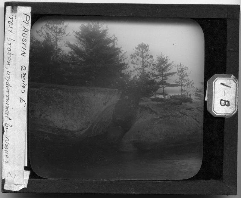
The Lake Huron shoreline in Grindstone City, Michigan. The rocky cliffs have been undermined by the lake and erosion, creating natural outcrops in the landscape. Newly broken rocks can be seen in the foreground, fallen from the cliff to the shoreline. Foliage hangs over the side of the cliff and a grove of trees can be seen to the right.
The Lake Huron shoreline in Grindstone City, Michigan. The rocky cliffs have been undermined by the lake and create natural outcrops in the land. The foliage that grows on top of the outcrops can be seen hanging over the side of the cliff. A tree grove can be seen in the background.
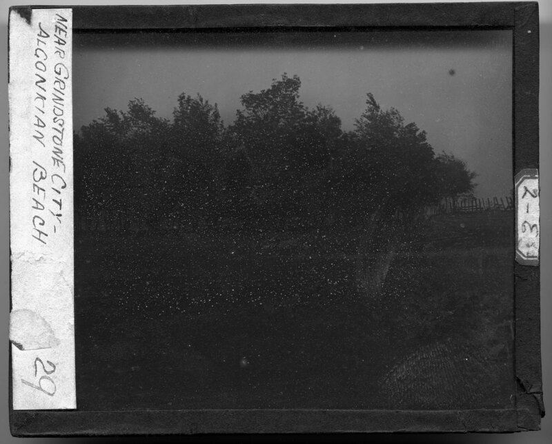
Open field with little vegetation and a large grove of trees in the background in Grindstone City, Michigan. It is noted the picture was taken near Algonkian Beach. A wooden fence row can be seen to the right and large boulders dot the field.
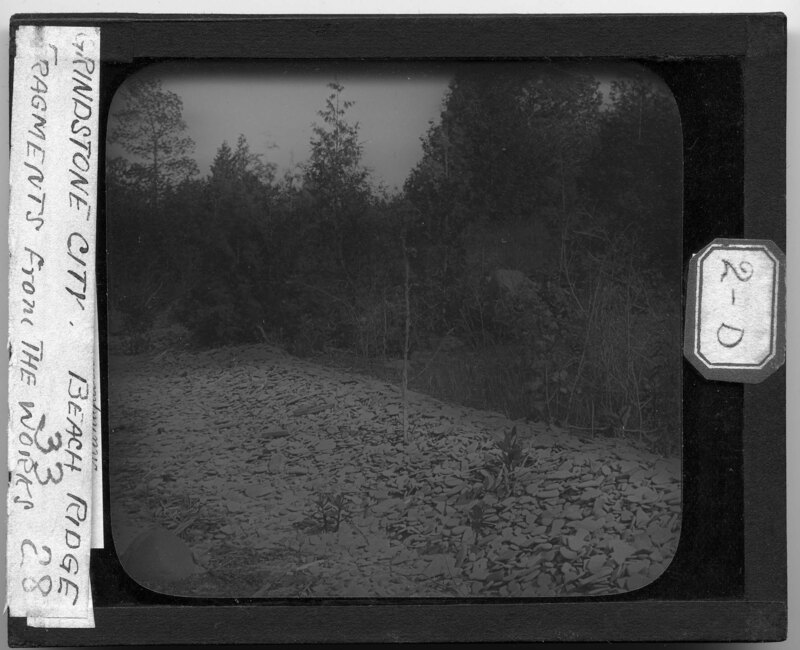
A fragment pile from the quarry in Grindstone City, Michigan. Small pieces of material break off when the slab of rock are cut from the quarry and become waste material that is dumped away from the quarry.
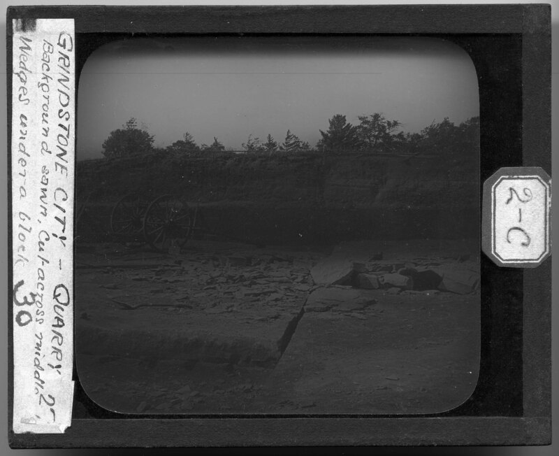
The quarry where the stone is mined to make grindstones in Grindstone City, Michigan. A wooden wagon wheel loading cart can be seen in the foreground and broken rubble stone is sitting on top of a block of stone being cut and broken out of the quarry. Wooden pegs help break the stone into long sheets and create wedges, driving cracks through the quarry.
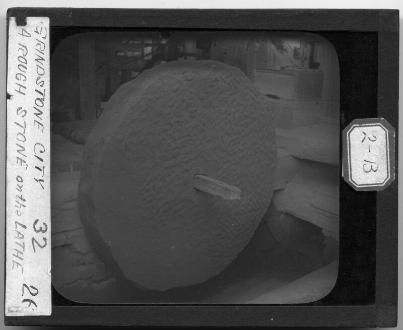
A rough grindstone sitting on a lathe waiting to be shaped and sanded down at a factory in Grindstone City, Michigan. Machinery can be seen behind the stone, used in the production of the finished stones.
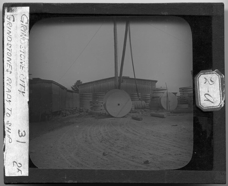
Piles of grindstones at a factory in Grindstone City, Michigan. The grindstones have been cut and shaped and are waiting to be shipped. A rail car sits next to the stacks of stones and a warehouse style building can be seen in the background.
Burnt Cabin Point in East Michigan. The landscape is sandy and covered in limb debris and logs. Dune grass covers most of the beach area and the area is generally a low lying, stagnant water area near the lake shore. Trees dot the shore.
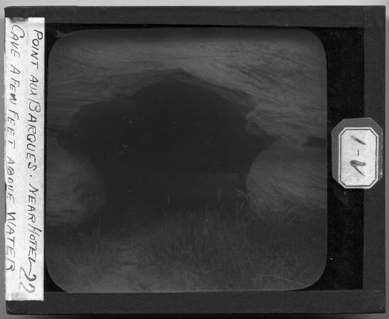
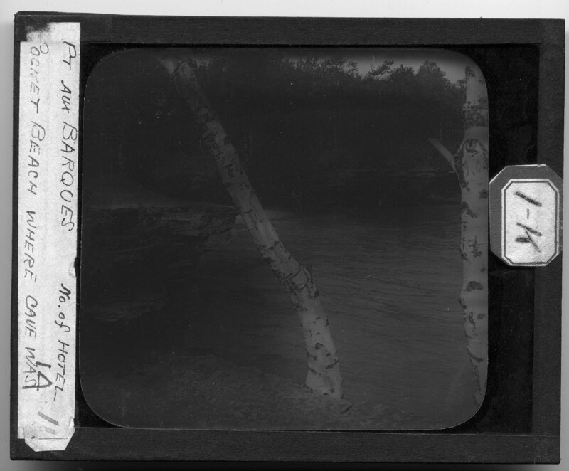
A rocky cave carved out by erosion along the Lake Huron shore at Point Aux Barques, Michigan. Dune grass grows around the mouth of the cave and the cross bedding of the rocks has been exposed through erosion.
The rocky cliffs along the shoreline of Lake Huron at Point Aux Barques, Michigan. Trees and scrub bushes grow on the outcrops which have been formed from undermining of the rocks by the lake.
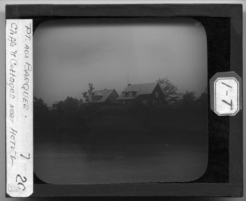
Cottages on the Lake Huron coast at Point Aux Barques, Michigan. The lake has undermined the rocky shore, creating natural outcrops in the stone shoreline. Trees and scrub bushes grow on the outcrops and surround the cottages that sit on top of the cliffs.
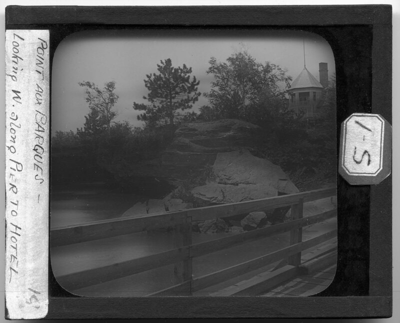
The shoreline of Lake Huron at Point Aux Barques, Michigan. Taken from a wooden pier, this picture shows the rocky shoreline, undermined by waves. Trees and scrub bushes grow on the outcrops and a building with a rounded porch sits away from the shoreline.
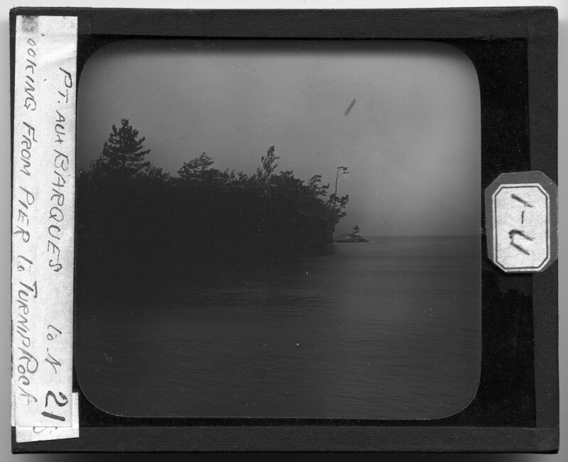
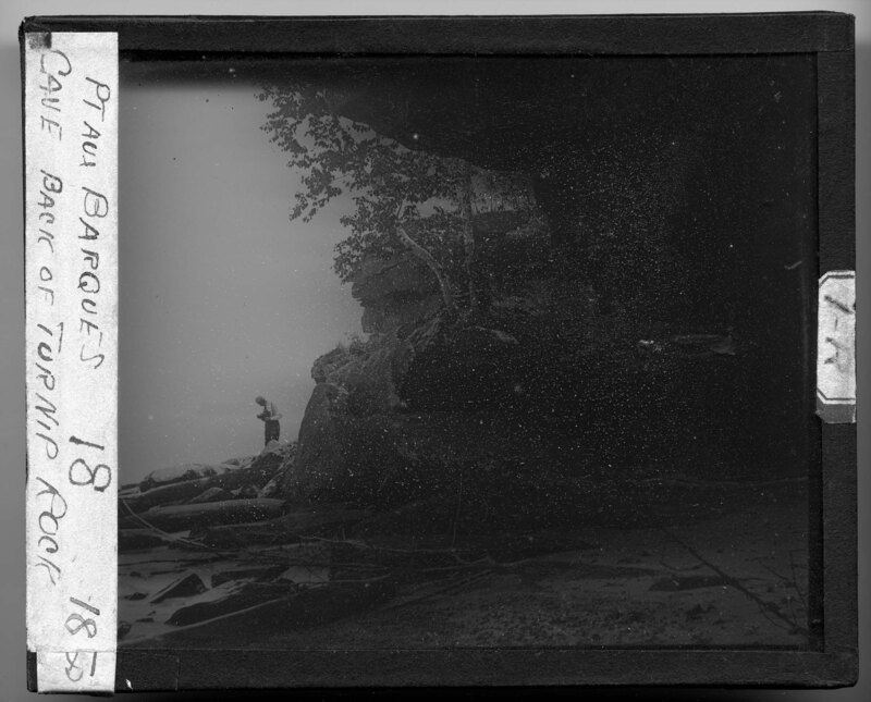
A photographer stands on the rocky shoreline of Lake Huron near Turnip Rock at Point Aux Barques, Michigan. The photograph was taken from inside one of the caves cut out by the lake near Turnip Rock. Birch trees grow on top of the outcrops and large timbers have washed ashore on the rocks to the left. Limb debris covers the beach.
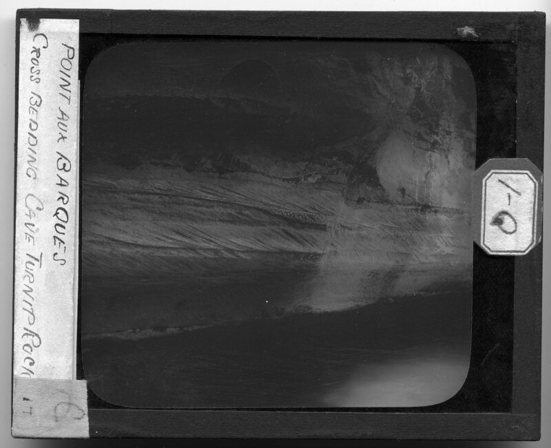
Undermined shoreline of Lake Huron at Turnip Rock near Point Aux Barques, Michigan. Lichen covers the rocky face and cross bedding has been exposed showing the different layers of sediment formation in the rocks.
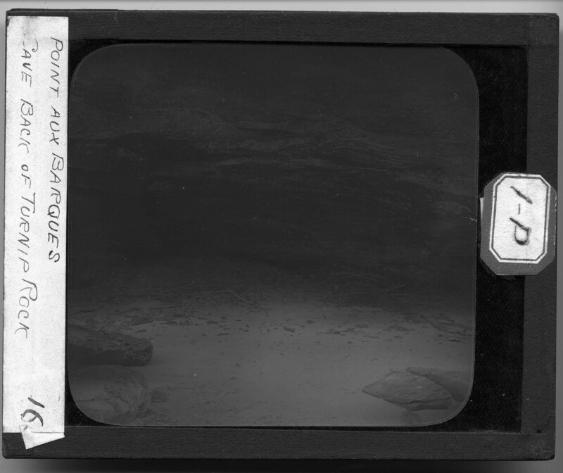
Shoreline cave on Lake Huron at Turnip Rock near Point Aux Barques, Michigan. Lichen covers the rocky walls and limb debris covers the sandy beach part of the cave. Collapsed pieces of the cave have collected towards the back and small rocks litter the beach.
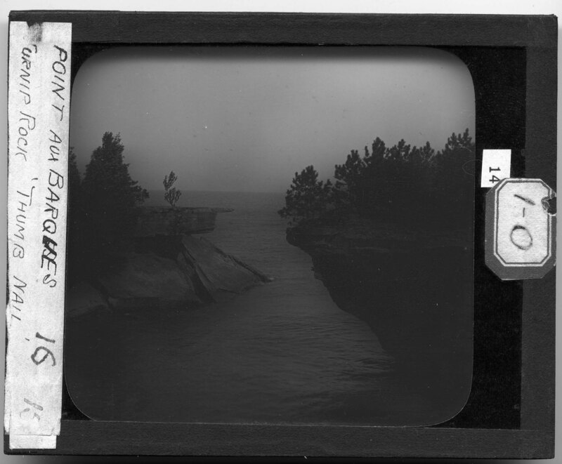
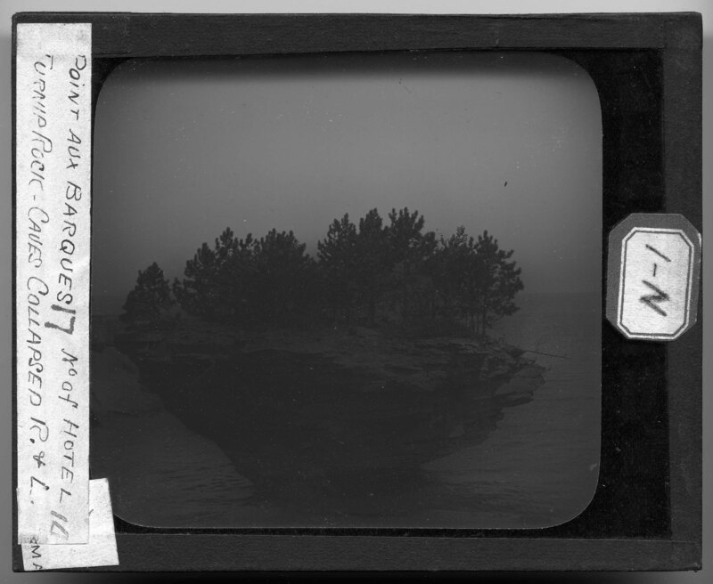
Turnip Rock at Point Aux Barques, Michigan. Located on the shores of Lake Huron, this large rock formation has been carved out by the lake for thousands of years and has been left in the middle of the lake as the shoreline recedes. Trees and scrub bushes grow on top of the island. A view of the shoreline can be seen to the left.
Turnip Rock at Point Aux Barques, Michigan. Located on the shores of Lake Huron, this large rock formation has been carved out by the lake for thousands of years and has been left in the middle of the lake as the shoreline recedes. Trees and scrub bushes grow on top of the island.
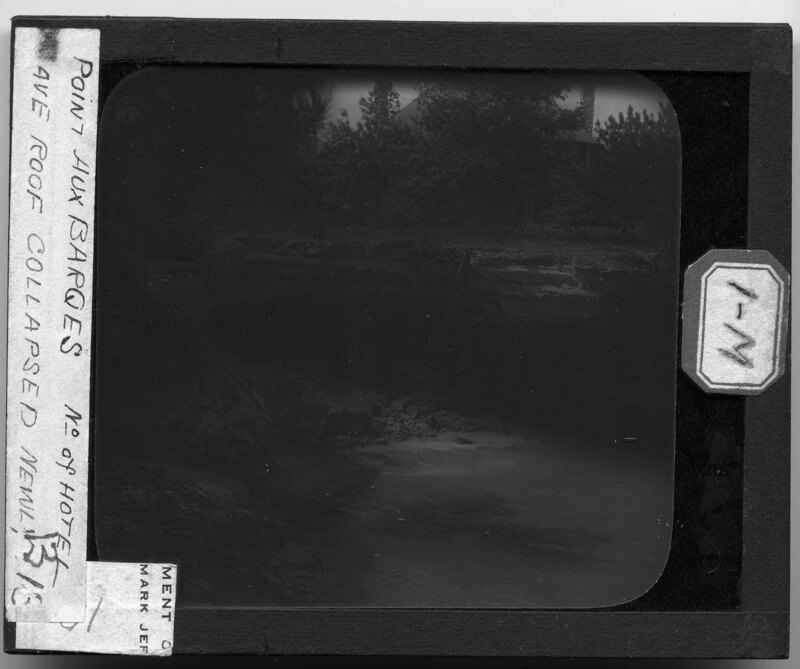
The collapsed shoreline of Lake Huron at Point Aux Barques, Michigan near Turnip Rock. The shoreline is rocky and has been carved out by erosion, creating cave-like outcrops. A house has been built on the outcrop and sits behind a grove of trees.
A small beach cut into the shoreline of the Lake Huron at Point Aux Barques, Michigan. A wooden staircase leads down to the beach and the rocky shoreline creates a cave-like appearance over the beach. Trees and grasses grow on the outcrops and large boulders sit on the beach near the stairs.
Two men are standing on the shoreline of Lake Huron at Point Aux Barques, Michigan. They appear to be hiking the shoreline and have stopped on a rocky part of the small beach along the lakeshore. The rocky shoreline is very jagged and has been undermined by the lake creating cave-like outcrops. Grass and trees grow on the outcrops and a birch tree can be seen in the foreground.
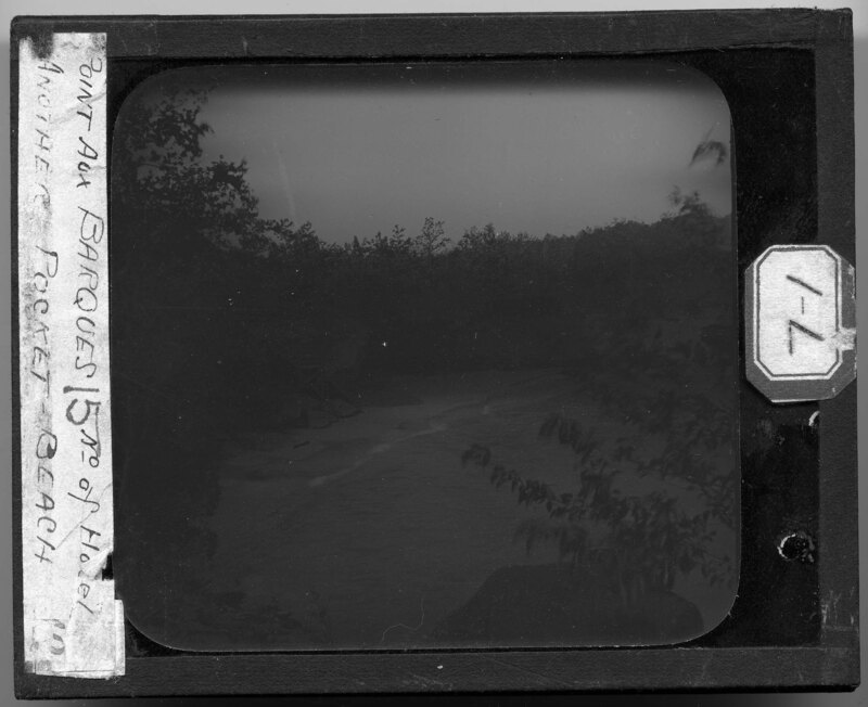
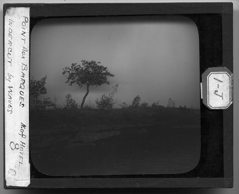
Rocky shoreline eroded by Lake Huron near Point Aux Barques, Michigan. Scrub trees and bushes cover the shoreline and it is noted that the picture shows a pocket beach where a cave used to be.
Lake Huron shoreline at Point Aux Barques, Michigan, east of Port Austin. The rocky sandstone shoreline has been carved out by erosion and a channel can be seen running through the rocks. A concave dip in the rock holds water that has splashed up on the rock. Lichen covers the surfaces of the rocks.
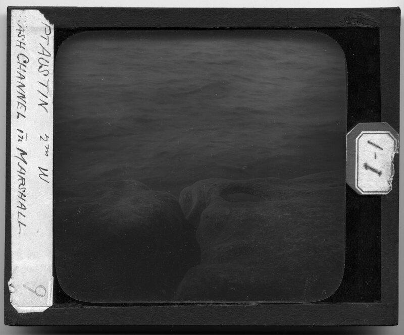
A man sitting on a rock formation of the shoreline of Lake Huron near Port Austin, Michigan. A wash channel carved into the sandstone can be seen to his left. He is writing something in a notebook and has a satchel over his shoulder.
The rocky sandstone shoreline of Lake Huron near Port Austin, Michigan. Waves have carved out the rock formations lining the shoreline and have undermined them so there are caves in the rocks. Trees grow farther back from the shoreline and scrub bushes grow in between the rock formations.
The shoreline of Lake Huron at Port Austin, Michigan. Large rock formations have been created by erosion and now line the shoreline. A beach separates the tree and water lines and it is noted that the waves have undermined the rocks on the shoreline.
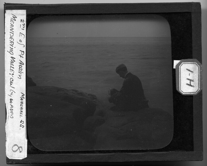
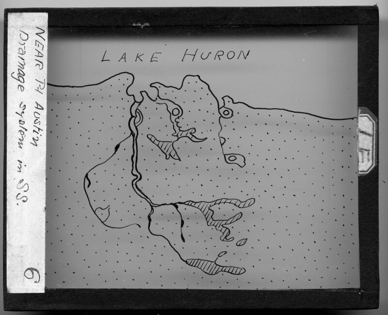
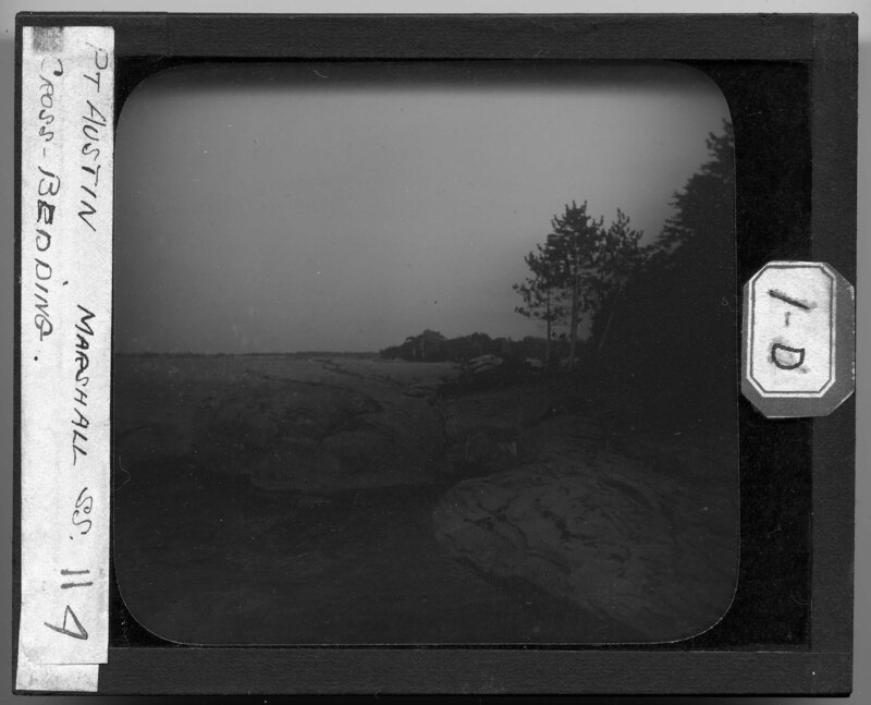
Landscape of the Lake Huron shoreline near Port Austin, Michigan. Over time, large boulders have been created on the shoreline and they have become cross bedded by erosion. Trees grow along the shoreline. It is noted that the sandstone in this area is Marshall Sandstone.
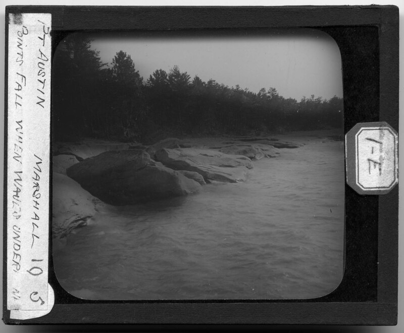
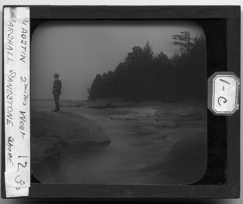
A man stands on a large boulder near the shores of Lake Huron in Port Austin, Michigan. It is noted that the rocks in this area are Marshall sandstone. Trees grow along the shoreline and boulders line the beach.
A broken rock formation on the shores of Lake Huron in Port Austin, Michigan. The waves have undermined the rocks so that they have become split and there is a small beach in between them. Trees and lichen grow on the rocks.
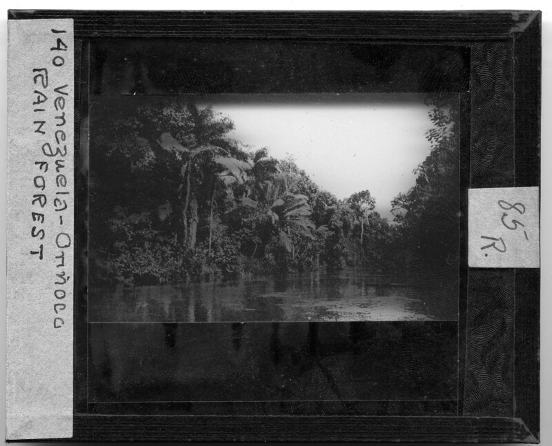
Image from a published source. Orinoco River running through the Venezuelan rain forest. Dense foliage covers the river bank. Slide labeled with text, "Made by G.R. Swain, 713 E. University Ave., Ann Arbor, Michigan." Swain was staff photographer at U of M from 1913 to 1947.
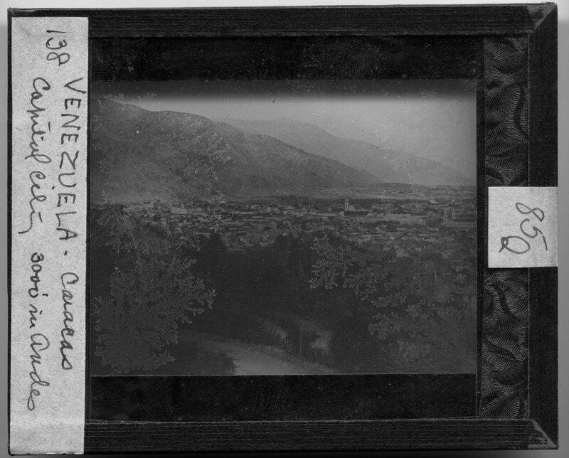
Image from a published source. View of Caracas, Venezuela at the base of mountains in the background. The city is very spread out with very few tall buildings. Slide labeled with text, "Made by G.R. Swain, 713 E. University Ave., Ann Arbor, Michigan." Swain was staff photographer at U of M from 1913 to 1947.
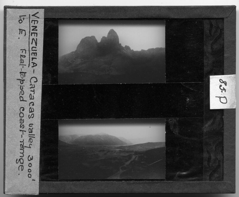
Image from a published source. Two images, one of a mountain in Venezuela and the other of the flat topped coast range. Slide labeled with text, "Made by G.R. Swain, 713 E. University Ave., Ann Arbor, Michigan." Swain was staff photographer at U of M from 1913 to 1947.
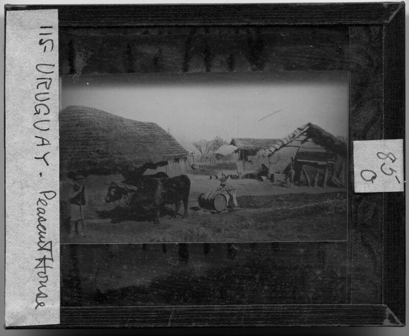
Image from a published source. Peasant houses in Uruguay. A man leads a team of oxen as they till a field outside of the houses. The structures are one story buildings with thatch roofs and are made of an adobe material. A woman can be seen feeding the chickens in the background. Slide labeled with text, "Made by G.R. Swain, 713 E. University Ave., Ann Arbor, Michigan." Swain was staff photographer at U of M from 1913 to 1947.
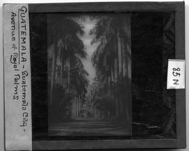
Image from a published source. A row of tall palm trees creates a corridor in Ecuador on the way to Pichincha. A dirt path runs between the rows of trees. Slide labeled with text, "Made by G.R. Swain, 713 E. University Ave., Ann Arbor, Michigan." Swain was staff photographer at U of M from 1913 to 1947.
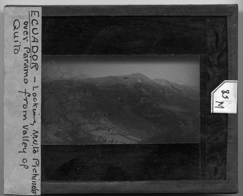
Image from a published source. aerial image of a mountainscape in Ecuador overlooking Pichincha to the N.W. The mountains are covered in foliage but very few trees. A winding road can be seen going up the side of the one of the ridges. Cultivated land can be seen in the valley of the mountains. Slide labeled with text, "Made by G.R. Swain, 713 E. University Ave., Ann Arbor, Michigan." Swain was staff photographer at U of M from 1913 to 1947.
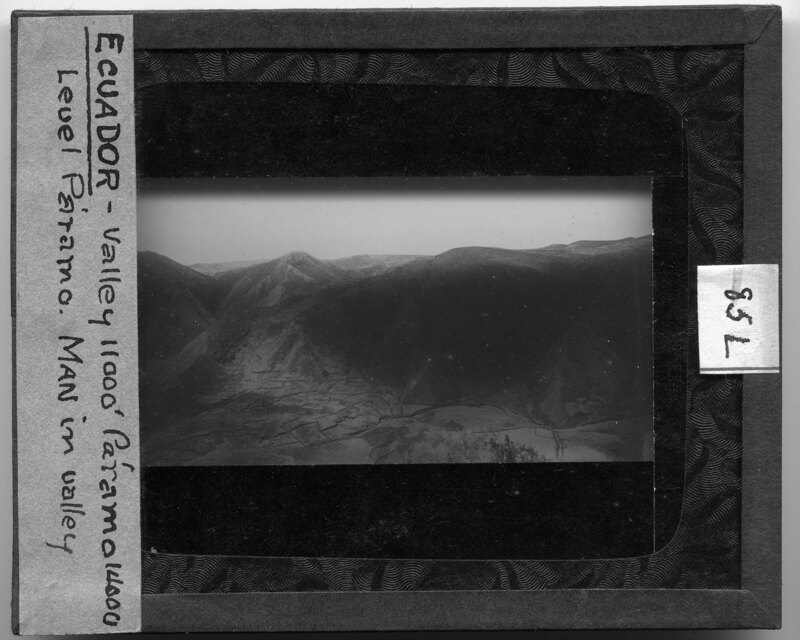
Image from a published source. aerial image of a mountainscape in Ecuador. Cultivated land can be seen marked out on the side of one of the mountains and in the valley. There are very few trees. Slide labeled with text, "Made by G.R. Swain, 713 E. University Ave., Ann Arbor, Michigan." Swain was staff photographer at U of M from 1913 to 1947.
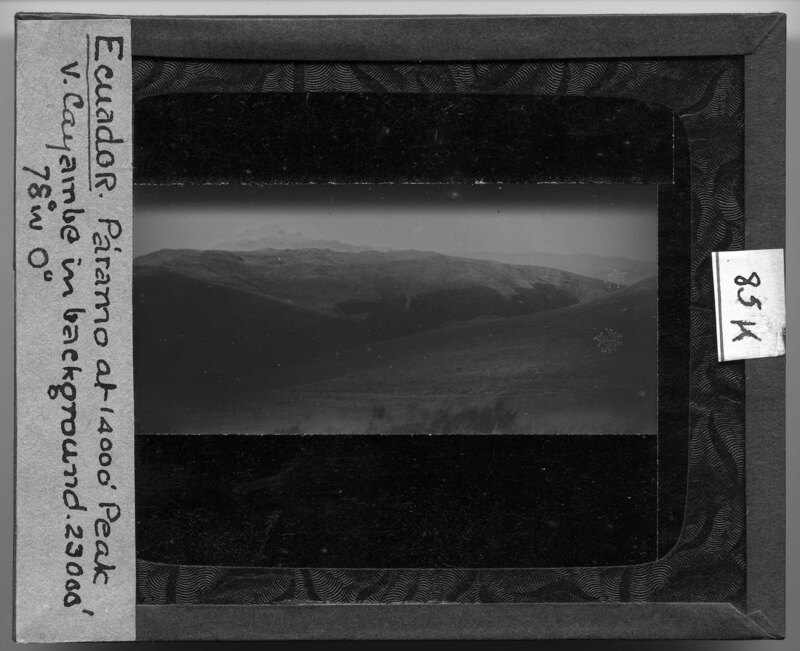
Image from a published source. Mountainscape of a paramo, or a high elevation tropical landscape, with Cayambi mountain in the background at 23,000'. The landscape is sparse with no trees and very short vegetation. Slide labeled with text, "Made by G.R. Swain, 713 E. University Ave., Ann Arbor, Michigan." Swain was staff photographer at U of M from 1913 to 1947.
Image from a published source. Workers stand next to coffee plants being shaded by banana trees in Costa Rica. The workers are holding large shovels and appear to be digging a trench, likely for irrigation. Slide labeled with text, "Made by G.R. Swain, 713 E. University Ave., Ann Arbor, Michigan." Swain was staff photographer at U of M from 1913 to 1947.
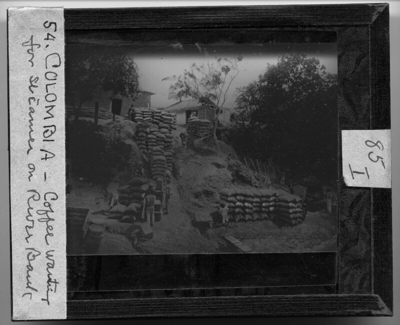
Image from a published source. Workers stack burlap bags of coffee beans on a riverbank in Colombia, awaiting transport. On top of the hill straw thatch roof houses line the walkway and trees partially cover the riverbank. Slide labeled with text, "Made by G.R. Swain, 713 E. University Ave., Ann Arbor, Michigan." Swain was staff photographer at U of M from 1913 to 1947.
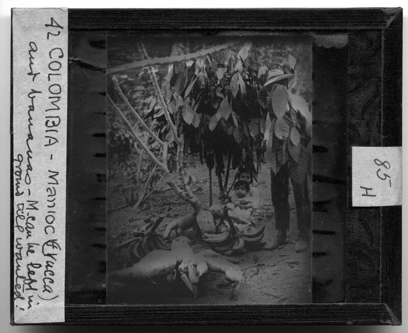
Image from a published source. A man and two children are sitting by a manioc plant with bananas surrounding them. The manioc plant is native to tropical areas and is a woody root crop. Slide labeled with text, "Made by G.R. Swain, 713 E. University Ave., Ann Arbor, Michigan." Swain was staff photographer at U of M from 1913 to 1947.
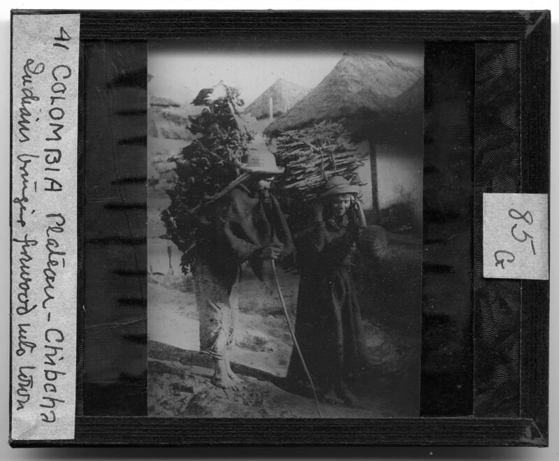
Image from a published source. A man and a woman are carrying firewood on their backs into town in Colombia. They are both working class people and are wearing workers clothing. Behind them, straw roofed houses line the dirt street. Slide labeled with text, "Made by G.R. Swain, 713 E. University Ave., Ann Arbor, Michigan." Swain was staff photographer at U of M from 1913 to 1947.
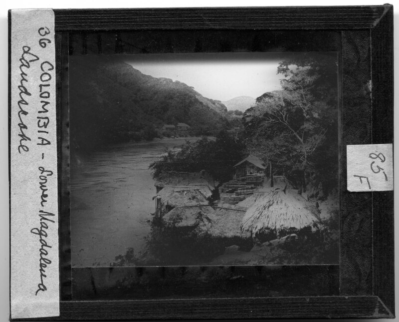
Image from a published source. River scene with mountains covered in dense foliage and straw huts in the foreground. The houses are built right next to the river and are worked into the natural landscape. Further down the river bank, frame houses can be seen sitting next to the river. Slide labeled with text, "Made by G.R. Swain, 713 E. University Ave., Ann Arbor, Michigan." Swain was staff photographer at U of M from 1913 to 1947.
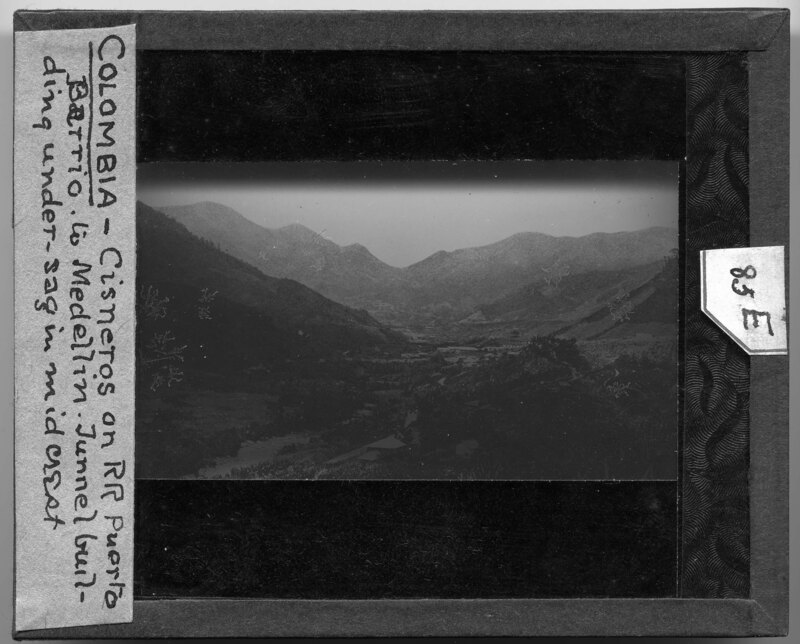
Image from a published source. Mountainscape of the Puerto Barrioto Medellin in Colombia. The valley is covered in dense foliage and buildings sit in between the mountains. Slide labeled with text, "Made by G.R. Swain, 713 E. University Ave., Ann Arbor, Michigan." Swain was staff photographer at U of M from 1913 to 1947.