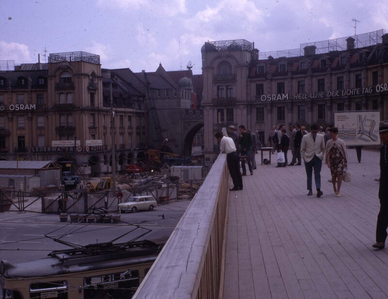
Karlsplatz Map Area
Item
-
Title
-
Karlsplatz Map Area
-
Photographer
-
Reinhard Wittke
-
Description
-
Map of Karlsplatz right center edge. Grouping of people on raised walkway made of wood. Building on upper right side has writing on it: OSRAM HELL WIE DER LICHTE TAG. This building lis light colored with numerous floors and has a red roof. There are dormers and decorative windows and fencing along the roof. Lower left corner cable car with people on it. Middle left construction area with machinery and fencing. Above the construction area are buildings that look identical to the building on the right. Middle is an arch, Karlstor, which was the city wall from the middle ages.
-
Date Span
-
1969
-
Object Type
-
Color Photograph
-
Subject
-
Karlstor; Karlsplatz; Munich, Germany; Europe
-
Collection Location
-
Box 52, Folder 4
-
Location
-
Munich, Germany
-
Exact Date
-
1969
-
Film Size
-
35mm
-
High Resolution Available
-
TIF
-
Cataloger
-
Courtney Bishop
-
Date Digital File Created
-
2016 October 12
-
Digital File ID
-
010_RW_52_029
-
Rights
-
This Item is protected by copyright and/or related rights. You are free to use this Item in any way that is permitted by the copyright and related rights legislation that applies to your use. In addition, no permission is required from the rights-holder(s) for educational uses. For other uses, you need to obtain permission from the owner, Eastern Michigan University Archives (lib_archives@emich.edu).


