Utah. Rivers and rainfall map
Item
-
Title
-
Utah. Rivers and rainfall map
-
Photographer
-
Unknown
-
Description
-
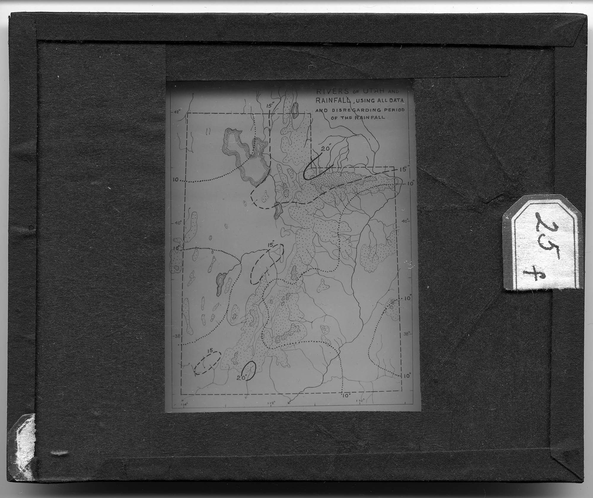
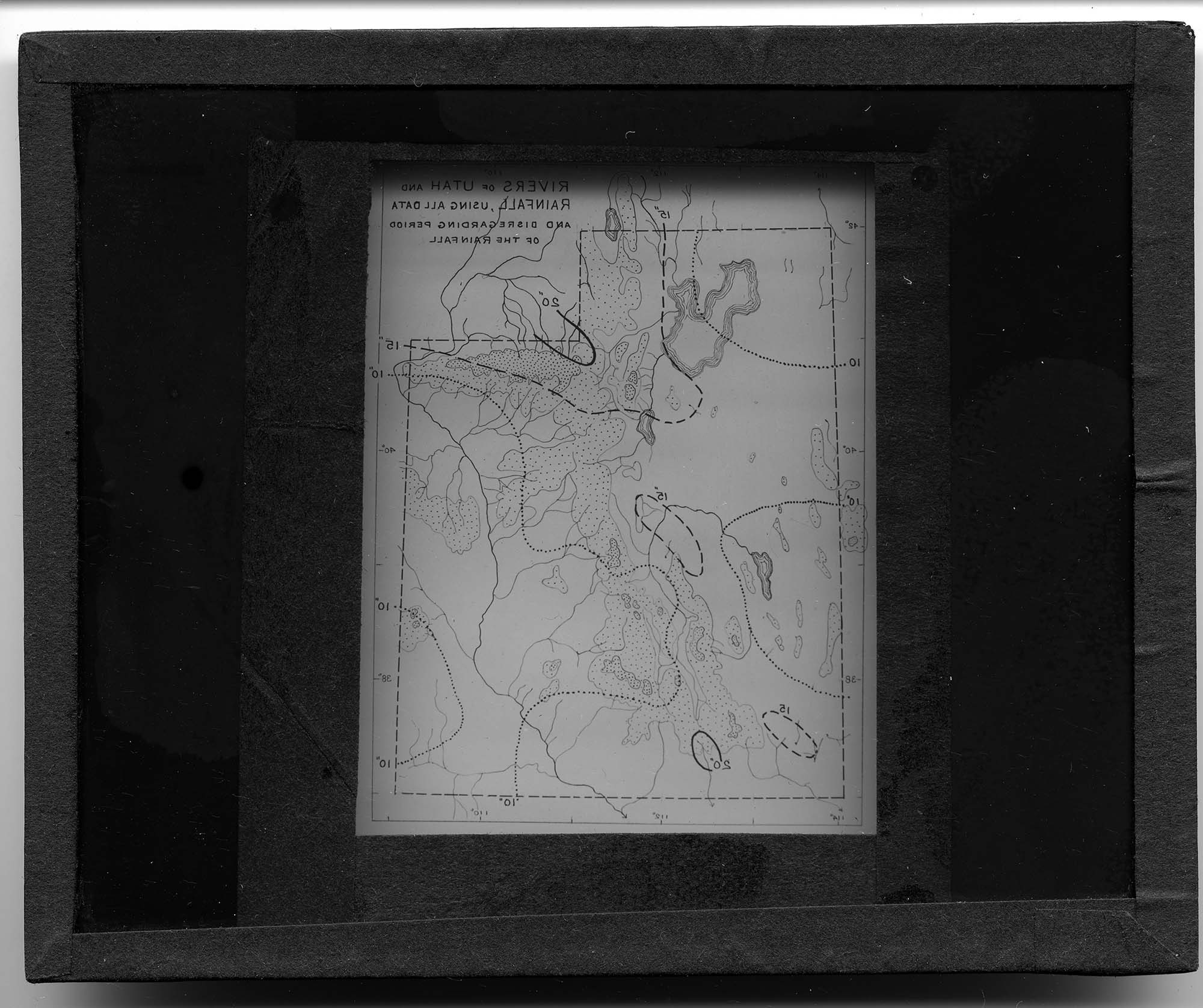
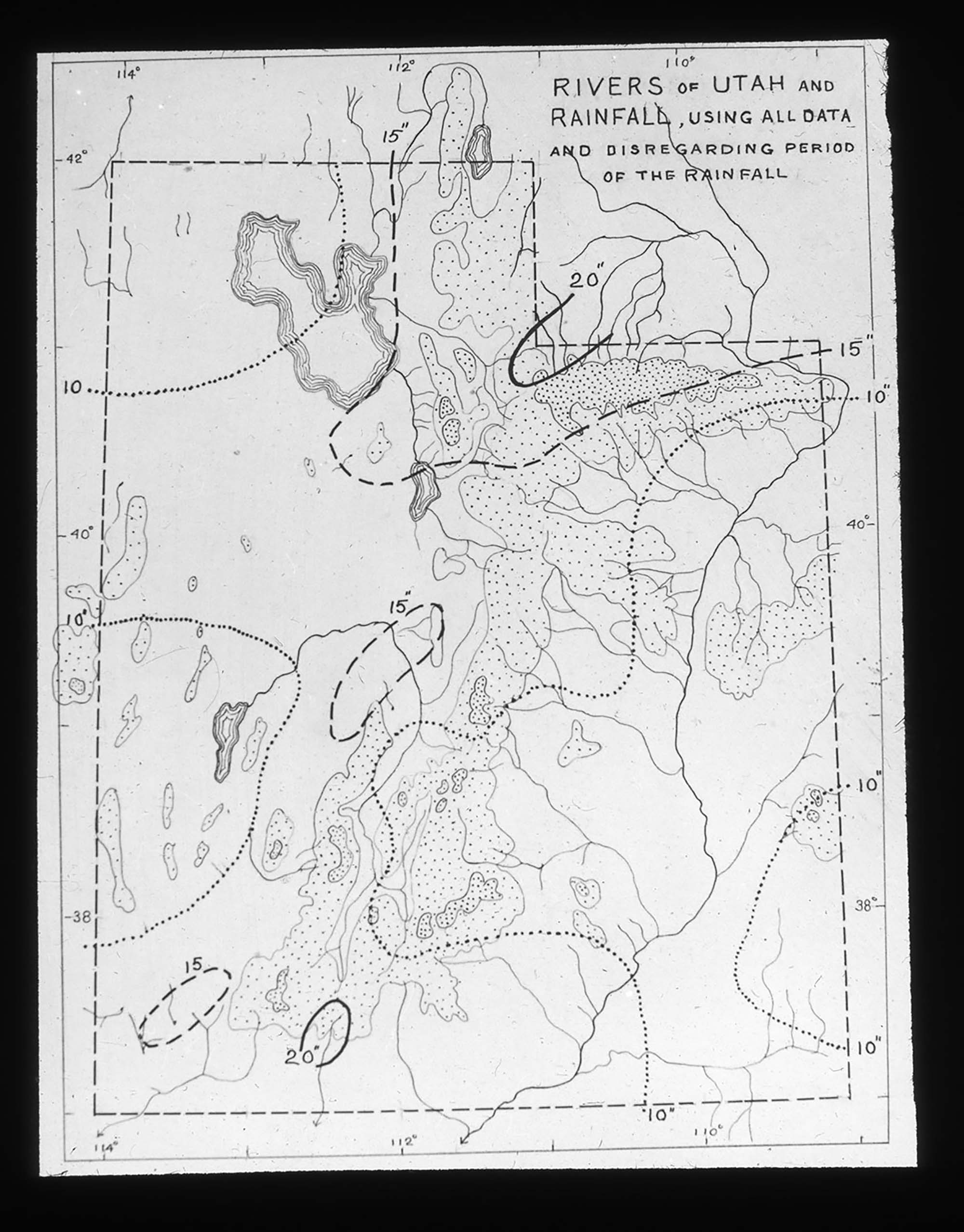
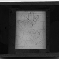
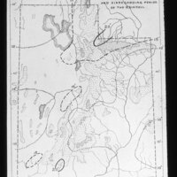
Map depicting the prominent rivers in Utah. It is noted that rainfall amounts are also noted but are based on all data collected up until the map was drawn and there is no particular period of time used when considering the measurements. Various styles of lines are used to depict inches of rain and they are drawn around regions of the state to show where the most rainfall occurs.
-
Date Span
-
1900-1935
-
Object Type
-
Black and White Positive Lantern Slide
-
Subject
-
Cartography; Rainfall; Rivers; Utah
-
Collection Location
-
Box 93
-
Location
-
Utah, United States
-
Exact Date
-
Exact Date Unknown
-
High Resolution Available
-
TIF
-
Cataloger
-
Rachel Ellenson
-
Date Digital File Created
-
9/20/2016
-
Digital File ID
-
010_MJ_93_063
-
Type
-
MJ
-
Rights
-
The copyright and related rights status of this Item has been reviewed by the organization that has made the Item available, but the organization was unable to make a conclusive determination as to the copyright status of the Item. Please refer to Eastern Michigan University Archives (lib_archives@emich.edu). for more information. You are free to use this Item in any way that is permitted by the copyright and related rights legislation that applies to your use.