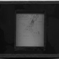
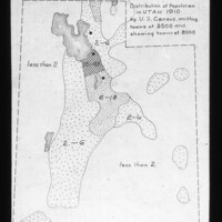
Utah. Distribution of population 1910 map
Item
-
Title
-
Utah. Distribution of population 1910 map
-
Photographer
-
Unknown
-
Description
-
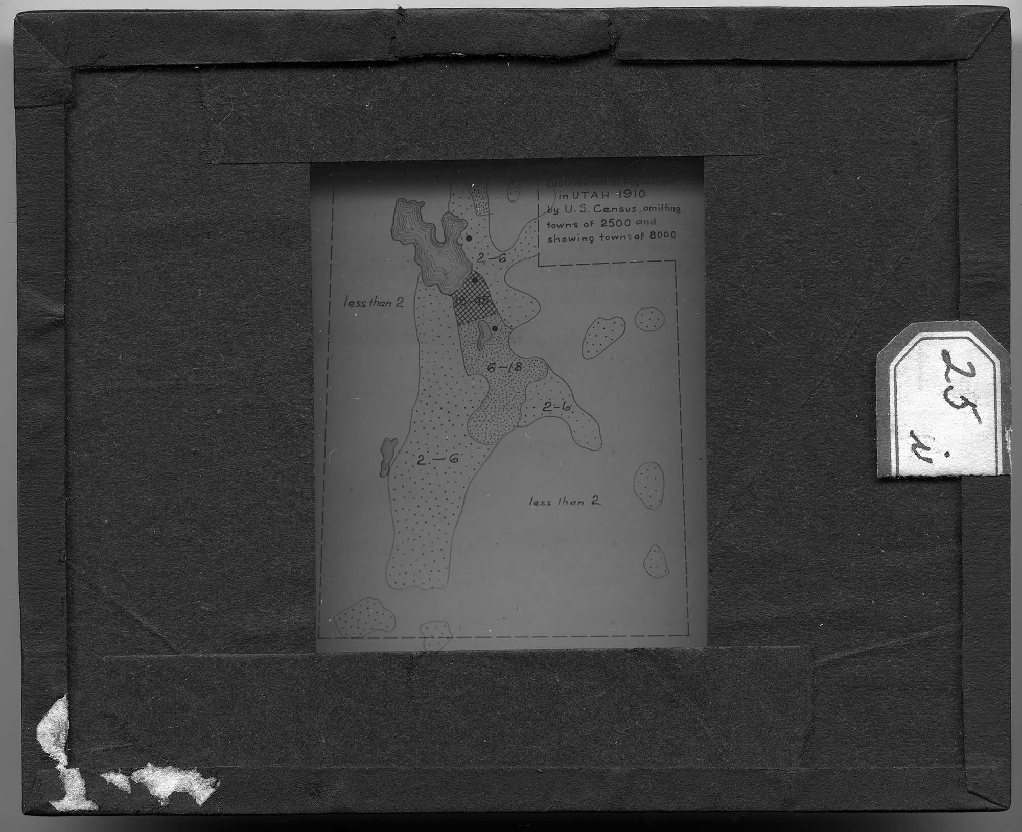
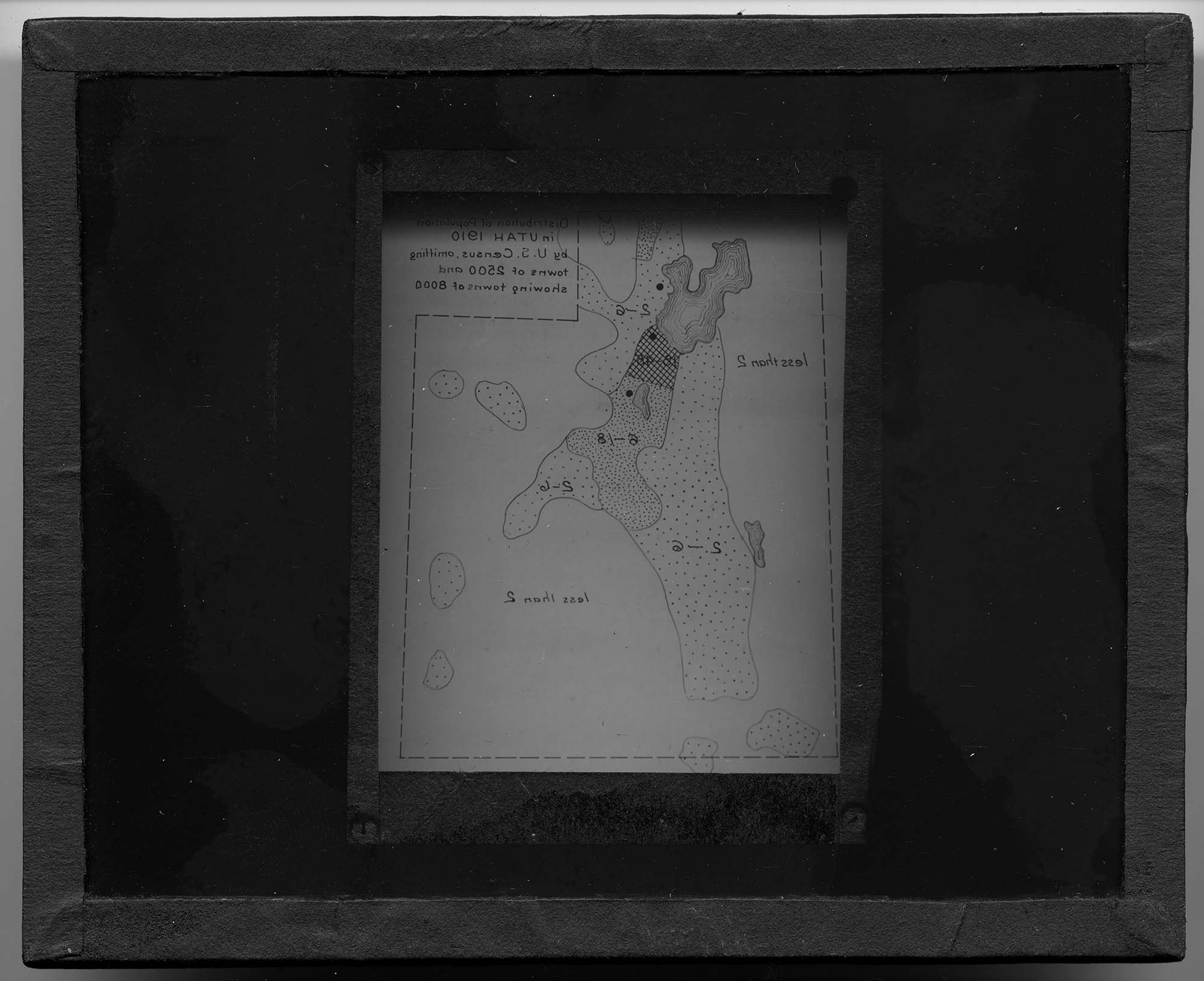
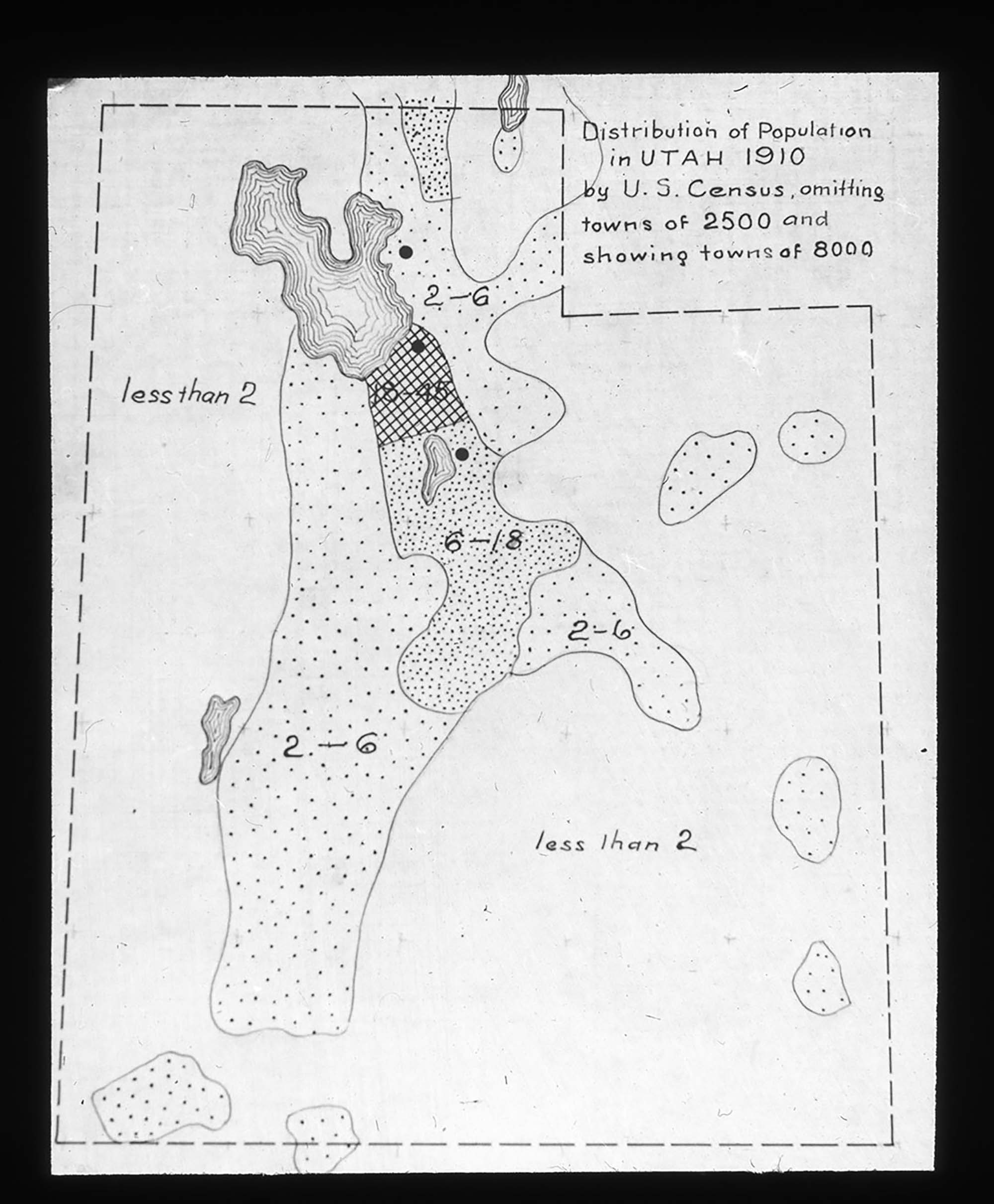
Map depicting the distribution of Utah's population in 1910, according to the U.S Census. The map omits towns with less than 2500 people and shows towns with more than 8000 people. There is no legend to describe what the different drawing textures mean but Utah's Great Salt Lake is shown with elevation marks in the top left portion of the slide.
-
Date Span
-
1900-1935
-
Object Type
-
Black and White Positive Lantern Slide
-
Subject
-
Cartography; Population; Topography; Utah
-
Collection Location
-
Box 93
-
Location
-
Utah, United States
-
Exact Date
-
Exact Date Unknown
-
High Resolution Available
-
TIF
-
Cataloger
-
Rachel Ellenson
-
Date Digital File Created
-
9/20/2016
-
Digital File ID
-
010_MJ_93_066
-
Type
-
MJ
-
Rights
-
The copyright and related rights status of this Item has been reviewed by the organization that has made the Item available, but the organization was unable to make a conclusive determination as to the copyright status of the Item. Please refer to Eastern Michigan University Archives (lib_archives@emich.edu). for more information. You are free to use this Item in any way that is permitted by the copyright and related rights legislation that applies to your use.